Travelling to the Bungles
Submitted: Monday, Jun 12, 2023 at 14:18
ThreadID:
145754
Views:
1594
Replies:
6
FollowUps:
5
This Thread has been Archived
Scout
We are leaving the
Sydney, next Saturday, planning to drive to
Port Augusta, Womera, along the Olympic way to the
Oodnadatta track.
along the
Oodnadatta track to Maria. Then the Stuart Highway to the
Gunbarrel Highway and up to
Yulara (via Mulga Park road.)
along the Docker Road to the Sandy Bight Rd to
Kintore.
We could go right here and rejoin
the Tanami track back to
Halls Creek.
Alternately there seems to be a road through Kiwirrkura up to Balgo then to the Tanami Road.
Can anyone give me so information about this last road. We have travelled along the Sandy Bight before and are ok in this area.
Awaiting enlightment. We do not wish to be on a road similar to the
Canning Stock route. We are
well provisioned and capable, but not up to continuous sandhills at our stage of life, and on our own.
Reply By: lindsay - Monday, Jun 12, 2023 at 15:41
Monday, Jun 12, 2023 at 15:41
I think you will get lost if you are looking for a sign post that says Maria.
AnswerID:
643833
Follow Up By: Scout - Tuesday, Jun 13, 2023 at 06:39
Tuesday, Jun 13, 2023 at 06:39
Thanks for correcting my typo
FollowupID:
923654
Follow Up By: Member - McLaren3030 - Tuesday, Jun 13, 2023 at 06:49
Tuesday, Jun 13, 2023 at 06:49
Hi Scout,
Yes, it is either Maree at the Southern end of the
Oodnadatta, or
Marla at the Northern end at
the junction with the Stuart Highway.
As far as some of the other roads/tracks you have mentioned, you will need permits from the various indigenous communities/land councils.
If you plan to visit Lake Eyre out from
William Creek, you will also need a South Australian Parks Pass.
Macca.
FollowupID:
923657
Reply By: Peter_n_Margaret - Monday, Jun 12, 2023 at 16:15
Monday, Jun 12, 2023 at 16:15
I have never driven that road north from Kiwirkura, but I do know at least one person who has. It traverses some nice country I understand.
It does not show on any map I have, but all decent maps show east-west sand dunes virtually all the way (and you are travelling north, across them.
It is a very remote area and you will need permits to transit the Aboriginal land. I don't know how easy they will be to get.
Not a route to travel alone I suggest.
Cheers,
Peter
OKA196 motorhome
AnswerID:
643834
Reply By: Stephen L (Clare) SA - Monday, Jun 12, 2023 at 20:16
Monday, Jun 12, 2023 at 20:16
Only know one person that has traveled it.
Idler Chris will be able to help with first hand experience.
AnswerID:
643835
Reply By: andy - Tuesday, Jun 13, 2023 at 05:32
Tuesday, Jun 13, 2023 at 05:32
We travelled this track 2 times solo. It is
well defined over its whole length of 500 km and regularyly used by the locals. It threads through a beautiful and changing landscape, only a few small sand hills. It is one of the nicest trips we did. The second time we travelled we found the part between
Yagga Yagga and Balgo to be very corrugated. The southern part has been graded several times during mining activity. There are a few
places with water pumps. I think it is essential to ask in Kiwikurra if and where water is available.
Andy
AnswerID:
643839
Follow Up By: Scout - Tuesday, Jun 13, 2023 at 06:43
Tuesday, Jun 13, 2023 at 06:43
Thanks for this information. We are driving a landcruiser and pulling a camper. Is this still ok?
We carry a lot of water.
FollowupID:
923656
Reply By: Member - A J - Tuesday, Jun 13, 2023 at 08:05
Tuesday, Jun 13, 2023 at 08:05
Scout - there is an article on Youtube by Allan Whiting done in 2019 Balgo to Kiwirrkura which may assist you
A J
AnswerID:
643840
Follow Up By: Scout - Tuesday, Jun 13, 2023 at 08:24
Tuesday, Jun 13, 2023 at 08:24
Thank you. Will look at this
FollowupID:
923659
Reply By: JOHN C36 - Tuesday, Jun 13, 2023 at 09:07
Tuesday, Jun 13, 2023 at 09:07
I drove north up Balgo Road in 2015. The route is not shown on most maps but it is shown on
Exploroz Traveller. The route meanders quite a lot as it often follows old cleared lines. The section from
Kiwirrkurra to
Lake Mackay is better maintained. The sand hills in this section were capped with rubber matting. Further north the few sand hills are smaller. None of the sand hills were difficult.
Going north the start of the route is marked by this large white tyre.
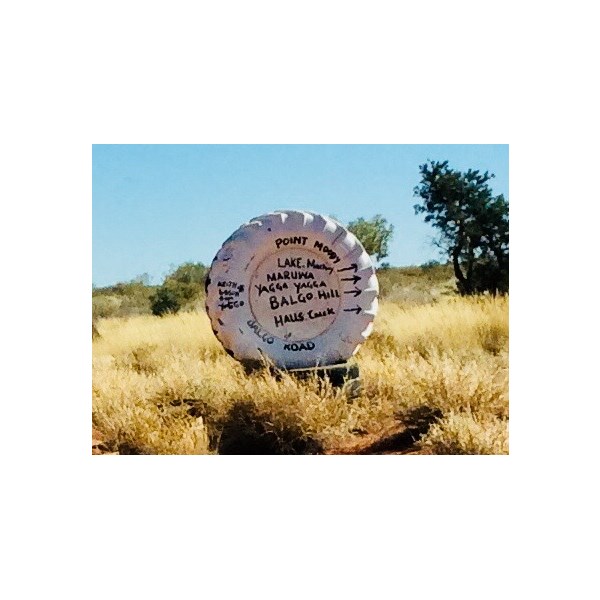
Road sign
was blindingly white in 2015.
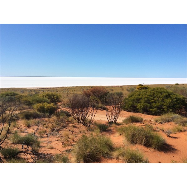
Lake Mackay
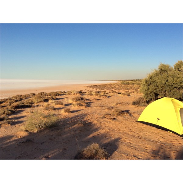
Lake Mackay campsite
After
Lake Mackay the route goes through desert oaks.
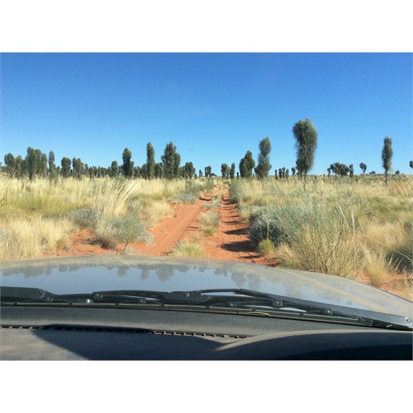
Desert Oaks
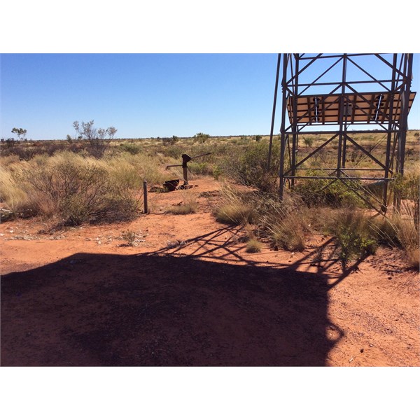
Water was available at Dwarf
Well.
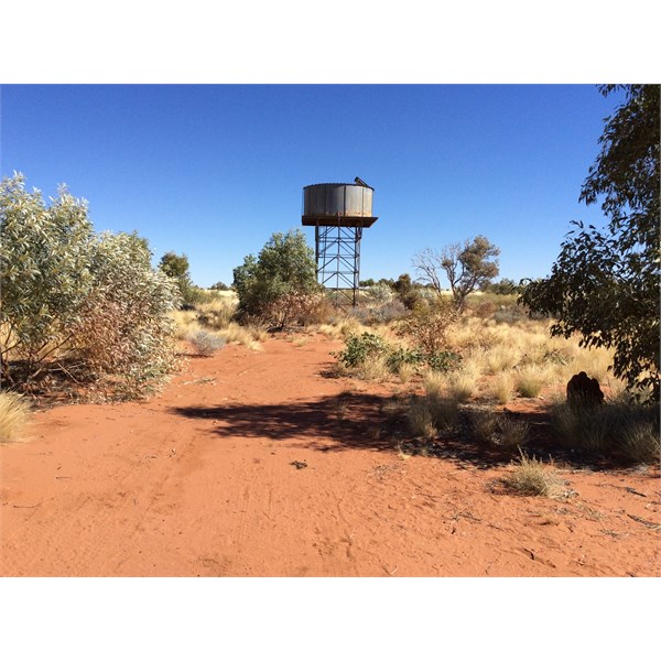
Dwarf Well
Dwarf Well
Water was also available at
Lamanbundah outstation.
To be continued. Exploroz won’t let me add any more photos to this post.
AnswerID:
643841
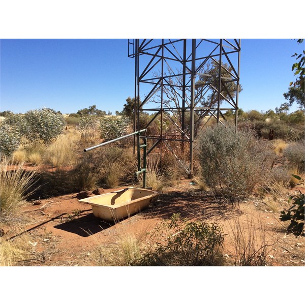
Follow Up By: JOHN C36 - Tuesday, Jun 13, 2023 at 09:22
Tuesday, Jun 13, 2023 at 09:22
Lamanbundah outstation water pump.
Lamanbundah water pump
Near Balgo is the spectacular Balgo Pound.
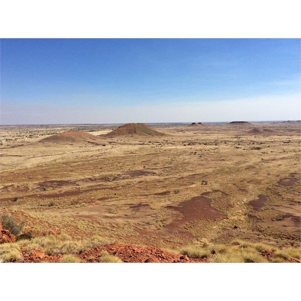
Balgo Pound
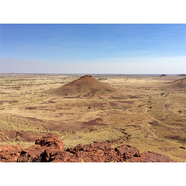
Balgo Pound
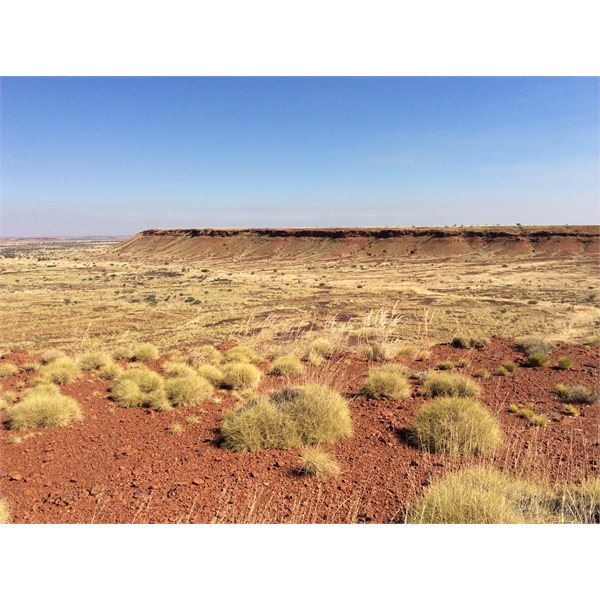
Balgo Pound
Balgo Road is very remote. I did not see another vehicle. I communicated with the Central Land Council to request permission. They issued the permit in a week.
Cheers,
John
FollowupID:
923660