Oziexplorer mapping program - Maps for the USA
Submitted: Monday, Apr 29, 2024 at 01:10
ThreadID: 147613
Views:1641
Replies:4
FollowUps:5
John Baas
Slightly off topic for this site, maybe, but I'm headed to Texas USA later this year.
Does anyone know where I'd be able to source a consolidated set of .ecw (or other Ozi accessible format) maps for Texas please?
Cheers. JB.
Reply By: Peter_n_Margaret - Monday, Apr 29, 2024 at 08:10
Monday, Apr 29, 2024 at 08:10
OziExplorer ? :)
Including
University of Texas Library Online ?
Cheers,
Peter
OKA196 motorhome
AnswerID:
645751
Follow Up By: John Baas - Monday, Apr 29, 2024 at 16:32
Monday, Apr 29, 2024 at 16:32
Thanks Peter; yes OziEx (it was in the topic title albeit slightly mis-spelt)...
However the link takes one to a myriad of individual maps whereas what I'm looking for is a seamless map for the whole of TX similar to ExplorOz's seamless topo of Australia.
A similar problem exists when I go to the following:
https://www.usgs.gov/programs/national-geospatial-program/national-map. A fabulous resource but only at very detailed levels as far as I can tell.
Cheers.
John.
FollowupID:
926129
Follow Up By: Peter_n_Margaret - Monday, Apr 29, 2024 at 17:06
Monday, Apr 29, 2024 at 17:06
If you have the time, individual maps can be zipped together if you can find something you like.
Cheers,
Peter
OKA196 Motorhome
FollowupID:
926130
Follow Up By: John Baas - Monday, Apr 29, 2024 at 19:09
Monday, Apr 29, 2024 at 19:09
Re: If you have the time, individual maps can be zipped together if you can find something you like. - Yes, I have used OziMap Merge before, but, downloading numerous indiv tiles is what I'm seeking to avoid....
FollowupID:
926131
Reply By: The Explorer - Monday, Apr 29, 2024 at 20:24
Monday, Apr 29, 2024 at 20:24
Hello
John
What type of "maps" are you chasing - road, topo, air/sat ? You can make some of these with a little bit of effort (and who knows how much storage space) using MOBAC.
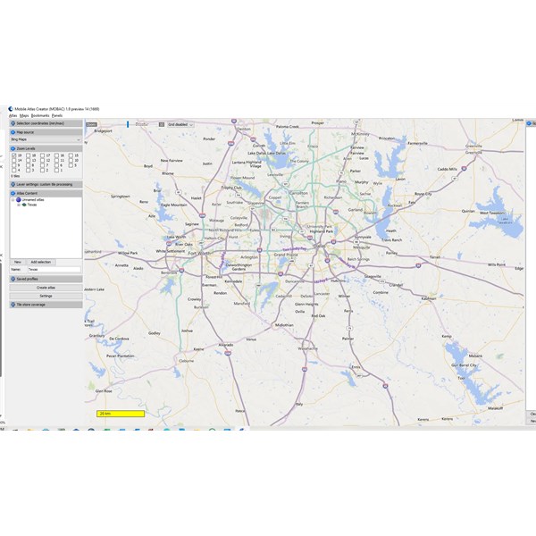
MOBAC Texas
For roads I use phone app Maps.me for travelling - download area of interest and use offline...or google maps if you have data allowance.
Cheers
Greg
| I sent one final shout after him to stick to the track, to which he replied “All right,” That was the last ever seen of Gibson - E Giles 23 April 1874 Lifetime Member
My Profile My Blog Send Message
Moderator |
AnswerID:
645757
Follow Up By: John Baas - Monday, Apr 29, 2024 at 23:52
Monday, Apr 29, 2024 at 23:52
Hi Greg.
Thanks, but you might recall, back in the day, that I had used MOBAC (under your guidance thanks) for quite extensive area mapping, but then, Google put the brakes on and only postage stamps could be created.
Has that sad situation changed?
The area I'm particularly interested in, see image, is the Gulf coast between Galveston and Corpus Christi as I intend to spend a week or so there birding on the back end of a trip to visit family.
Cheers.
J.
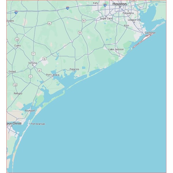
Gulf Coast USA
FollowupID:
926132
Follow Up By: The Explorer - Tuesday, Apr 30, 2024 at 09:49
Tuesday, Apr 30, 2024 at 09:49
Ok, yes you can still google satellite and maps as a source along with Microsoft virtual earth. Cant remember our previous conversations on the matter. Basically you have to use older version of MOBAC and/or correct source urls...I will contact you by email to discuss further, but will have to be later in day as I haven't quite retired yet :)
Cheers
Greg
| I sent one final shout after him to stick to the track, to which he replied “All right,” That was the last ever seen of Gibson - E Giles 23 April 1874 Lifetime Member
My Profile My Blog Send Message
Moderator |
FollowupID:
926134
Reply By: Candace S. - Tuesday, Apr 30, 2024 at 14:26
Tuesday, Apr 30, 2024 at 14:26
Google Maps or Apple Maps on your phone should be sufficient for finding your way around, but it seems you're looking for something more.
If you can explain a little more about what you're looking for, I'll try to figure out some suggestions.
AnswerID:
645760
Reply By: Peter J4 - Wednesday, May 01, 2024 at 06:17
Wednesday, May 01, 2024 at 06:17
If I remember correctly from when we spent the best part of a year travelling in the US and Canada (it was 12 years ago) when we took our GPS navigator from Oz with OziExplorer and turn by turn navigation there were no maps like we have with Natmap.
They do their mapping on a state by state basis as you have found only small maps. They were also very expensive. There also didn't seem to be anything like Hema etc except Garmin and a couple of other companies where you had to download individual maps.
We ended up using a large format touring atlas andthe turn by turn which worked very
well.
AnswerID:
645762