Road Charters Towers to Mareeba Gregory Development and Kennedy hiways
Submitted: Friday, Sep 13, 2013 at 15:50
ThreadID:
104305
Views:
6806
Replies:
5
FollowUps:
1
This Thread has been Archived
Member - Peter E7
Has anyone down this trip in a Big Rig if so can they advise are there many long climbs on these roads
Thanks
Peter E7
Reply By: Bob Y. - Qld - Friday, Sep 13, 2013 at 17:18
Friday, Sep 13, 2013 at 17:18
Peter,
Yes it has. What sort of "big rigs" are you talking about?
The one pictured below, as
well as some shorter, but just as steep hills as you near
Ravenshoe. Been too long ago but think the country from
Ravenshoe to
Mareeba is very undulating.
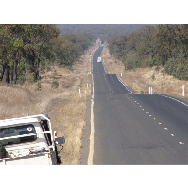
Long Hill, between Mt Surprise Turnoff & The Lynd.
And these blokes are on the road, from north of the Lynd to
Mount Garnet.
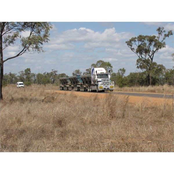
Ore Train, on Kennedy Developmental Road.
Not sure what the altitude of Charters Towers is, but
Ravenshoe is the highest town in Qld, so you're going to be doing a fair bit of climbing to get there.
Bob.
AnswerID:
518081
Reply By: Member - Alan H (QLD) - Saturday, Sep 14, 2013 at 07:24
Saturday, Sep 14, 2013 at 07:24
Use the call points to let the ore trucks know you are coming and listen on channel 40 for trucks announcing their arrival at call points. If you hear them prepare to pass as the call points are on narrow bridges or raised sections of road.
I found the road to be fairly caravan friendly and while there are some hills the more steeper bits are at the
Mareeba end.
The ore trucks go Mt Garnet to Charters and don't go slow
Call point one is at Fletcher
creek.
Alan
AnswerID:
518103
Reply By: Member - Andrew L (QLD) - Saturday, Sep 14, 2013 at 09:14
Saturday, Sep 14, 2013 at 09:14
I travelled that road 2 weeks ago, pulling 3 ton of Bushtracker. Its a usual 2 lane regional road, black top all the way. Plenty of vans, trucks etc, just take it easy, use channel 40, talk to the trucks to assist their passing, use call points on the narrow bridges/causeways.
AnswerID:
518107
Reply By: Nomadic Navara - Saturday, Sep 14, 2013 at 09:16
Saturday, Sep 14, 2013 at 09:16
There are no long climbs along that stretch of road. It is undulating and that's about it. There is nothing along there to compare with any of the 4 roads that go from the tablelands to the coast (and if you descend one of those I trust you will use low gear for the steeper descents.) Anyone who thinks there are serious gradients along there is either adverse to letting/making their gear box work or has an overloaded rig. Travellers should tackle hills occasionally to give their motors a bit of different running and relief from just loping along the flat country with constant revs.
As for the call points, they used to be on single lane road with limited visibility like in dips with single lane bridges. A few years ago they may have been necessary for van drivers who don't take much care. The other day when I drove that stretch I found that the road had been upgraded in all but one or two of those call points. The call point signs are still there but if you moderate your speed around those twists and dips there is no where you can not get your rig off the road in time to allow free passage of the road trains. You are also likely to have to cool your heels at a few bits of roadworks.
Relax, moderate your speed where necessary and enjoy the trip.
AnswerID:
518108
Reply By: Member - Peter E7 - Saturday, Sep 14, 2013 at 14:51
Saturday, Sep 14, 2013 at 14:51
Thanks for all the informative replies
Big Rig is a coach with a car trailer
I now have an idea of the road and conditions
Will not tackle any steep descents into
Cairns
Was concerned there may have been some long drags up steep hills
Thanks again
AnswerID:
518131
Follow Up By: Rockape - Saturday, Sep 14, 2013 at 15:24
Saturday, Sep 14, 2013 at 15:24
Peter,
if you take the Palmerston Highway down the range it will be no problem for your setup. It is the best the way down to
Cairns. No long drags up that road.
FollowupID:
797880