Settled in 1866, Roebourne is WA’s oldest surviving town north of
Geraldton. It served as the administrative centre for the Shire of Roebourne (previously the Roebourne Roads Board) until 1975, when operations were transferred to
Karratha. Roebourne has an estimated
population of 1,150 people and is located 39 kilometres east of
Karratha on the banks of the Harding River. Roebourne has retained its special character with its historic buildings and pioneering history.
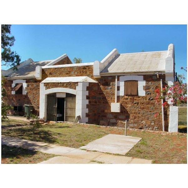
Roebourne Tourist Centre, Ex prison
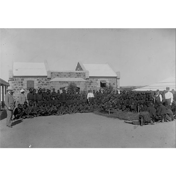
Aboriginal prisoners, Roebourne Gaol, 1900-1910
The Prisoners probably didn't do a lot to get locked up .
In 1818, Captain Philip Parker King was commissioned by the Admiralty to travel to the neighbourhood of Rosemary Island "to discover whether there be any river in that part of the coast likely to lead to an interior navigation into this great continent". King, on the 'Mermaid' arrived in the
Dampier Archipelago, named the Intercourse Islands, Lewis and Enderby Islands and Nickol Bay.
Francis Thomas
Gregory on the 'Dolphin' arrived at Nickol Bay in 1861, naming Hearson's Cove, the Maitland and Fortescue rivers, the Hamersley Ranges, Mt Samson and Mt Bruce.
Walter Padbury, inspired by reports from the
Gregory expedition, decided to start a sheep station on the "uninhabited" north-west coast. His party landed at Tien Tsin, named after the barque captained by JT Jarman, in 1863, with stock and supplies. Later that same year John Wellard followed this example and the managers of these parties, Charles Nairn and William Shakespeare Hall, are remembered as the pioneers of the north west.
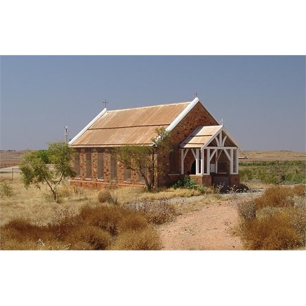
Roebourne Anglican Church
John and Emma Withnell arrived in April 1864, travelled overland up the Harding River until they arrived at Yeera-Muk-A-Doo Pool and camped at the base of a
hill, which Emma named Mount Welcome.
More settlers, some associated with the
Denison Plains Association, the
Portland Squatting Company and the Camden Harbour Pastoral Association, arrived, and in 1865 Government officials from the failed Camden Harbour settlement, including Resident Magistrate RJ Sholl, received orders to transfer the Government establishment to Tien Tsin.
Sholl recommended Tien Tsin as a port and chose a town site at Mount Welcome, the place taken up by the Withnells. Roebourne was named after the Surveyor General JS Roe the first Surveyor General of Western Australia, and was proclaimed a township 17 August 1866.
The District of Nickol Bay, defined as "All that portion North of a due East and West line from the mouth of the Murchison River" was gazetted in 1871 and in July of that year the first election of members of the District of Nickol Bay was held; members elected being:
In 1872, the town was destroyed by a cyclone. Many of the buildings from shortly after this time are
heritage listed. The site of the Withnells' house, which was rebuilt in 1937 by a later owner, is located on
Hampton Street at the foot of Mount Welcome
Roebourne Municipal Council was dissolved in 1906 and included in the Roebourne Roads Board and in 1910 the Town of
Cossack was abolished.
East, West and Central wards were gazetted in 1914 and in 1916 the number of members for each ward allocated.
The Roebourne Roads Board became the Shire of Roebourne in 1961 and in 1971 the area of the shire was reduced to 5900 square
miles, including Roebourne,
Cossack, Whim
Creek,
Point Samson, Wickham,
Karratha and
Dampier and the stations
Karratha, Mardie, Mt Welcome, Woodbrook, Warambie, Pyramid,
Sherlock, Mallina and
Cooya Pooya.
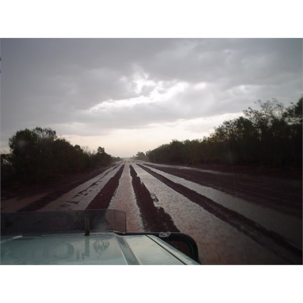
Wittenoom to Roebourne in Rain Wednesday, October , Taken: 24 Oct 2006
With the beginning of the iron ore industry in the early 1960s,
Dampier was chosen as the Port for Hamersley Iron's operations and this signaled the beginning of major development in the shire. With the introduction of jet aircraft, regular passenger flights to the unsealed Roebourne airport were discontinued and in 1966 Hamersley Iron constructed a sealed airport, then the
Dampier Airport.
Karratha became the administrative centre for the Shire of Roebourne in 1975 when Shire offices were relocated to Welcome Road.
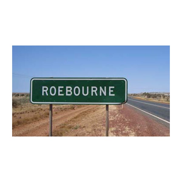
Roebourne
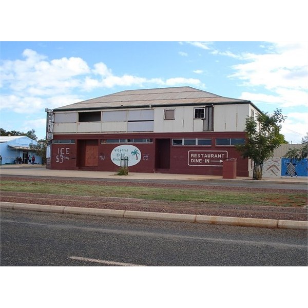
Roebourne Pub
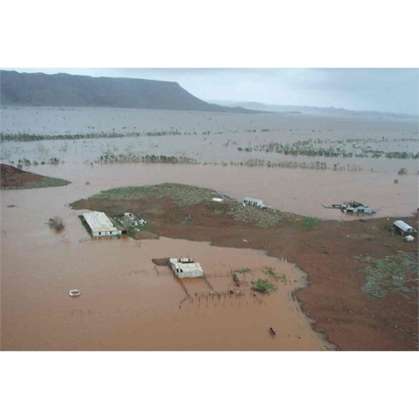
View of the old Cooya Pooya homestead near the Harding River Dam, south of Roebourne Tropical Cyclone Monty March 2004
Roebourne has continued to develop and is a thriving hub for Aboriginal enterprise and culture. Roebourne has excellent sporting facilities for a town of 800 people including recently constructed covered basketball courts and a public swimming pool. In 2009 the Clontarf Foundation Roebourne Academy was established.
.