What is this? Found on Google Earth
Submitted: Thursday, Oct 03, 2013 at 15:30
ThreadID:
104577
Views:
5881
Replies:
7
FollowUps:
26
This Thread has been Archived
Member - Duncan W (WA)
Go to GE coordinates 28 19'27.95"S 122 0'23.22"E
it will take you to a point NW of
Laverton near Erlistoun Stn. What in the world are they building out there, the
airstrip looks big enough to land a jet on it and there is quite a lot of what look like new buildings. There is no
sign of any mining directly within or around this site although that would be my first sugestion if asked.
Cheers
Dunc.
Reply By: Member - Graeme W (NSW) - Thursday, Oct 03, 2013 at 15:44
Thursday, Oct 03, 2013 at 15:44
Could be part of the Jindalee Radar network.
Jindalee Radar
Graeme
AnswerID:
519108
Follow Up By: Member - Duncan W (WA) - Thursday, Oct 03, 2013 at 21:40
Thursday, Oct 03, 2013 at 21:40
Thanks Graeme looks like most have a similar view to you.
Cheers
Dunc.
FollowupID:
799162
Reply By: equinox - Thursday, Oct 03, 2013 at 15:45
Thursday, Oct 03, 2013 at 15:45
Hi Dunc,
It looks very similar to the radar unit 80 kilometres to the east at almost the same latitude. Not sure if yours has an
airstrip, maybe it is part of the radar system.
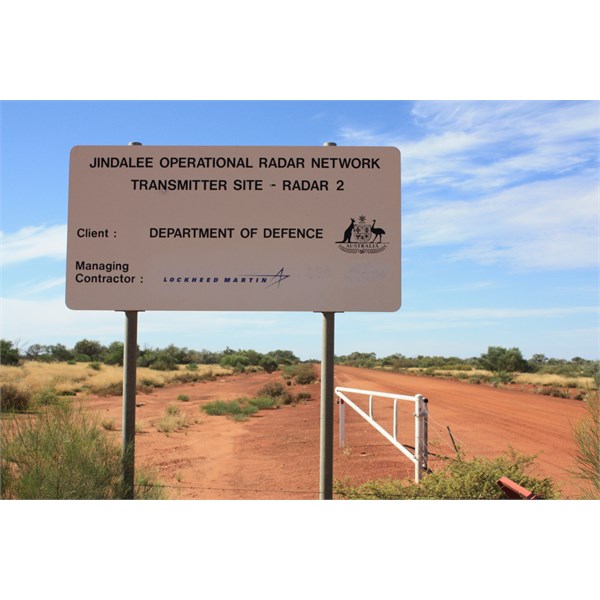
Eastern Radar Access
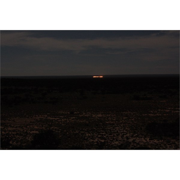
Eastern Radar at night
Cheers
Alan
AnswerID:
519109
Follow Up By: Member - Duncan W (WA) - Thursday, Oct 03, 2013 at 21:42
Thursday, Oct 03, 2013 at 21:42
Hi Alan the image at the coordinates given show a huge runway running in a NE and at the Northerly end another runway joining going in a South westerly direction. Very wide and what appears to be landing lights along one side.
Cheers
Dunc
FollowupID:
799163
Follow Up By: Member - Duncan W (WA) - Thursday, Oct 03, 2013 at 21:52
Thursday, Oct 03, 2013 at 21:52
Alan I've just had another look and what I thought was a runway could actually be the radar if it is made up of a large number of poles with wires strung between (only guessing about the wires).
D
FollowupID:
799166
Follow Up By: equinox - Thursday, Oct 03, 2013 at 21:55
Thursday, Oct 03, 2013 at 21:55
One way to find out Dunc, Good luck :-)
FollowupID:
799167
Follow Up By: Member - Duncan W (WA) - Friday, Oct 04, 2013 at 09:20
Friday, Oct 04, 2013 at 09:20
Me thinks a good way to get shot at if you get too close.
Mind you sounds like a good excuse for a road trip.
FollowupID:
799185
Follow Up By: Echucan Bob - Saturday, Oct 05, 2013 at 14:22
Saturday, Oct 05, 2013 at 14:22
Duncan, that's a pretty tight corner half way down the runway!
FollowupID:
799243
Reply By: Ron N - Thursday, Oct 03, 2013 at 16:09
Thursday, Oct 03, 2013 at 16:09
Dunc - This is almost certainly part of the Jindalee Operational Radar Network. Co-ordinates are in the Wikipedia entry. A huge, costly, important, and little-publically-known development of radar and interception that is almost exclusively an Australian invention, and which has capabilities that have the Americans impressed.
Probably what impresses the Americans most, is JORN's ability to detect Stealth aircraft and incoming missiles - let alone JORN's ability to detect something as small as a Cessna 172 moving around an
airstrip on East Timor. The amazing part about JORN is its ever-increasing abilities - with the next stage, ramping up its abilities by a factor of 10!
AnswerID:
519111
Follow Up By: Notso - Thursday, Oct 03, 2013 at 17:28
Thursday, Oct 03, 2013 at 17:28
The Yanks came in on the project fairly early, then dropped out saying it would never work!
A bit of good old Aussie ingenuity.
FollowupID:
799130
Follow Up By: Jarse - Thursday, Oct 03, 2013 at 17:43
Thursday, Oct 03, 2013 at 17:43
We've also had a few other aeronautical firsts: Domestic DME (before international was created), the Flight Data Recorder, and the Microwave Landing System (MLS).
We have some pretty talented people here in Oz.
FollowupID:
799133
Follow Up By: Notso - Thursday, Oct 03, 2013 at 18:07
Thursday, Oct 03, 2013 at 18:07
The SCRAM Jet will be next, the
Brisbane Uni is having some success at the moment, although the last test failed,
FollowupID:
799139
Follow Up By: Member - Duncan W (WA) - Thursday, Oct 03, 2013 at 21:45
Thursday, Oct 03, 2013 at 21:45
Thanks Ron for your advice and the follow-ups from Notso & Jarse. Until today's replys I'd never heard of the Jindalee Operational radar
Cheers
Dunc
FollowupID:
799164
Follow Up By: Gone Bush (WA) - Friday, Oct 04, 2013 at 10:02
Friday, Oct 04, 2013 at 10:02
Yes, it's interesting what Jindalee can pick up.
Like when the Indos sneak a military aircraft up behind a commercial passenger jet over the
Kimberley, just to see how far they can get into Aussie airspace.
And icebergs in the North Sea.
FollowupID:
799188
Follow Up By: pop2jocem - Friday, Oct 04, 2013 at 13:09
Friday, Oct 04, 2013 at 13:09
Maybe them pesky Indon fishermen have been sneaking "people ferries" in behind cargo ships???
Just saying (;=))
Cheers
Pop
FollowupID:
799196
Follow Up By: Echucan Bob - Saturday, Oct 05, 2013 at 14:20
Saturday, Oct 05, 2013 at 14:20
"JORN uses radio frequencies between 5 and 30 MHz." (Same as my Codan)
"The high frequency radio transmitter arrays at
Longreach and
Laverton have 28 elements, each driven by a 20 kilowatt power amplfier giving a total power of 560 kW." (6000 times as powerful as my Codan)
No wonder the HF spectrum is so full of weird interference.
With ionospheric conditions so variable its a marvel that a reflected HF signal can yield any useful data at all, let alone 'seeing' a Cessna taxi somewhere in Indonesia.
No doubt the Chinese, Russians and Israelis are doing similar things to the HF spectrum. Not to mention the Indonesian fishing boats with their kilowatt linears.
Come to think of it, its a miracle that we can use HF for communications at all.
Bob
FollowupID:
799242
Follow Up By: Ron N - Saturday, Oct 05, 2013 at 14:43
Saturday, Oct 05, 2013 at 14:43
Bob, don't even start to think about what's being transmitted on the radio frequencies, from Harold Holt base at NW Cape!
There's still a lot of deep suspicion that some of their high-powered RF output from NW cape was responsible for the unplanned dive problems on a couple of Airbuses!
FollowupID:
799244
Follow Up By: Hairy (NT) - Saturday, Oct 05, 2013 at 18:26
Saturday, Oct 05, 2013 at 18:26
"There's still a lot of deep suspicion that some of their high-powered RF output from NW cape was responsible for the unplanned dive problems on a couple of Airbuses!"
Yeah.....but that was over shadowed by the news when Pine Gap was proven to be a submarine base! LOL
FollowupID:
799252
Reply By: MEMBER - Darian, SA - Thursday, Oct 03, 2013 at 16:10
Thursday, Oct 03, 2013 at 16:10
My guess would be coal
mine preparation - one of the roads leading out of that site goes to a coal
mine 50k away - (but what would I know ?).
AnswerID:
519112
Follow Up By: Notso - Thursday, Oct 03, 2013 at 17:24
Thursday, Oct 03, 2013 at 17:24
It's tagged in Google Earth as the Jindalee recieve site.
FollowupID:
799129
Follow Up By: MEMBER - Darian, SA - Thursday, Oct 03, 2013 at 17:56
Thursday, Oct 03, 2013 at 17:56
"It was a 'what the heck' moment Ron - worth a shot I thought...it's quiet here today.... lucky I'm not in mining :-o)......but I spotted this black stuff about 8km from
Laverton...... it looked a bit 'coaly'. 28°33'26.41"S 122°22'28.07"E ...... maybe nickel ?
FollowupID:
799135
Follow Up By: Ron N - Thursday, Oct 03, 2013 at 18:48
Thursday, Oct 03, 2013 at 18:48
Darian - I doubt whether your "black stuff" is nickel. There's definitely Nickel in quantities around
Laverton.
Nickel is found as Nickel Sulphide and is never black - more generally, a motley, greenish-bronze colour.
You can always tell you've got Nickel Sulphide, because it's so much heavier than any other ordinary rock. It's S.G. is around 1.6-1.8.
Here's a pic of Nickel Sulphide ore (link below) - it's not a really good pic, but the best I can find at present.
I had some top class Nickel Sulphide specimens from around Kambalda once, but I couldn't tell you where they are now.
http://www.scienceimage.csiro.au/index.cfm?event=site.image.thumbnail&id=1893&viewfile=f&divid=NM
A black rock from around
Laverton is more likely to be an Iron-rich rock, possibly Hematite or Magnetite. There's a lot of Iron associated with Gold in the W.A. Goldfields, and its common form is Banded Iron Formation (BIF), which often has some very intense black-coloured Iron-compound rocks in it.
A big chunk of the really dark Hematite from a thick band of BIF would give you a rock that looked just like coal.
Cheers - Ron.
FollowupID:
799143
Follow Up By: Member - Duncan W (WA) - Thursday, Oct 03, 2013 at 21:48
Thursday, Oct 03, 2013 at 21:48
Ron for some unknown reason my GE at work doesn't always allow some of the attached GE photos to be opened. If they did no doubt I'd have discovered that it was Jindalee, which then would have caused me to do a Google Search. Damned impressive the amount of money they are throwing at this site based on the aerial image
Cheers
D
FollowupID:
799165
Follow Up By: get outmore - Thursday, Oct 03, 2013 at 21:56
Thursday, Oct 03, 2013 at 21:56
Sg of nickel sulphide is much more than 2.6 to 2.8. Thats the sg of normal rock nickel sulphide can be around 4.5 in its massive form
FollowupID:
799168
Follow Up By: Ron N - Thursday, Oct 03, 2013 at 23:38
Thursday, Oct 03, 2013 at 23:38
Get outmore - Where do you get those figures from? This following chart shows the S.G. of Nickel ore at 1.6.
I've worked in Nickel mines and loaded and hauled thousands of tonnes of Nickel ore, so I know exactly how much it weighs!
http://www.csgnetwork.com/specificgravmattable.html
FollowupID:
799173
Follow Up By: get outmore - Friday, Oct 04, 2013 at 07:20
Friday, Oct 04, 2013 at 07:20
From doing countless sg determinations on countless samples of nickel sulphide and its host rock....
FollowupID:
799179
Follow Up By: Ron N - Friday, Oct 04, 2013 at 11:03
Friday, Oct 04, 2013 at 11:03
You win!! LOL I must have been handling a lot of low-grade nickel ore!
You'd have to have some high nickel % concentrations in the massive sulphides to get S.G.'s of up to 4.5!
What % of nickel content would bring up that figure? I reckon I've seen about 5% nickel in massive sulphides.
FollowupID:
799191
Follow Up By: get outmore - Friday, Oct 04, 2013 at 11:18
Friday, Oct 04, 2013 at 11:18
ive hadf a look at that chrt you linked to and it has some inconsistencies
at an of 1.6 is not much denser than
water really
from memory while the sg of mnormal
rock types such as basalt, diiorite dolerite can vary alot its generally somewhere between 1.8-2.6
diseminated pentlandite at around 3% will go an sg of around 3-3.5
and massisive pentlandite %10 and above or so will go around sg4.5
FollowupID:
799192
Reply By: Member - PJR (NSW) - Thursday, Oct 03, 2013 at 22:19
Thursday, Oct 03, 2013 at 22:19
Jorn receiver site.
Phil
AnswerID:
519139
Reply By: Member - Bentaxle - Friday, Oct 04, 2013 at 17:58
Friday, Oct 04, 2013 at 17:58
Could be for a gold minesite, I can remember coming across some exploration drill sites in that area about 4yrs ago on a trip with member Phil B, the name begins with a "T" but can't remember the rest. Another group went out a year or so later and found that the track now had a cyclone fence across and a reference to a site for airfield.
| May the fleas of a thousand afghan camels infect the crutch of your enemy and may their arms be too short to scratch.
Lifetime Member
My Profile Send Message |
AnswerID:
519187
Reply By: Wayne - Saturday, Oct 05, 2013 at 22:47
Saturday, Oct 05, 2013 at 22:47
Dunc
Went past there in June this year. Definitely the JORN radar site. There were big signs everywhere saying Keep Out, not only in that area marked, but all along the road to the north and south. We kept driving west (the track deteriorates, but is a good alternative if you like getting away from everyone) and these signs were everywhere.
If you zoom in you can see the road going past. To the west and on the south side of the track there are lots of other tracks which must go to different antenna. Not sure, we didn't go looking. Further west you can see where a gas line is being constructed. There are even trucks on the "road" looking feature. 28 24'23.22"S 121 47'34.71"E
We drove this track when going from
Laverton to
Leonora. We've done the bitumen enough times to want an adventure.
Cheers
Wayne
AnswerID:
519234
Follow Up By: Member - Duncan W (WA) - Sunday, Oct 06, 2013 at 00:19
Sunday, Oct 06, 2013 at 00:19
Hi Wayne, the GE image is pretty clear when you zoom right in and you're right about the number of tracks that appear to head to other
infrastructure.
Pretty amazing facility and no doubt
well guarded. What surprises me is that such a facility is so close to mining operations.
FollowupID:
799265