Thanks to Fred B Ex NT for doing the SHP last week while I was in Concord Hospital and being looked after by all the lovely Nurses, Fred also compiled this weeks SHP for me, Thanks mate.
The Dickabram Bridge is a
heritage-listed road-and-rail bridge over the
Mary River near Miva, north-west of Gympie in Queensland, Australia. (Coordinates: 25°57'14?S 152°29'43? E ) The bridge is 1km east of the Dickbram (Miva)
cemetery at Miva. It was the major bridge on the Kingaroy line. The bridge is one of only two remaining road-and-rail bridges in Australia and the only one in Queensland. It is the oldest remaining large steel truss bridge constructed in Queensland.

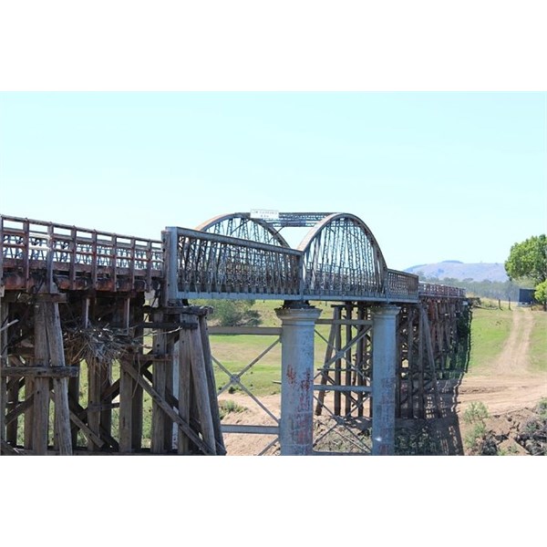
Dickabram Bridge crossing the Mary River
Concrete filled Steel Tubular Piers
The steel and timber truss bridge, built by McDermott Owen & Co., was completed in November 1886 and the line opened for traffic between Dickabram and
Kilkivan on 6 December 1886. It is 191m long and stands 23m above the
Mary River. All spans are metal trusses except for the 11m approach spans which are tied timber girders. The two river piers are cast iron cylinders; the remaining piers and road deck are timber.
The name of the bridge comes from a local Aboriginal word Dickabram meaning Sweet potato that grew along the river flats there. The bridge decking was submerged under
water only once during the 1893 floods, while the 2011 floods lapped the underside of the decking.
The extensive restoration of the bridge, involving replacement of hardwood timber beams and decking, was completed in April 2009. Minor works to repair some decking and to remove flood
debris (2011 & 2013) is currently underway (October 2013).
Although, it is said no-one died in the construction of the bridge, one man disappeared, never to be seen again. The main piers of the bridge are steel tubes filled with concrete. The concrete was mixed, then carted in wheelbarrows and tipped down the tube. It is believed that this man tripped and fell into the tube of wet concrete and wasn’t missed until much later.
The Dickabram Bridge celebrated it’s 125th anniversary on the 17th September 2011. Celebrations were due to be held in January (completion date of the bridge) but had to be delayed due to the 2011
Mary River Floods. The celebration was attended by the Govenor of Queensland, Her Excellency Ms Penelope Wensley AC. Her speech makes interesting reading.
Click Here
For video of the 2011 flood at Dickabram Bridge .
Click Here
Prior to the construction of the bridge, local farmers and settlers had to take a punt across the
Mary River. Moving their goods and chattels across the
Mary River wasn’t always an easy process. Great-great-grandfather of author Jason Nahrung, was a German Immigrant who settled near Miva, and you can read his story
Link:
http://jasonnahrung.com/tag/dickabram-bridge/
Life in the region would have been a difficult one and is attested to by the number of the Nahrung family and other local settlers are interned at the nearby Dickabram (Miva)
cemetery. The
cemetery records are held at the Council offices, which are in the main street of nearby township of
Tiaro. Dickbram
cemetery is
well maintained, has many older headstones, and cast iron grave numbers. The Dickabram Cemetry is located at Lat: 25°57'37"S, Lon: 152°29'05"E
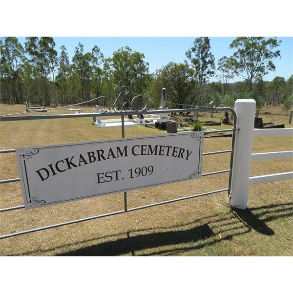
Dickabram Cemetary
The last official trains to cross the Dickabram bridge were diesel locomotives removing empty ore cars (used to carry ore from now defunct mines in the area). The penultimate train to cross the bridge, is believed to possibly be the longest train to ever cross the Dickabram bridge (this is unconfirmed). This was possible due to all the ore cars being empty, and therefore, the train not exceeding the load limit on the bridge. You can see the youtube footage Below.
The Dickabram Bridge known, has been in use for 125 years without substantial modification. It was built at a high level where less substantial bridges had been washed away. The bridge was originally part of the
Kilkivan branch, which was initially built to service the mineral wealth of the area. It took the next 30 years, for the railway extended to Kingaroy, then Tarong, Nanango, and Proston. Trains crossing the bridge have transported a huge variety of goods, including timber, cream, peanuts, cattle, potatoes, as
well as people.
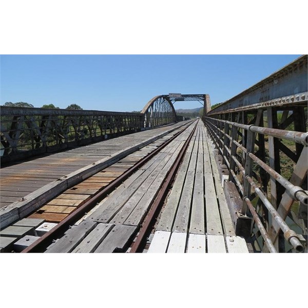
Dickabram Bridge October 2013
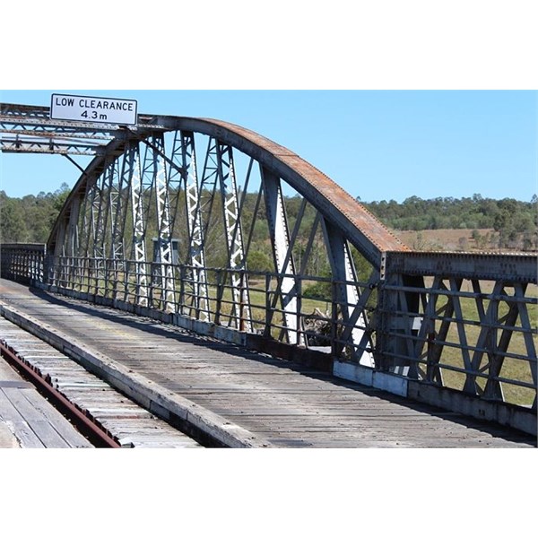
Dickabram Rail Bridge-steel cross hatching
The Kingaroy - Theebine railway was used for argiculture and commercial freight as
well as passenger public transport and was one of the first branch lines built in Queensland. For a number of years the line was used to run vintage trains and “tourist trains”. But as the tracks and bridges became too expensive to maintain, it fell into disrepair. Major factors in the closure of the line were, the very high cost of maintenance, the closure of the
Murgon Abatoir, use of road transport for the peanut farmers, and the closure of mines in the area. The disused line was officially closed 24/12/2009. Eventually, much of the track was removed and it is no longer possible to run trains on the line.
The federal and state governments propose using the disused rail corridor as a “rail trail” that both cyclists and hikers can use. The Kingaroy to Theebine Rail Trail has the ability to connect the Brassall Bikeway,
Brisbane Valley Rail Trail and the
Bicentennial National Trail. Developing this rail corridor into a rail trail would ultimately deliver a continuous
recreation trail over 350 kilometres in length. It would connect the communities of
Ipswich to the Sunshine Coast with a trail traversing the regional and rural communities of
Somerset and South Burnett.
The Dickabram bridge is still in use today as a road bridge, used by local traffic and tourists alike.
.