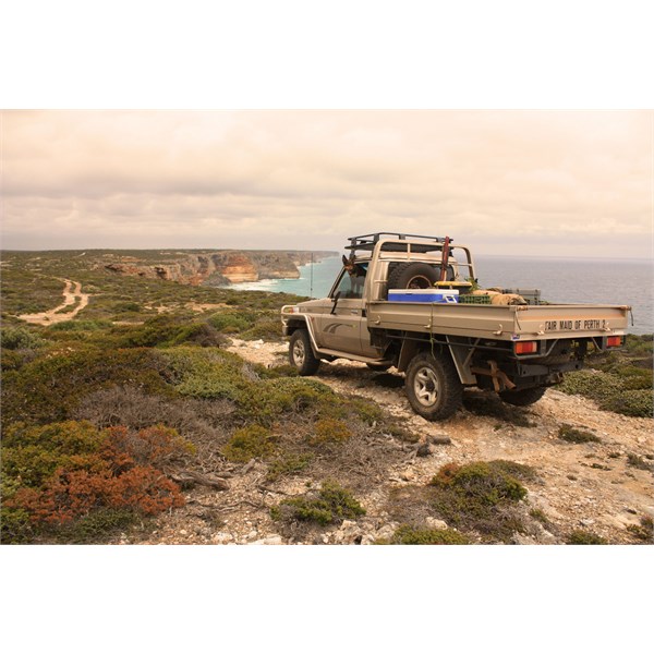
Great Australian Bight - Esperance to Cocklebiddy
Submitted: Friday, Dec 06, 2013 at 20:47
ThreadID:
105397
Views:
3964
Replies:
4
FollowUps:
6
This Thread has been Archived
Member - Peter Beard (WA)
We're heading to Tasmania in a couple of weeks and want to follow the tracks from
Esperance to Cocklebiddy via Mt Ragged,
Israelite Bay,
Bilbunya Dunes,
Toolinna Cove and
Twilight Cove. Has anyone been down that way recently? Just wondering what the track conditions are and whether we'd be better off to follow
the beach or the old telegraph line. Any recent info would be most appreciated.
Peter
Reply By: DiscoTourer - Friday, Dec 06, 2013 at 22:13
Friday, Dec 06, 2013 at 22:13
It's a nice drive along the telegraph track from Israelite to
Bilbunya Dunes, but slower and very tight a few k's out from Bilbunya. The
beach access much faster and quite compact (less than a 3rd of the time and quite wide). We towed our trailer with ease.
Have not been further down from
Bilbunya Dunes for about 10-11 years so can't recall the tracks very
well, but from vague recollection it did not pose much difficulty.
I too am off to Tassie on the 26th, but crossing the paddock the traditional way purely because of meeting the boat in time.
Brett....
AnswerID:
522680
Follow Up By: DiscoTourer - Friday, Dec 06, 2013 at 22:17
Friday, Dec 06, 2013 at 22:17
Oh, and tele track from
Norseman across to just south off Balledonia is fine. Road south towards my Ragged is fine, just need to lower pressures a little due to
the rock strewn roads and tracks. Mt Ragged to Israelite while windy on spots is also fine.
Two months ago.
Brett.....
FollowupID:
803817
Reply By: Member - Peter Beard (WA) - Friday, Dec 06, 2013 at 22:30
Friday, Dec 06, 2013 at 22:30
Thanks Brett, that's good info. How long is it since you did
the beach run? So long as I'm not going to bury/flood the Cruiser
the beach sounds like the best option. We've also got a ferry booking!
Cheers
Peter
AnswerID:
522681
Follow Up By: Kanga1 - Saturday, Dec 07, 2013 at 08:42
Saturday, Dec 07, 2013 at 08:42
Hi Peter, we spoke to the
Ranger some years ago before attempting this trip he told us not to attempt driving
the beach when the tide is higher than a specified amount that I can't remember, (someone on here will know) and to be very careful of seaweed traps. Seaweed can build up and be covered up by sand. If you are travelling solo be aware of this, mostly down the
Point Malcolm end. Enjoy your trip, I'll keep an eye open for your bus in Tas. Kanga.
FollowupID:
803825
Follow Up By: DiscoTourer - Saturday, Dec 07, 2013 at 12:55
Saturday, Dec 07, 2013 at 12:55
Peter,
It was mid October.
The seaweed extended about 1km east of
Point Dempster. Take the
Point Dempster track to the right when heading east. Not far up is
the beach entry to the right (there are a few so pick the best one). I walked the entry to
the beach and felt seaweed was hard enough. It went for about 20 metres to the sand. Made it through easily enough. Beach run was fine. Was mid tide and sufficiently wide and hard enough all the way to Bilbunya.....picture Fraser Island east coast if you have been up that way.
Brett...
FollowupID:
803845
Reply By: get outmore - Saturday, Dec 07, 2013 at 02:06
Saturday, Dec 07, 2013 at 02:06
Biggest trick is to take the Telegraph track from isrslite for at lesdt 15k the sand over weed near isralite is lethal. Snd after that massive seeweed clumps make things tricky tide depending.
From cat
camp to bilbunya along the besch will be good and maybe before. Tide and weed depending
AnswerID:
522686
Follow Up By: Echucan Bob - Saturday, Dec 07, 2013 at 10:42
Saturday, Dec 07, 2013 at 10:42
GOM
I'd guess about 0.15, or the autocorrect on the cheap phone is playing up.
Bob
FollowupID:
803836
Follow Up By: Member - Peter Beard (WA) - Saturday, Dec 07, 2013 at 13:53
Saturday, Dec 07, 2013 at 13:53
Thanks GOM, had a bit of trouble deciphering your post (something wrong with your spillchucker) but I think I got the gist. I downloaded an Oziexplorer plot from User Treks submitted by member Kevin P (
http://www.exploroz.com/UserTreks/381/WA+Overland_telegraph_Esperance_to_Eyre.aspx#rqc_tabs=2). Looks like he tried to drive
the beach from Point Lorenzen but had to get back on the telegraph track about halfway to
Wattle Camp. I'll probably follow the telegraph line to
Wattle Camp and try
the beach from there. It's just the two of us in a single car so we don't want to get stuck in seaweed. I've got the tidal predictions for when we're travelling from BOM and will time
the beach run from
Wattle Camp with low tide.
Cheers
Peter
FollowupID:
803849
Reply By: equinox - Saturday, Dec 07, 2013 at 18:42
Saturday, Dec 07, 2013 at 18:42
Hi Peter,
I've followed the section from
Toolinna Cove to Cocklebiddy about two years ago.
The first bit of my blog,
Baxter Cliffs, Hampton Tableland and some Western Nullarbor Tracks describes the journey.
A great drive, which follows the Telegraph Line most of the way. The Baxter Cliffs are quite magnificent (note my comments on mice) as is
Twilight Cove.
Some plots:
Baxter Cliffs
Cheers
Alan
AnswerID:
522715
Follow Up By: Member - Peter Beard (WA) - Sunday, Dec 08, 2013 at 15:55
Sunday, Dec 08, 2013 at 15:55
Thanks Alan, your blog is a great read. This will be my eighth crossing of the paddock and each one until now has been a flat out race to get to the other side ASAP. This time will be a bit slower and your plots will come in very handy.
Thanks again,
Peter
FollowupID:
803897