From the earliest days of European and Chinese settlement in the
Darwin region, securing a reliable
water supply was an issue.
Manton Dam forms part of the traditional lands of the Larrakia Aboriginal people. Its local landscape, wildlife and native plants supported their way of life over thousands of years.
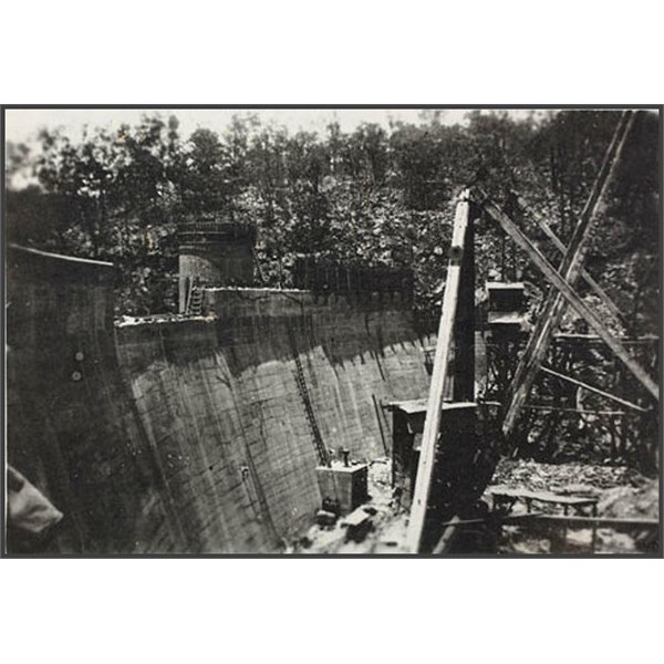
Manton Dam wall under construction 1940s
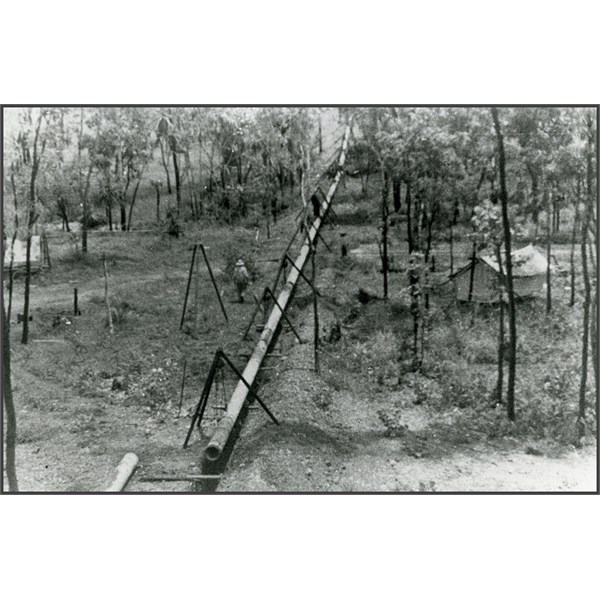
construction of the pipeline between Manton Dam and Darwin
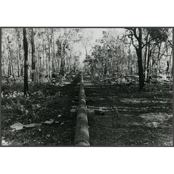
Pipeline from Manton Dam to Darwin
The dam sits across the Manton River, which was named after James T Manton. James
Manton was the second Northern Territory Government resident from 1866-67 (South Australian Government’s representative) and he is also acknowledged as the person who chose the site of modern day
Darwin.
The site for
Manton Dam was selected by geologist, Dr. W G Woolnough in 1936. It was built to not only meet the needs of
Darwin’s growing civilian
population, but an increased military presence as the threat of war drew closer. In particular, the Royal Australian Navy (RAN) called for a reliable
water supply for its fleet as did the Royal Navy and as it was agreed that the existing, limited
water supply needed to be expanded, this was achieved with
funding from the RAN.
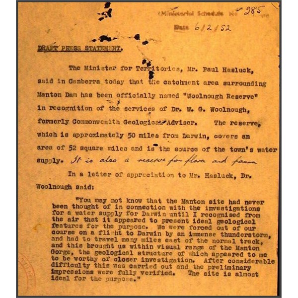
Dr. W.G. Woolnough Recognition of Services in Connection with Manton Dam (N.T.)
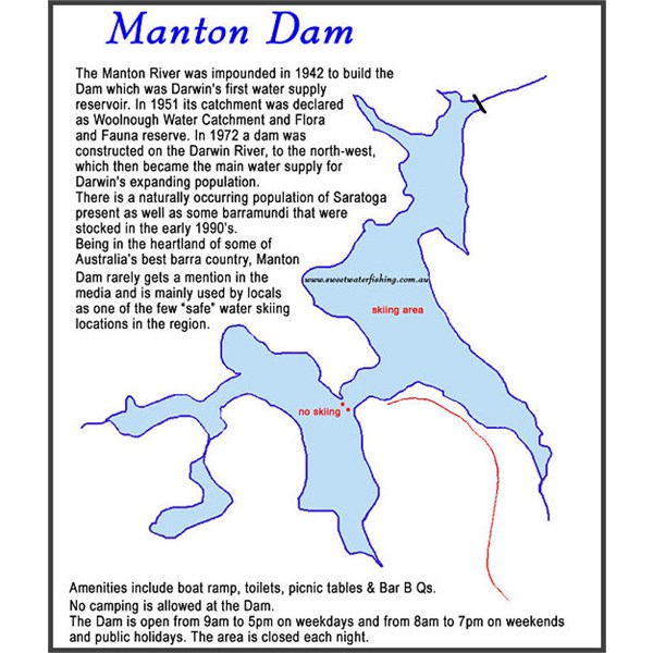
Manton Dam Map
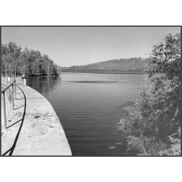
Manton Dam from the top of the wall 1961
Tenders for the construction of the dam and supply and installation of plant and equipment were called for in late 1937. Construction of the dam and the pipeline to
Darwin started in 1938
During construction numerous industrial disputes (organised by the North Australian Workers Union) caused the financial collapse of the contractor (Manton Construction Pty Ltd) and there was increasing tension between the defence forces and the civilian administration, mainly over prioritising
water supplies between the military and civilians.
The dam wall was completed in January 1941 with pump testing being carried out in February and March of that year. The first
water flowed from
Manton Dam to the Howard Springs
junction on 11 February 1941 and into
Darwin one month later, however construction of the dam itself was not completed until 1942.
The entry of Japan into WWII upgraded the strategic value of the dam and military units were assigned to guard the structure. A plan to demolish the dam in the event of an invasion was prepared in 1942 and two torpedo nets were strung across the dam in 1943.
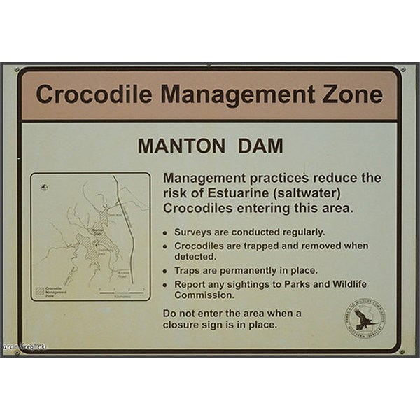
Crocodile Warning Sign
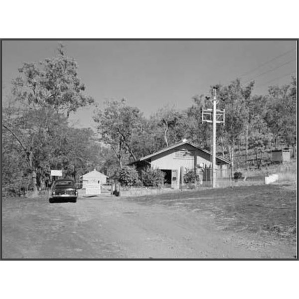
Manton Dam Entrance Gate 1961
Despite anti-aircraft guns being allocated to defend the dam, guns were not available and while one anti-aircraft searchlight was positioned at the dam, this was relocated to nearby Haycock
Hill in October 1943.
In response to further supply requests from the RAN,
Darwin’s
water supply was reassessed in 1944 resulting in the construction of a second pipeline and upgrading
of storage facilities in 1945.
The dam, pumping stations, pipelines and storage facilities, which were under the ‘ownership’ of the RAN, were all handed over to the NT Administration in the early post-war years.
In 1964 electric-driven pumps were installed in No 3 pump house (nearest to the Stuart Highway and these pumps are still in place and remain fully operational today.
Manton Dam was to remain
Darwin’s main source of potable (drinking)
water until 1972 when
Darwin River Dam (DRD) was constructed and commissioned. While
Manton Dam was no longer in service, it remains the emergency back up
water supply for
Darwin should it be required.
As such, all equipment has been maintained in a state of readiness and
Manton Dam has been put into service twice since that time. Firstly after Cyclone Tracy in 1974 and again in 1992 when a major fire temporarily halted pumping operations from DRD.
In 1989 the NT Government opened the southern edge of the
Manton Dam catchment for
recreation, setting aside an area for
water sports, fishing and family activities that is extremely popular with local residents.
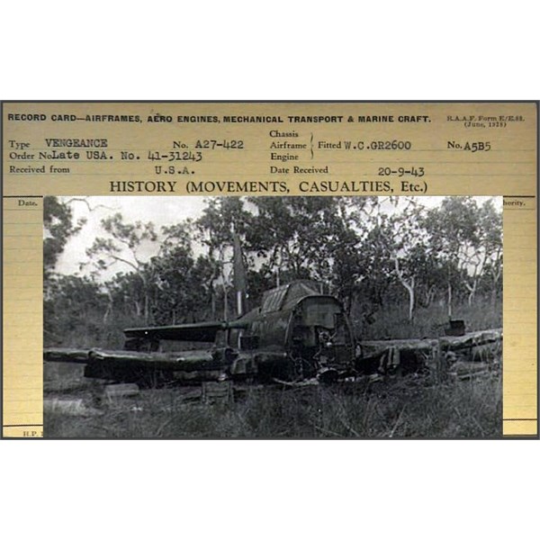
Wreck of A27-422 at Manton Dam.
And 1 file re the 2 Spitfires that had a mid air collision during the war.
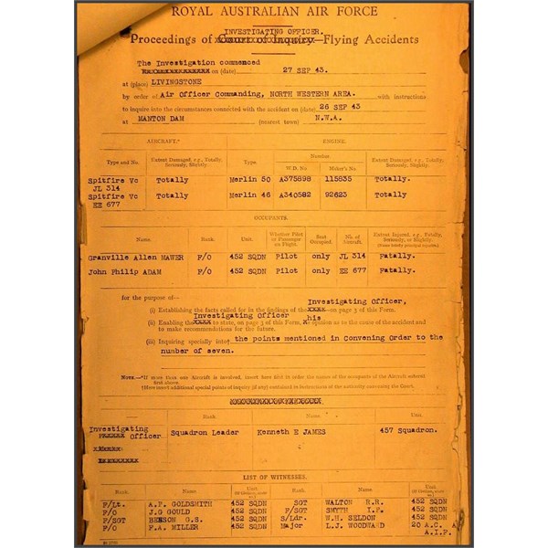
Spitfires JL314 and EE677 - Investigation re accident to near Manton Dam on 26.9.1943
Take a stroll along the boardwalk to the base of the dam wall and maybe throw in a line if the black bream are present in the pools below the dam wall. From Pump house No. 1 take the path to the top of the dam wall and take in the view of the dam, the catchment area, the intake “tower”, the spillway and the remains of the anti-torpedo net foundations.
Take the time to enjoy the
well-tended and shady
picnic area and utilise the free electric barbeque.
Most of all, take time to relax and reflect a little on the history and
heritage value of the site.
.