Navigating, Google Earth
Submitted: Monday, Jun 08, 2015 at 13:58
ThreadID:
119116
Views:
3460
Replies:
8
FollowUps:
7
This Thread has been Archived
Member - Trouper (NSW)
I use garmin for all my 'back of beyond' navigation and am quite happy with that. I also use Google Earth on PC when planning trips particularly out of the way
places checking that the tracks are still where their supposed to be.
So as a matter of interest, can you use google earth on say a tablet that has an appropriate app to navigate with instead of Hema or Mudmap or 250k maps
Reply By: get outmore - Monday, Jun 08, 2015 at 14:14
Monday, Jun 08, 2015 at 14:14
you mean like the google earth app?
you do need mobile internet for it to work though
AnswerID:
554700
Reply By: vk1dx - Monday, Jun 08, 2015 at 14:23
Monday, Jun 08, 2015 at 14:23
Careful relying on GE to see if a track "is still there". We planned a trip through some private property, a 1.2Mill acre place, and I followed the track on GE at home. No good trying to do that when there isn't any internet in the bush.
Got permission and off we go. Came in the "back gate" as instructed by owners and tried to follow the track. Nope not there now. The track on GE was actually a ploughed fire break and not a track at all. We went back to the "rear gate" and just followed one of the station tracks.
Seems that GE don't update the outback photos much.
Worth a try but just remember that the track may not be there now. Same as the maps. They can be wrong also.
Phil
AnswerID:
554702
Follow Up By: Member - Trouper (NSW) - Monday, Jun 08, 2015 at 18:10
Monday, Jun 08, 2015 at 18:10
Agree Phil, I have GE on the computer at home it is not dependent on internet to operate its just there. Its just a 'program' sitting there and I sometimes consult it and 'drill in' onto the area i need. I often use it in conjunction with the online oztopo and compare notes as it were.
jeff
FollowupID:
840822
Follow Up By: vk1dx - Monday, Jun 08, 2015 at 18:26
Monday, Jun 08, 2015 at 18:26
Hi Jeff
Try this exercise. Disconnect your home PC from the internet and start GE.
It will start and display error messages saying that it doesn't have access to the internet. ooops.
It needs the internet my friend. It's data files are on the GE server.
Phil
FollowupID:
840823
Follow Up By: carnaby - Monday, Jun 08, 2015 at 18:49
Monday, Jun 08, 2015 at 18:49
Hi all,
I also use a Garmin to navigate and download the all my track data to my laptop using Basecamp a garmin product this you can see using google earth .
I do a lot of pre trip exploring using GE and take gps locations off that transfer to my garmin.
after a exploring an area i can boot up GE and the last area will come up in high def and you can check areas Without the internet
but if you go out of the area you looked at you cant see much detail
Alan
FollowupID:
840825
Follow Up By: vk1dx - Monday, Jun 08, 2015 at 19:55
Monday, Jun 08, 2015 at 19:55
I tried that. Seems like a lot of work to me. Just imagine getting all the displays for a trip from
Canberra to the Simpson and then home again. I think the maps in the WinCE box installed in the dash will do.
I have been known to make a track file before I go of our anticipated route but have given up on that because we usually change our mind during the trip to see more things that we learn about as we travel.
Phil
FollowupID:
840828
Reply By: GarryR - Monday, Jun 08, 2015 at 18:44
Monday, Jun 08, 2015 at 18:44
I have used GE to look at a future trip for planning, but that is it. You must remember that GE don't update their maps regularly, similar to paper maps. Some of my topo paper maps have not been updated for as much as 60yrs, hence some of the track details are incorrect. As I am involved in preparing hiking
routes with and for the scout group, I find it frustrating that what you plan is no longer there. I find cross refering eg Hema with mudmap for example is my best chance of planning a more accurate route.
AnswerID:
554712
Reply By: Member - Trouper (NSW) - Monday, Jun 08, 2015 at 18:45
Monday, Jun 08, 2015 at 18:45
Phil, er thanks mate, yeah was not aware of that. I'm obviously not good with these things
Cheers
AnswerID:
554713
Follow Up By: Member - Trouper (NSW) - Tuesday, Jun 09, 2015 at 12:34
Tuesday, Jun 09, 2015 at 12:34
Hi Carnaby, That is exactly what i do using Basecamp in conjunction with GE..................Cheers
FollowupID:
840853
Reply By: ExplorOz Team - Michelle - Tuesday, Jun 09, 2015 at 14:49
Tuesday, Jun 09, 2015 at 14:49
Using the mapping in ExplorOz
Places, we actually offer Google satellite base maps and Street maps along with the
EOTopo topo maps as alternative base map layers so you can have the option on the same screen with a flick of a button. I do a lot of online research for outback areas from the desktop computer using this method and toggling between the different base maps to verify positions for
Places etc is part of my job. For each toggle you usually need to adjust the zoom level. This option isn't available offline but its very handy for trip planning. You can drill in a lot further with the satellite maps in most circumstances and its useful to a point, but sometimes the topography is too forested but its all just another tool.
AnswerID:
554744
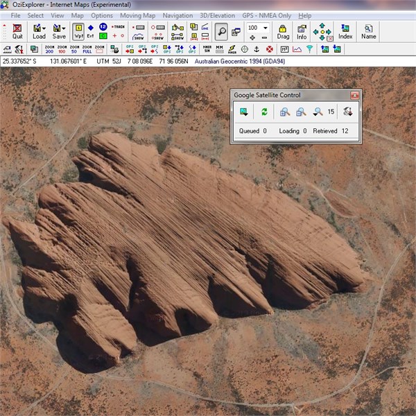
Reply By: The Explorer - Tuesday, Jun 09, 2015 at 15:08
Tuesday, Jun 09, 2015 at 15:08
...for all those OziExplorer (PC version) users out there keep in mind you can open Google Earth images (and a few other map sources) directly into OziExplorer using "Internet Maps" - all explained
HERE
So - you can do what Basecamp users (etc) are doing without the need to flick between GE and your mapping program - Just open OziExplorer load up Internet Maps and you can then trace tracks etc, save them as GPX (for example) and load them onto you GPS/Tablet/Nav device for later reference while on tour.
Also all the GE images you look at while online with OziExplorer are cached (saved) on your PC so you can view them later without an internet connection, which means if you have a laptop etc running the full version of OziExplorer you can reference the GE (or other) images while in the middle of nowhere (assuming they have previously been cached).
The cached images work with Ozi Moving Map so this is what the OP was chasing though as mentioned ..need PC version of OziExplorer and you need to cache all the images you want at the correct zoom level while online (note: I have never tried this so just what is claimed)
Ozi & GE
Cheers
Greg
| I sent one final shout after him to stick to the track, to which he replied “All right,” That was the last ever seen of Gibson - E Giles 23 April 1874 Lifetime Member
My Profile My Blog Send Message
Moderator |
AnswerID:
554745
Reply By: The Explorer - Tuesday, Jun 09, 2015 at 15:52
Tuesday, Jun 09, 2015 at 15:52
And then there is Plan B:
Download Google Earth images as geo-referenced tiles and use them in OziExplorer (PC, Android, CE) (and other map programs) like you would any other map.
There are a number of free software programs out there that allow you to make a calibrated map of areas from GE including (I think):
gMapMaker
MobAC
TerraIncognita
GoogleMV
SAS.Planet
..could be more ?
MobAC works for me - haven't tried the other ones.
Cheers
Greg
| I sent one final shout after him to stick to the track, to which he replied “All right,” That was the last ever seen of Gibson - E Giles 23 April 1874 Lifetime Member
My Profile My Blog Send Message
Moderator |
AnswerID:
554747
Follow Up By: equinox - Wednesday, Jun 10, 2015 at 21:25
Wednesday, Jun 10, 2015 at 21:25
I used gMapmaker a few years ago.
It was good to import the calibrated images in Ozi.
If you downloaded to much and at a high level of detail Google would lock you out of GE for a few hours.
To be honest I find it easier to plot waypoints on GE before a trip then just use those WPT's utilising the normal maps.
Cheers
Alan
FollowupID:
841908
Follow Up By: The Explorer - Wednesday, Jun 10, 2015 at 22:17
Wednesday, Jun 10, 2015 at 22:17
Think I gave up on gMapmaker years ago myself but it is very easy to make images ready to go with MobAC (for example) and having the images handy (along with waypoints/track traces)...is very handy even if you dont use them every time. Many different scenarios and one person requirements are different to another so no set rule - do what suits you - just an option. I never leave home without every map/image I can get my hands on.
I use Microsoft Virtual Earth a lot these days - no lock out. Map source depends what area though as in some GE is better resolution/age in other MSV is better...and then there is ArcGIS Satellite..not bad also and another alternative. Nearmap is very good for Southwest WA (I assume other populated areas over east)..but you have to pay a small annual fee for personal use.
All good fun
Cheers
Greg
| I sent one final shout after him to stick to the track, to which he replied “All right,” That was the last ever seen of Gibson - E Giles 23 April 1874 Lifetime Member
My Profile My Blog Send Message
Moderator |
FollowupID:
841912
Reply By: Member - bungarra (WA) - Wednesday, Jun 10, 2015 at 21:12
Wednesday, Jun 10, 2015 at 21:12
GE will retain some detail from the last image/images visited once you shut down....if you start panning around too much outside that captured imagery you will get nothing
When way out bush with no signal I use it for localised image checking...as I am not looking at a large area and GE doesn't have a fit trying to connect as it draws on the small amount of image memory from last use
I use this situation when checking the GE but in this situation I am not panning that far distance as I have already captured that image...I have never measured the area involved but it would be a few hundred sq km at times
AnswerID:
555796