Stuart Highway part 2
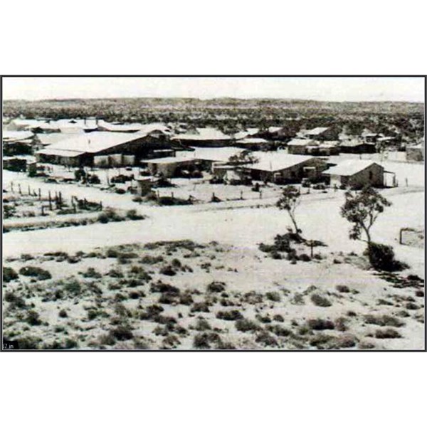
Wycliffe Well was sunk circa 1872 for the
Overland Telegraph Line but the
water quality was poor. A
bore was sunk in June 1937 as part of the general upgrading of facilities on the North-South Stock Route and it was from this supply that a two hectare Army farm was established until mid-1945.
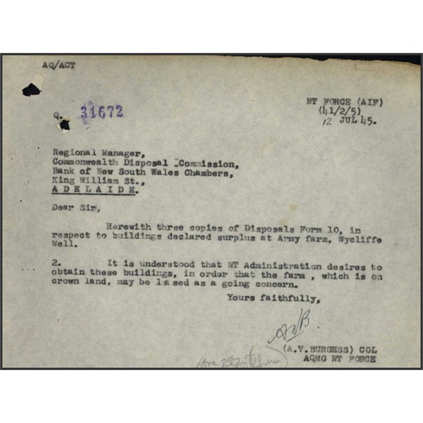
Wycliffe Well Army Farm building info
Prior to WWII, at a location 12km east of
Wauchope, the metal wolframite had been mined by tributers working for private enterprise. In 1942,the site together with another one at Hatches
Creek were taken over by the Commonwealth in an effort to increase production of the strategic metal,used in the production of armaments.
Enlistments depleted the available workforce. However, this was technically overcome when 587 Chinese quarrymen, from Nauru and Ocean Island,were sent to assist. Working conditions were primitive, and food and shelter inadequate, resulting in a general strike on 7th August 1942. Relations between the Chinese and their Australian overseers were not very cordial and administrative incompetence added to a chaotic situation which resulted in a decline in production. Continued low production, availability of other supplies and decreasing demands eventually led to the field being abandoned. The Chinese were transported to
Brisbane in November 1943 where they were used as construction workers for the
United States Army.
Thetrack to the wolframite field and historic minesites is not suitable for conventional vehicles, and caution, even in 4WD vehicles, is advised.
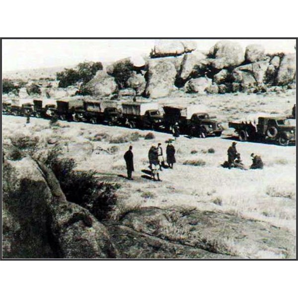
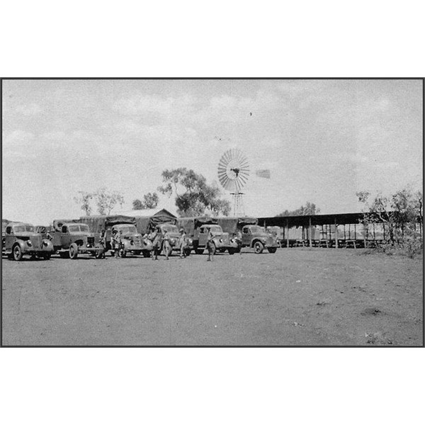
Convoy stop at Devils Marbles
At The
Devils Marbles the original track has been retained and now provides off highway access to the Conservation Commission Reserve. The location was never utilised as an official stopping point but it would have been a very rare occurrence if a Northbound convoy did not stop for purposes of sightseeing at least for a short while. The variety of WWII photographs available attest to the site’s popularity.
At Bonney
Well the convoys utilised this
well sunk in 1879 as a convoy luncheon stop during the war years, although no evidence of military activity remains. The
well has remained relatively intact since 1879 and has recently been restored.
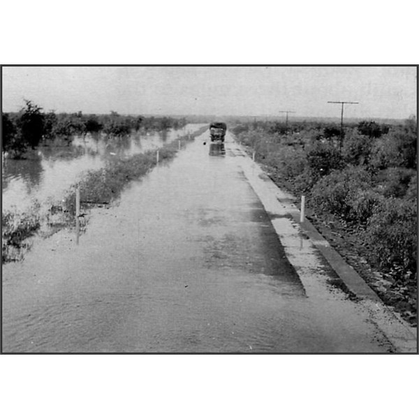
Newcastle Waters Causeway
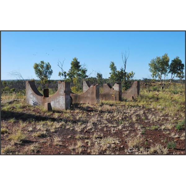
Cradles for the fuel tank at Banka Banka
The Section from
Tennant Creek to
Newcastle Waters features the WWII staging
camp of Banka Banka which represented the secondovernight stop for the thousands of troops brought from the south by rail to
Alice Springs and then ferried north by truck convoy to the railway at
Larrimah. This highlights the magnitude of the tasks involved in turning what was little more than a series of dirt tracks following the
Overland Telegraph Line into a major road, the Stuart Highway. The new highway provided an important means of transport for desperately needed personnel and supplies at a time when the sea
routes were at risk due to enemy activity.The need for a reliable overland route became even more imperative after the first Japanese air attack on
Darwin on 19th February 1942.

American GI Truck
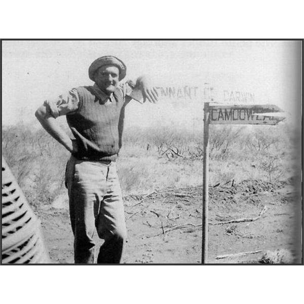
Camooweal Sign
Lunch at Cabbage Gum Bore
The east-west road, the
Barkly Highway,which connected the railhead at Mt Isa with the southern terminus of the railway to
Darwin, was also constructed during this period.
The junction of this highway with the Stuart Highway is known as Three Ways and remains an important transport
junction to this day.
By 1937,the Department of the Interior was responsible for maintenance to the north-south track under the supervision of the Resident Engineer, DD Smith. In April 1939, all
government works in the Territory came under the control of the Administrator who was made aware of the poor condition of the road by the Military authorities. As part of the Army’s requirement for overland supply
routes to
Darwin, Federal funds were allocated by the Departmentof the Interior for the upgradingof the Overland Telegraph track into a gravelled all-weather road from the
Tennant Creek district north to
Larrimah siding. Michael Terry, a Bulldozer operator wrote: "Three hundred and one
miles were scheduled for
clearing,forming, grading in 90 days. The most ambitious, the fastest assignment, to be performed, under the toughest conditions, ever handed to our Road Engineers,and which permitted no ”ifs," no "buts," allowed no excuses for tardiness." Work was commenced in September 1940 and was completed by November that year. The work was undertakenby teams from the state road authorities: South Australia worked on the section from
Tennant Creek to Fergusson
Creek, Queensland was responsible for the section from Fergusson
Creek to Dunmarra and New South Wales worked from Dunmarra to
Larrimah. According to Michael Terry: "Every man made up his mind to see the job through - and he did...New SouthWales completed her 86.5
miles ...in 63 working days. Queensland rushed her 90.5
miles , South Australia polished off her 124miles ,so that on November 29th, 1940,for the first time in the history of Man,the 301
miles between Tennant’s
Creek Telegraph Station and Larramah siding were joined for speedy all-weather motor traffic.
North-South Road Roadworks
The first
Alice Springs-Larrimahtroop carrying convoy was despatched by Colonel Veale in March 1941. By June 1942, the North-South road had been substantially damaged and broken up under the punishing impact of the continuous military traffic. The possibility of building a rail link between
Alice Springs and Birdum was ruled out as the cost was too excessive. In August 1942, the Country Roads Board of Victoria was engaged to rebuild and to seal the
Larrimah to
Alice Springs section. It established its headquarters on the western outskirts of
Tennant Creek.
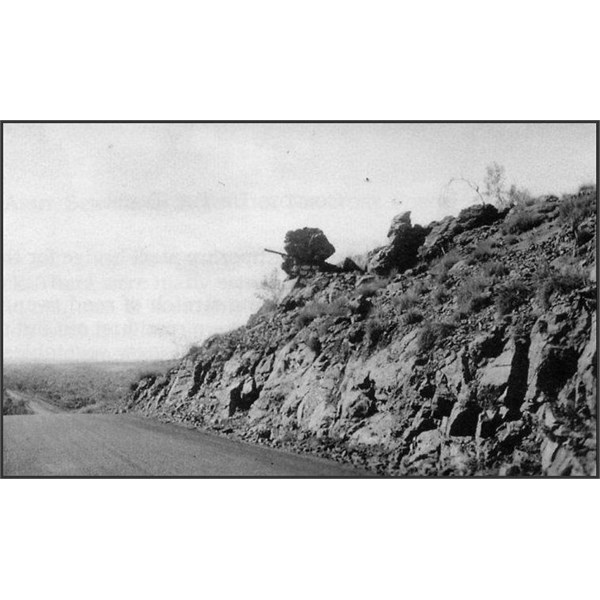
Churchill's Head
Tennant Creek late 1941

Conners Well
Following the Japanese air attack on
Darwin in February 1942, which rendered sea supply
routes hazardous, a daily supplementary service operated along the east-west road from Mt Isa to
Larrimah. This motor transport service was carried out by the negro drivers of the 29th and 48th Quartermaster Regiments of the
United States Motor Transport Command 1 which made its headquarters at Mt Isa on 28TH June 1942. Equipment available totalled an operating fleet of 1482 vehicles and approximately 3500 coloured drivers. Total Army personnel assigned to the operation numbered approximately 5000. A roundtrip from the railhead at Mt Isa to
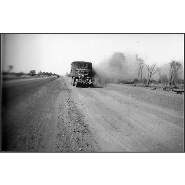
Larrimah took 12 days. By August, truck springs began to snap in increasing numbers, static parts such as radiator supports and trailer lunette bars broke, and radiator hoses were constantly breaking due to the washboard condition of the road.
Command officially disbanded on29th October 1943, although small units remained in case the war situation changed. During their tour of duty, the 29th and 48th Quartermaster Regiments mounted 173 convoys which, in addition to cargo, transported 2402 mail bags, and 4329 Australian and 842 American personnel. A medical account for the 29th Quartermaster Regiment for the month of December 1942 reported: "These colored soldiers have borne up
well under the strain,but the constant sameness, the long days of sitting behind the wheel, of driving eight hours a day, going to bed, getting up the next day to face the same thing, and at the end of convoys to have to work nearly the entire three days they are in Base
Camp to prepare for the next convoy, has resulted in a great lowering of physical resistance." Three Ways is still a popular stop-off along the Stuart Highway and is marked by a plinth in honour of Dr John Flynn,founder of the Royal Australian Flying Doctor Service.
TO BE CONTINUED
.