Stuart Hwy Part 4
Larrimah retains many of its wartime sites, notably the rail siding, repeater station, BIPOD installation and
camp areas. The Wayside Inn is a focal point of the township. A military town by origin,
Larrimah was established as an expedient solution to nearby Birdum‘s inaccessibility during the wet seasons. The site was essentially the Southern most railroad
junction and accordingly the military developed it as a rail head and major staging
camp.

Sleeping huts at Larrimah staging camp
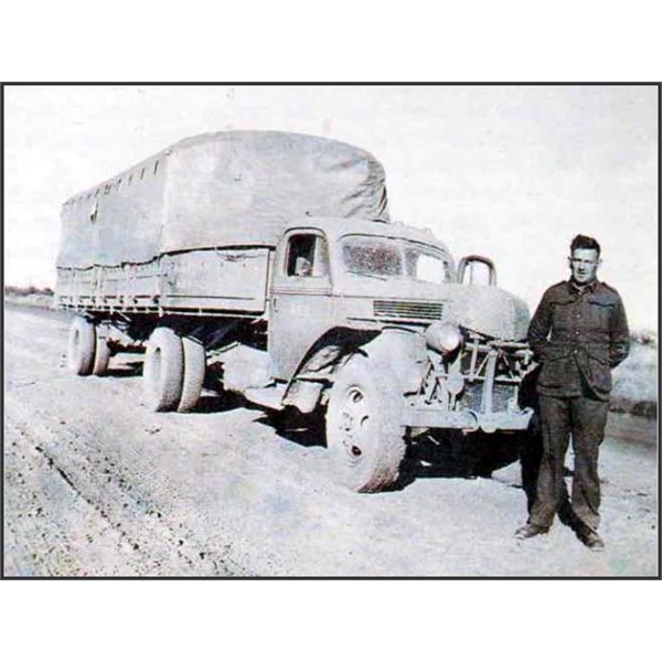
Semi-trailer near Larrimah, 1943
In late 1941, the Army's requirement for direct voice communications was realised and a repeater station was constructed adjacent to the
Larrimah siding in early 1942. Originally comprising two Sidney Williams huts, the site was later developed and used throughout the war years in conjunction with similar sites at
Barrow Creek,
Tennant Creek,
Newcastle Waters and
Pine Creek. Together they provided a military network of communications between
Darwin and the South.
With the Japanese advancing rapidly throughout the Pacific, the Allies were pushed from the islands to the North, for a time the American war effort was seemingly directed from "the Porch of the Birdum Hotel",as the regular reports indicated.
Larrimah developed rapidly,with two sidings, one for fuel and a second for freight and passengers, established at the railhead. Warehouses, alarge staging
camp, canteen and field
bakery were constructed and a large Bulk Issue Petrol and Oil Depot (BIPOD) was installed on the town's Southern outskirts.
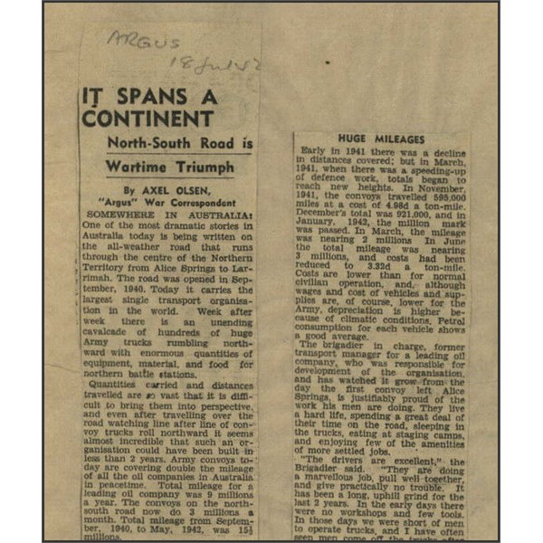
Argus News report Stuart Hwy 1942 part 1
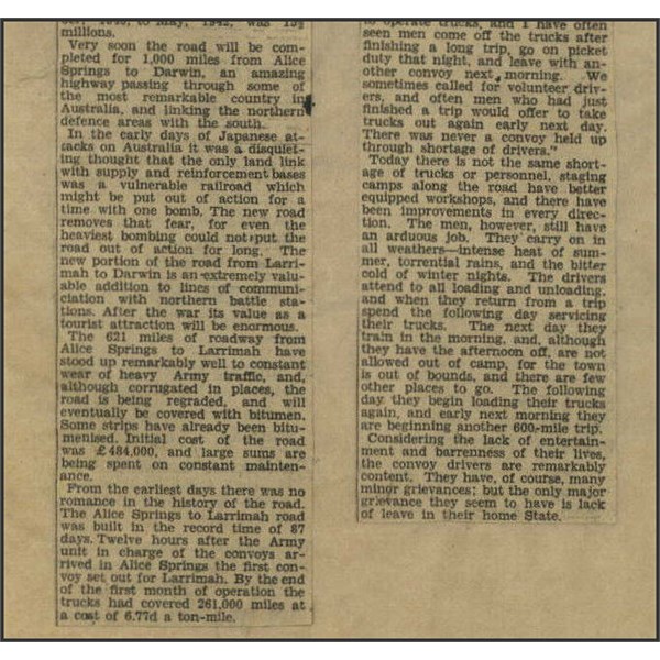
Argus News report Stuart Hwy 1942 part 2
The RAAF later developed the huge airfield and stores complex at Gorrie to the north, and a Rail Transport Office (RTO) was also established at
Larrimah siding.
Larrimah became a focal point for the transfer of personnel and stores from
Alice Springs and
Mount Isa to
Darwin and the military centres in the region and, over the war years, played host to over 150 units. These ranged from the extensive 8th Australian Staging
Camp and its 61 buildings, including a five tonne ice-making plant, to the 48th Australian Depot Cash Office, US 29th and 48th Quartermaster Trucking Companies
camp, Ordnance, Provost and Stores units. All combined to play a vital role in the North Western Area of operations. War's end saw the military withdraw from the area and the buildings sold off by the Commonwealth Disposals Commission. A number of units, notably communications and BIPOD personnel, remained at
Larrimah following the cessation of hostilities, but military activities effectively ceased in early 1946. The town grew from there and the Birdum Hotel was dismantled and its components utilised in the construction of the present Wayside Inn. Gorrie Airfield is located 10 km north of
Larrimah is marked by an interpretive
sign near
the entrance to the access road.
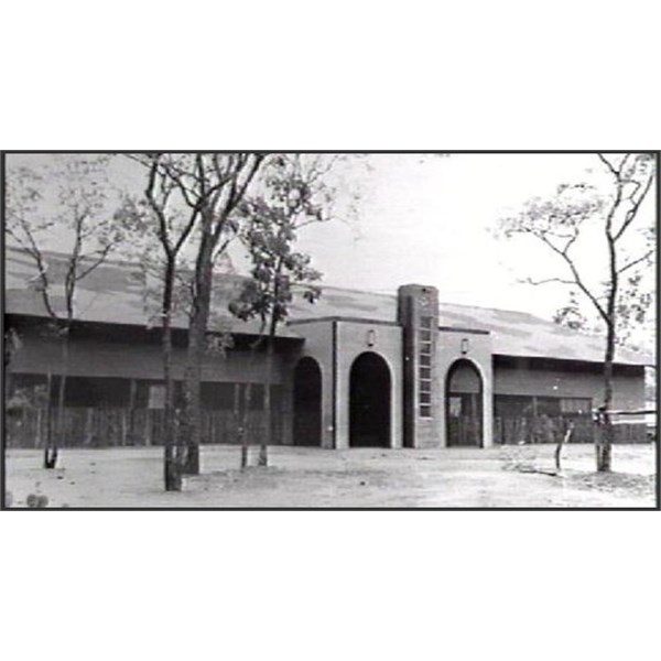
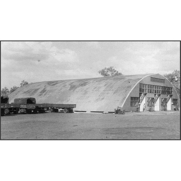
Airmens Recreation Hall at Gorrie 1944
14 ARD Gorrie, 1945
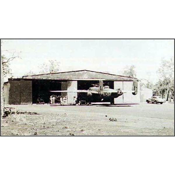
Gorrie Workshop
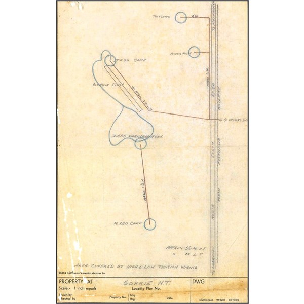
Gorrie Air Strip and locality
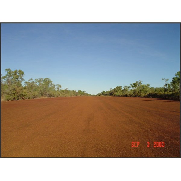
Gorrie Airfield in 2003
The
sign below was missing the last time I was there, it was probably taken by a tourist. There was 2 very large signs
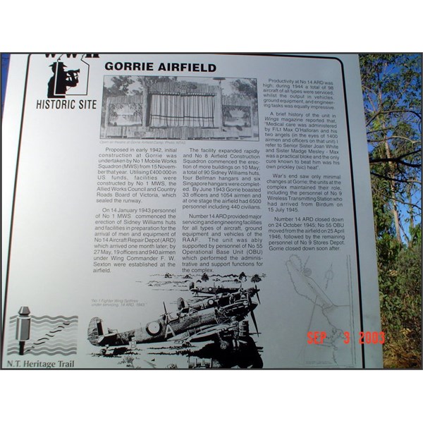
Gorrie Airfield Sign 2003
Spitfire photo on the Gorrie Airfield Sign
The RAAF‘s No 9 Stores Depot is 3.1km north of Gorrie Airfield
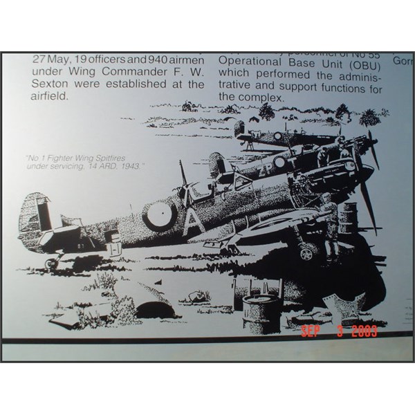
information sign on the eastern side of the Stuart Highway. Construction work started on Gorrie Airfield in November 1942 by No 1 Airfield Construction Squadron and later by the Allied Works Council. The runway was sealed in early 1943 by gangs of the Country Roads Board (Vic). Some £400 000 of US funds were utilised for the construction of the runway and airfield facilities. Number 9 Stores Depot was established east of the North South track in late 1942, whilst 14 Aircraft Repair Depot commenced activities in early 1943. Numbers 1 and 8 Airfield Construction Squadrons were involved in the erection of 90 Sidney Williams '
comet' huts for the complex which also included four Bellman hangars and six Singapore hangars by late 1943. The Airmen‘s
Recreation Hall was opened on 27 November 1943,the occasion being marked by a mixed dance. The Airmen's
recreation hut was a classic, built mainly from ‘scrounged‘ material, as was the hospital,church and some other facilities. The Station Sick Quarters opened on 14 July 1943 with a staff of one doctor and two medical orderlies; two nursing sisters arrived in October 1943.

Scout Cars near Mataranka
hosted over 100 military units during the war years. A wide range of units established themselves in the immediate area, ranging from No 42 Australian
Camp Hospital, Ordnance, Supply and Transport, Abattoir to Engineers and Provosts.
Part 5 and final next week
I wish you all a safe and enjoyable week leading up to Christmas.