Where is Bungabinni Well located on the CSR?
Submitted: Friday, Jan 15, 2016 at 17:51
ThreadID:
131369
Views:
2845
Replies:
2
FollowUps:
4
This Thread has been Archived
techedge
Greg & Josie Walker's CSR (spiral bound) map has Bungabinni at 22°09'24.8"S, 125°11'47.6"E (or -22.156889, 125.196556).
Has anyone verified this exact location? A good GPS should give a fix to within 3m - that's the sort of accuracy I'm after ;-).

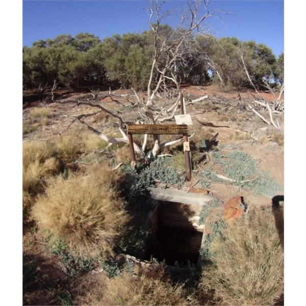
Bungabinni Well on the CSR
Reply By: The Explorer - Friday, Jan 15, 2016 at 18:38
Friday, Jan 15, 2016 at 18:38
Hi
Sorry cant help with exact coordinates but doubt you will have trouble finding it given how
well traveled the area is. There is a carpark/
camp area right next to it an no doubt a
well traveled path to the
well.
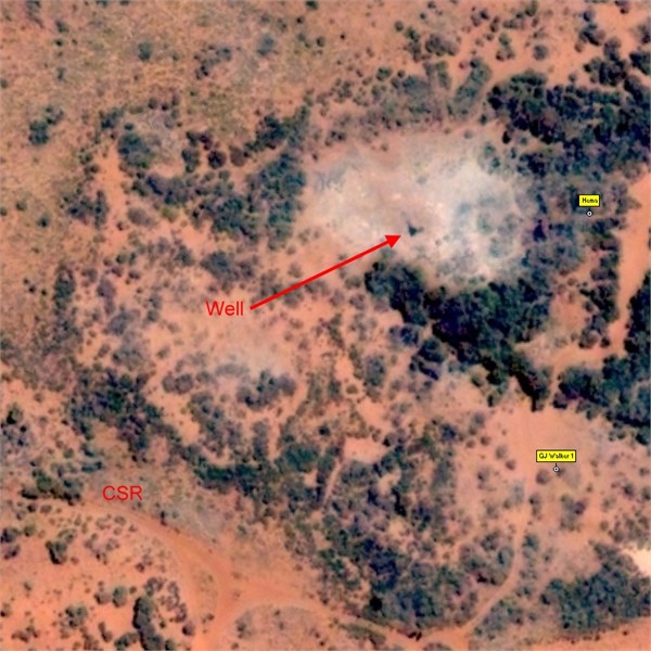
Greg & Josie Walker's coords appear to plot in one of the nearby carparks/
camp areas. Hemas coords (from Great Desert Tracks NW Map) also appears to plot in another carpark/
camp site ~90m north.
The
well itself (guessing its the black dot) is in the clay pan visible in this Microsoft Virtual Earth screen shot...at 726473 mE, 7548250 mN MGA Zone 51 (Datum GDA94) +/- a few metres.

Weeeellllll
Cheers
Greg
| I sent one final shout after him to stick to the track, to which he replied “All right,” That was the last ever seen of Gibson - E Giles 23 April 1874 Lifetime Member
My Profile My Blog Send Message
Moderator |
AnswerID:
594972
Follow Up By: techedge - Friday, Jan 15, 2016 at 18:52
Friday, Jan 15, 2016 at 18:52
Well, you learn something new every day - much appreciated Greg!
The info matches what everyone has been telling me back at the
Canning Stock Route facebook page run by Phil Bianchi. Thanks again for the link and image.
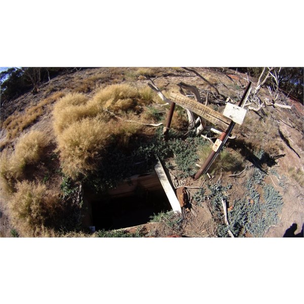
Here's another photo that my friend Thomas Kreis took in August 2015 (he also cycled the CSR that year) - his phone had the GPS location but a bit of moisture got into it some time between there and Billiluna and he lost the track.

Bungabinni Native Well close up.
FollowupID:
863574
Follow Up By: The Explorer - Friday, Jan 15, 2016 at 18:55
Friday, Jan 15, 2016 at 18:55
Phil Bianchi ! What would he know :)
Cheers
Greg
| I sent one final shout after him to stick to the track, to which he replied “All right,” That was the last ever seen of Gibson - E Giles 23 April 1874 Lifetime Member
My Profile My Blog Send Message
Moderator |
FollowupID:
863575
Follow Up By: Phil B (WA) - Saturday, Jan 16, 2016 at 07:35
Saturday, Jan 16, 2016 at 07:35
I've been sprung - LOL.
FollowupID:
863595
Follow Up By: The Explorer - Monday, Jan 18, 2016 at 13:27
Monday, Jan 18, 2016 at 13:27
Hi
Have just been to the CSR facebook page and my "guess" at where the
well is may be slightly wrong.
It would appear to be in the same clay pan but someone has posted the coordinates as 726503 mE and 7548244 mN....about 30m east of where I thought it looked to be. Either way should be easy to find.
Cheers
Greg
| I sent one final shout after him to stick to the track, to which he replied “All right,” That was the last ever seen of Gibson - E Giles 23 April 1874 Lifetime Member
My Profile My Blog Send Message
Moderator |
FollowupID:
863727
Reply By: Bob Y. - Qld - Friday, Jan 15, 2016 at 18:57
Friday, Jan 15, 2016 at 18:57
Ha ha, just about to suggest you visit Facebook, techedge, but you know all about that bit of chatter re this
well.
Bob
AnswerID:
594973