Anyone heading to the Simpson in late September?
Submitted: Wednesday, Aug 31, 2016 at 14:20
ThreadID:
133348
Views:
5285
Replies:
1
FollowUps:
11
This Thread has been Archived
Cameron A
Hi all,
A colleague and I are heading from Bundy to the Simpson over the school holidays. Because we're going in a single vehicle, I'm keen to find out if anyone else is going to be floating around the same
places at about the same time. Also it'd be good to catch up with some like minded people for a cold one.
We'll be leaving Bundy on the Sept 17, and plan on departing
Birdsville into the Simmo on the 20th. Looking at this stage to head down the
Birdsville Track, take
Warburton Crossing (if it's open, which doesn't appear likely), and head up K1 to Poeppel's via a few detours (up Knolls Tk probably). Planning on getting back to Birdvsille around Sept 26.
If you reckon you'll be in the area, sing out and we'll have a coldie.
Cheers,
Cam
Reply By: Bob Y. - Qld - Wednesday, Aug 31, 2016 at 14:49
Wednesday, Aug 31, 2016 at 14:49
We may be in area later, early Oct, but likely to be going over QAA Line and up
Hay River track, Cam.
Likely you can forget about the
Warburton for 2016.
We went over Simpson in June, and Knoll's Track didn't impress me at all. Rough as buggery between Knoll's and WAA
junction, as bad or worse than Camps 13-14 on the Madigan.
You could go along QAA Line, down K1 to
Rig Road, then along there to Lone Pine, up
Erabena Track to French Line, then east along to Knoll's, check them out, back to FL, do Poepells and back over QAA to
Birdsville.
Rig Road is really good travelling(did it in 2 days from
Warburton to 3 O'clock Ck, Oct 2015) and you can make up some time there.
That would eat up most of your 6-7 days, though with longer daylight hours, you could always go to Rig-French Line
junction, or do lower Colson Track and back over FL. See how you're travelling as you go.
Rig Road seems to be much quieter, as in vehicles, than the FL.
Finally, with the regular rain events that seem to be commonplace this year, some of these tracks could be closed. Eastern end of WAA Line was closed with a
salt lake right across the track in June. Would be surprised if it's even open now?
Bob
AnswerID:
603995
Follow Up By: Cameron A - Wednesday, Aug 31, 2016 at 15:18
Wednesday, Aug 31, 2016 at 15:18
Hi Bob,
Thanks for your reply! I was worried about the
Warburton, it's in the way of a hell of a lot of
water, so at least I know to write it off now instead...
I really appreciate the report on the state of the roads - I've only done the FL before, and was hoping to explore some of the roads lesser traveled, so that's excellent. I'll crack out the map book tonight and find an alternate loop based on your recommendations.
I haven't heard about the eastern end of the WAA either - that sort of detailed info isn't easy to come by without a phone call to Mungerannie or
Birdsville I'd suggest!
Thanks again, and have a safe and happy trip up the
Hay when you go (lucky bugger).
Cheers!
FollowupID:
873657
Follow Up By: Bob Y. - Qld - Wednesday, Aug 31, 2016 at 20:14
Wednesday, Aug 31, 2016 at 20:14
We didn't know about the
salt lake either Cam, but it was mentioned by member dad1340 that he'd heard there had been good rain in that area. When you look at the Simpson map there is a large number of salt lakes parallel to Knoll's track, and straddling the WAA Line.
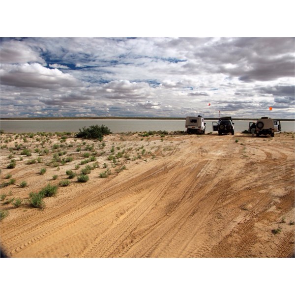
WAA Line, blocked by salt lake. June, 2016.
Would suggest you don't attempt the WAA Line, Cam, at least east-west as a single vehicle. Steep and quite soft sandhills will be even worse in Sept. Have only done a few short sections of FL, maybe next year for us.
Don Rowlands, NP
ranger in
Birdsville, would be worth seeing for road info when you hit
Birdsville.
Bob
FollowupID:
873664
Follow Up By: Cameron A - Wednesday, Aug 31, 2016 at 20:30
Wednesday, Aug 31, 2016 at 20:30
Thanks Bob, that's great advice. Photo says it all really...
I've had a look at the map, and provided the tracks are in good nick (and I will chase up Don once I hit
Birdsville for the latest), I think your suggestion of
Birdsville to Poeppel, south on K1 to the
Rig Road, across and back up Erabena then return via FL is the way to go. It's only about an extra 70km over what I was originally planning, and does take in a lot more of the Simpson than I originally planned.
I assume the south end of the K1 line and the east end of the
Rig Road wouldn't be affected by the flooding?
Cheers, thanks again for the advice.
Cam
FollowupID:
873665
Follow Up By: Bob Y. - Qld - Wednesday, Aug 31, 2016 at 20:54
Wednesday, Aug 31, 2016 at 20:54
Cam,
K1 turns off QAA at
Hay River turn off. You don't need to go into Poepells, though is only 3-4kms off K1, you could leave it for return trip on FL.
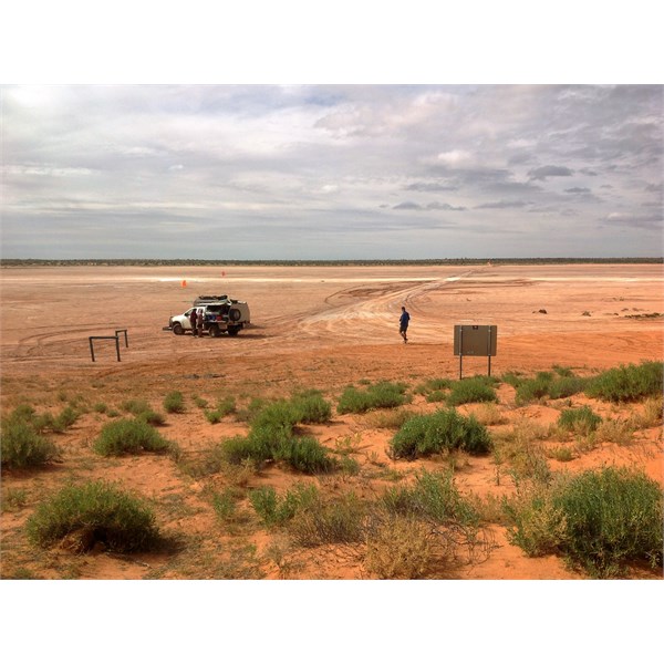
Hay River, K1 Junction on QAA Line, June, 2016.
No worries about flooding from
Warburton on Rig or K1.
We spent 6 days,
Birdsville to Mt Dare, but had slow starts in mornings and stopped many, many times for photos, or to check things of interest. Suppose if you were back on FL on 4th day you'd be travelling close to your schedule?
I might be a bit anal but ran my fog lights at all times on both Simpson & the Madigan, Cam, rather be seen than have an altercation. Did meet one Richard cranium on the
Hay who'd turned his UHF off because he was out of the sandhills!!!
We ran 20psi on all 3 vehicles, a DMax, an 80 series and my 79 series. Just see how you go as days will be warmer in Sept, and sand softer.
Bob
FollowupID:
873666
Follow Up By: Cameron A - Wednesday, Aug 31, 2016 at 21:06
Wednesday, Aug 31, 2016 at 21:06
That's good news. Last thing I need is to wander all the way down to Rig / K1 and hit a full
salt lake. I think you're right, back on FL by day 4 would be ideal, and a realistic pace for that particular trip I think.
I didn't get fog lights fitted when I had the bar put on, that was a bit short sighted in hindsight. I don't think there's anything anal about being safe though, there's always those morons who think it's a racetrack.
Do you know off the top of your head what sort of fuel economy the DMax got in
the desert? I'm running a late Mitsubishi Challenger which I think is reasonably comparable (Challenger might be a tad thirstier). At this point I'm planning on taking a total of 150 - 170L for the trip; given a round trip of around 675km, that'll allow 22 - 25 l/100km which I think should be heaps. Surely. Problem is, last time I did the FL from Mt Dare (in 2011 when
Birdsville to Poeppel was all underwater), I used bugger all fuel; but that was my old Hilux. Not sure how the new rig will behave.
FollowupID:
873667
Follow Up By: Member - David & Kerry W - Thursday, Sep 01, 2016 at 08:11
Thursday, Sep 01, 2016 at 08:11
G'day Cameron.
That was my Dmax.....The following is the last para of my write up..........
The Dmax surprised me, in the mud, through the
water, over the dunes and the biggest thrill of all (not white lightening!) but the automatic transmission. I have become a steering wheel attendant while some electronic gadget decides what to do and when. We were lucky with the dunes still damp from rain and not a hell of a lot of traffic. East west is harder than west east but undoubtedly more enjoyable as most scalloping occurs on the western side of dunes. Total distance was 1431k with a 661k dabble on the WAA line and 770k on the Madigan from Mount Dare. The Dmax used 163 lt of fuel averaging 8.77k to the litre or 14.4lt p/100k. Other than mud and
water the weather was kind.
Cheers, David
FollowupID:
873676
Follow Up By: Cameron A - Thursday, Sep 01, 2016 at 08:18
Thursday, Sep 01, 2016 at 08:18
Thanks David! 14.4 l/100km is fantastic, you'd have to be pleased with that.
I think the Dmax is quite a bit better on the juice than my auto Challenger, which doesn't have a great auto gearbox in terms of fuel economy, but I think that the amount of juice I'm planning on taking for my trip should be more than enough.
I'll have a hunt for your write up, it sounds like a fantastic trip. Madigan's line is definitely on the bucket list, but I'm a bit dubious about ever attempting it in the Challenger.
Thanks again, have a good one.
Cam
FollowupID:
873677
Follow Up By: Member - David & Kerry W - Thursday, Sep 01, 2016 at 12:59
Thursday, Sep 01, 2016 at 12:59
G'day Cameron.
The write up is not online. Yes very happy with the fuel consumption although we do travel light. Neither Bob nor I found the
Madigan Line at all daunting, in fact it really was an enjoyable drive - no low range except when I stuffed up on a dune approach gazing around and ending up on the side of the track and had to crawl back red faced.
Send a MM and I will email the trip write up (it will be a pdf)
I don't know the Challenger at all, but I am sure a Triton (which I have used on properties) would have no trouble.
Cheers, David
FollowupID:
873686
Follow Up By: Cameron A - Thursday, Sep 01, 2016 at 14:32
Thursday, Sep 01, 2016 at 14:32
Hi David,
That would explain my lack of luck in finding it... unfortunately as I'm not a member, I can't send an MM. Maybe I should reconsider that. ponderota at gmail dot com is my address, anyway. I'd love to read it.
I always viewed the
Madigan line as extraordinarily difficult, so that's a promising perspective. Obviously that's not to say supreme preparation isn't required, but maybe the Challenger could handle it. It is just a Triton with a slightly different rear
suspension I believe.
Have a great afternoon!
Cam
FollowupID:
873689
Follow Up By: Member - JOHN C16 - Friday, Sep 02, 2016 at 18:20
Friday, Sep 02, 2016 at 18:20
Bob is right that rain events are common this year. There has been another one in the last few days. Currently the
Birdsville,
Oodnadatta and Strzelecki Tracks are all closed.
Warburton crossing is closed. There is no access/exit on the Western side of Witjira National
Park.
Birdsville recorded 50mm rain in the last two days so probably there is
no access to the Simpson from the East at the moment either.
Hopefully it will be dry when you go and you can enjoy the wildflower display.
John
FollowupID:
873728
Follow Up By: Cameron A - Friday, Sep 02, 2016 at 18:31
Friday, Sep 02, 2016 at 18:31
Hi John,
I did read about the rain event in
Birdsville this afternoon, so have spent my arvo looking at alternatives if the eastern Simpson is still underwater! I have my fingers crossed that it's dry enough that we can enjoy the wildflower show and maybe have a slightly easier time on the sand.
Only time will tell, unfortunately. Hope like hell there's no more rain between now and then (none forecast in the next week, anyway).
Thanks for the update. Hoping for some good news now.
Cheers!
Cam
FollowupID:
873729