Augusta is a town on the south-west coast of Western Australia, where the
Blackwood River emerges into Flinders Bay. It is the nearest town to
Cape Leeuwin, on the furthest southwest corner of the Australian continent. The town is within the Shire of
Augusta-Margaret River local government area, and is in the Leeuwin Ward.
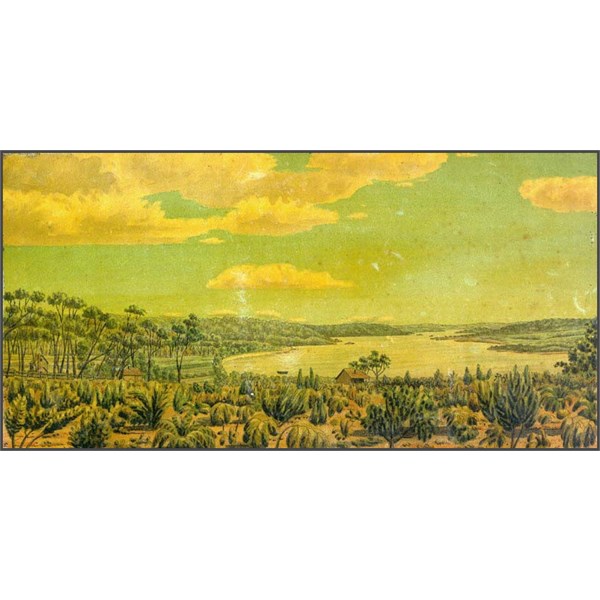
Painting of Augusta by Thomas Turner, 1830s.
was a summer holiday town for many during most of the twentieth century, but late in the 1990s many people chose to retire to the region for its cooler weather. As a consequence of this and rising land values in the
Augusta-Margaret River area, the region has experienced significant social change
The coastline near the
Augusta area was first sighted by Europeans in March 1622 when the Dutch East India Company ship Leeuwin (Lioness) mapped and named the land north of
Cape Leeuwin between
Hamelin Bay and
Point D'Entrecasteaux 't Landt van de Leeuwin. In 1801 Captain Matthew Flinders named the "south-western, and most projecting part of Leeuwin's Land"
Cape Leeuwin.
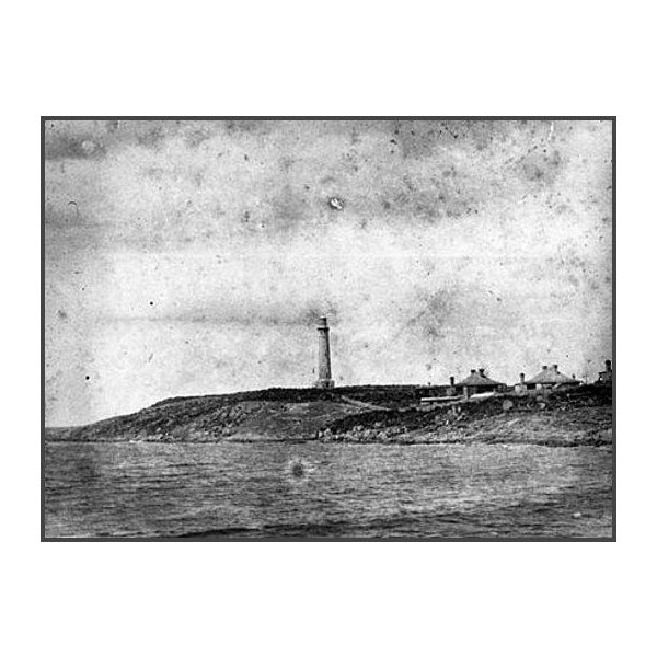
Lighthouses and Beacons - Cape Leeuwin, 1917
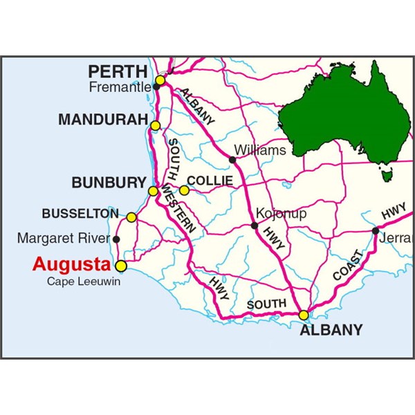
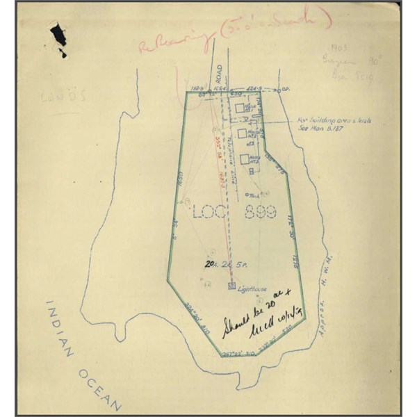
Augusta Map
was founded in 1830. In March of that year, a number of settlers, including John Molloy and members of the Bussell and Turner families, had arrived at the Swan River Colony on board the Warrior. On their arrival the Lieutenant-Governor Captain James Stirling advised them that most of the good land near the Swan River had already been granted, and suggested that they form a new sub-colony in the vicinity of
Cape Leeuwin.
The following month, Stirling sailed with a party of prospective settlers on board the Emily Taylor. After arriving at the mouth of the
Blackwood River, the party spent four days exploring the area. Stirling then confirmed his decision to establish a subcolony, the settlers' property was disembarked, and the town of
Augusta declared at the site.
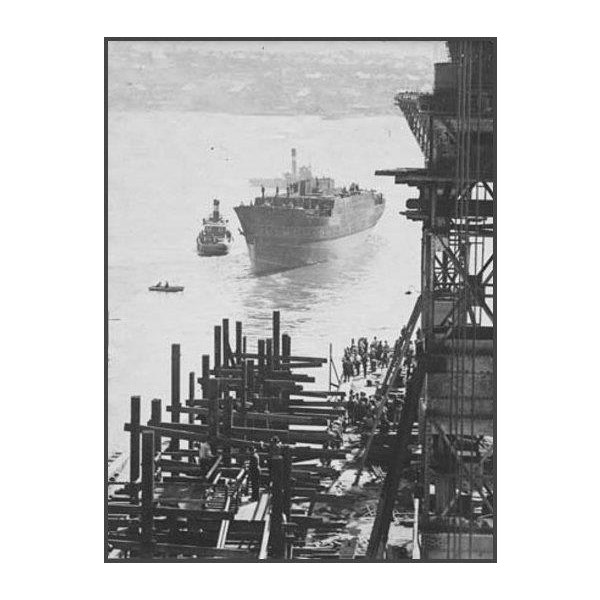
Cape Leeuwin - ship no 101 external views of construction [Completed ship leaving dock after launch, 10 December 1924,
Stirling named the town in honour of Prince Augustus Frederick, Duke of Sussex, the sixth son of George III, due to its location within Sussex County, one of the 26 counties of Western Australia that were designated in 1829 as cadastral divisions.
During the 1880s, an expansion of the timber industry occurred following the construction of a timber mill at nearby Kudardup and the completion of jetties at
Hamelin Bay and Flinders Bay.
Augusta was a stopping place on the
Busselton to Flinders Bay Branch Railway, which was government run from the 1920s to the 1950s. Prior to that M. C. Davies had a timber railway system that went to both
Hamelin Bay and Flinders Bay jetties in the 1890s.
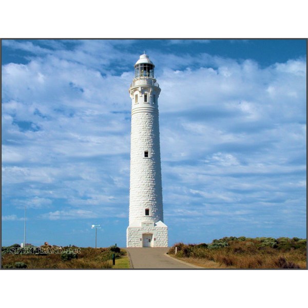
The Cape Leeuwin Lighthouse
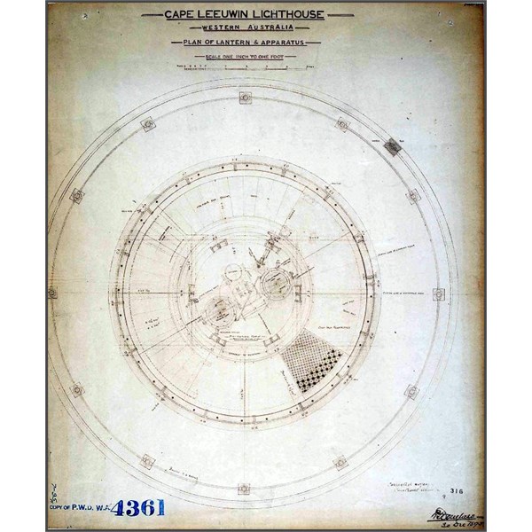
Cape Leeuwin Lighthouse Plan of Lantern and Apparatus 1915
In 1961, over 100,000 acres (40,000 ha) of farms, bush land and forests between Margaret River and
Augusta were destroyed by bushfires.
Augusta was saved from these because a serious fire a few months earlier had created a low fuel zone north of the town. The
Augusta residents cared for the school children who had been evacuated from Karridale and Kudardup.
Many tourist websites and information conflate
Augusta and
Cape Leeuwin with features that exist nearby. The
Augusta townsite now also includes the former separate Flinders Bay community at its southern end, where there had been a jetty, railway terminus, and whaling location. The new
Augusta Boat Harbour to the south of Flinders Bay, is
well outside of the townsite
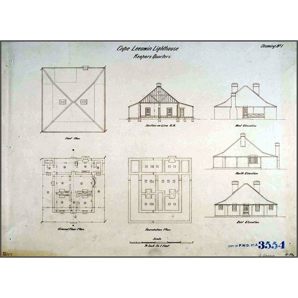
Cape Leeuwin Lighthouse Keepers Quarters 1915
Cape Leeuwin transport lighthouse Plan
Matthew Flinders named
Cape Leeuwin after the first known ship to have visited the area is the Leeuwin ("Lioness"), a Dutch vessel that charted some of the nearby coastline in 1622. The log of the Leeuwin has been lost, so very little is known of the voyage. However, the land discovered by the Leeuwin was recorded on a 1627 map by Hessel Gerritsz: Caert van't Landt van d'Eendracht ("Chart of the Land of Eendracht"), which appears to show the coast between present-day
Hamelin Bay and Point D’Entrecasteaux.
Cape Leeuwin itself cannot be recognised.
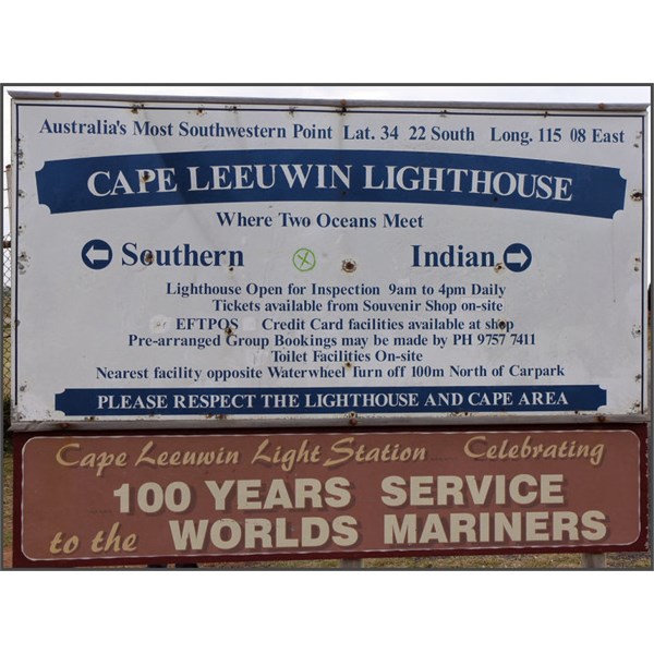
Sign at Cape Leeuwin Lighthouse
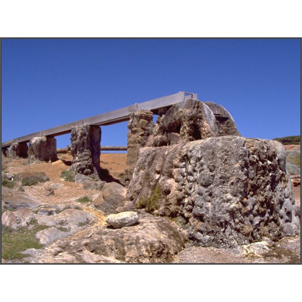
The old waterwheel near Cape Leeuwin Lighthouse
Other European vessels passed by for the next two centuries, including the Dutch 't Gulden Zeepaert, commanded by François Thijssen, in 1627 and the French Gros Venture, under Louis Aleno de St Aloüarn, in 1772.
The first known sighting of the cape was by Bruni d'Entrecasteaux in 1791. d'Entrecasteaux thought the cape was an island, and named it "Isle St Allouarn" ("St Allouarn Island"), in honour of Captain de St Aloüarn. Ten years later, Matthew Flinders began his survey of the South coast of New Holland from
Cape Leeuwin in 1801 when he named it. Flinders landed in the bay to the east of
Cape Leeuwin, today’s Flinders Bay. Flinders was aware that the area had been known to the Dutch as "Leeuwin's Land".
Cape Leeuwin is the most south-westerly mainland point of the Australian Continent, in the state of Western Australia. A few small islands and rocks, the St Alouarn Islands, extend further to the south. The nearest settlement, north of the cape, is
Augusta. South-east of
Cape Leeuwin, the coast of Western
Australia goes much further south.

The point at Cape Leeuwin where the Indian Ocean meets the Great Southern Ocean.
Located on headland of the cape is the
Cape Leeuwin Lighthouse and the buildings that were used by the lighthouse keepers. In Australia, the Cape is considered the point where the Indian Ocean meets the Southern Ocean; however most other nations and bodies consider the Southern Ocean to only exist south of 60°S
.