Margaret River access points for kayaking?
Submitted: Monday, Nov 13, 2017 at 17:54
ThreadID:
135861
Views:
7915
Replies:
3
FollowUps:
6
This Thread has been Archived
ExplorOz Team - Michelle
Can anyone tell me the various access points for kayaking on the Margaret River WA? We have our own kayaks and wondering about the merits of taking them on a short trip. The only place I know for sure is if you stay at the Riverfront Tourist
Park which is upstream of the Barrett St Weir and seems ok for paddling, but I can't figure out how/where to launch if you're not staying there - anyone have any ideas?
Reply By: The Explorer - Monday, Nov 13, 2017 at 18:26
Monday, Nov 13, 2017 at 18:26
Hello
Don't know the full picture ...but you can launch them at Barret Street Weir itself (turn left down gravel track a few 100m before Riverfront Tourist
Park.
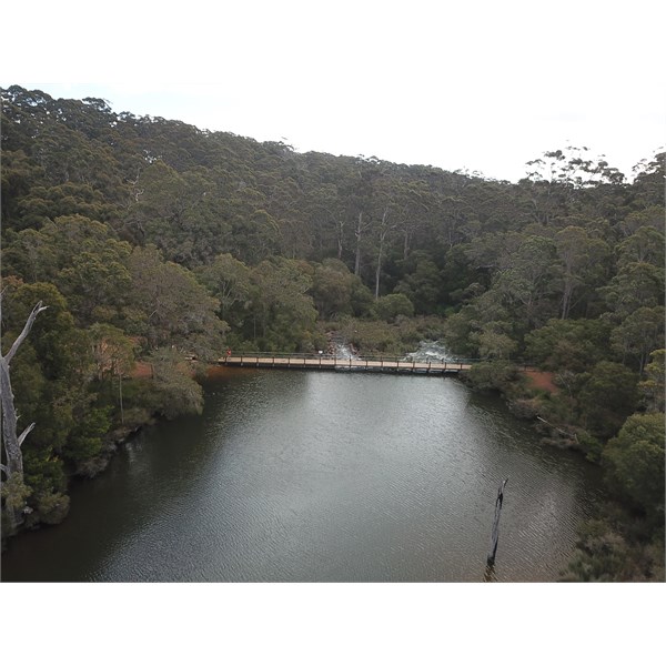
Barret St Weir - looking down stream
Be aware they are buidling a new bridge over Margaret River so you may not get far upstream (~1.3 km) from here as I think you can't get past due to construction activities.
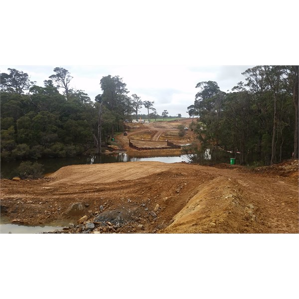
New Bridge
Further upstream is Canebreak Pool in Rapids Conservation Reserve, (~30km upstream from Margs). I have only been a very short distance in a canoe either side of the
camp area so not sure how far you can get either way.
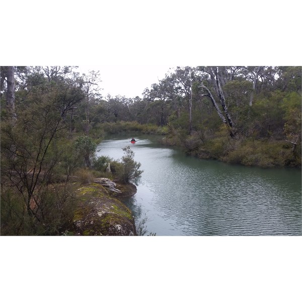
Canebreak Pool
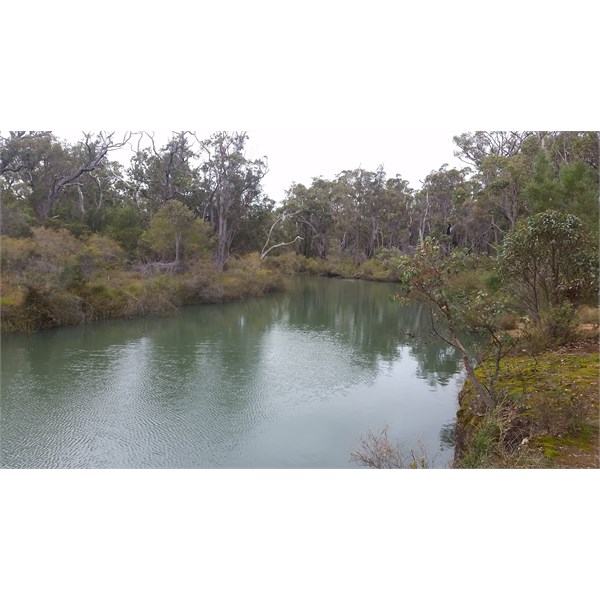
Canebreak Pool
I dont know the situation downstream from Margs, except of course paddling up from the river mouth.
Cheers
Greg
| I sent one final shout after him to stick to the track, to which he replied “All right,” That was the last ever seen of Gibson - E Giles 23 April 1874 Lifetime Member
My Profile My Blog Send Message
Moderator |
AnswerID:
614946
Follow Up By: ExplorOz Team - Michelle - Monday, Nov 13, 2017 at 18:35
Monday, Nov 13, 2017 at 18:35
Wow that's awesome info thanks so much Greg for the photos and prompt response - really helps.
FollowupID:
885679
Follow Up By: The Explorer - Monday, Nov 13, 2017 at 18:39
Monday, Nov 13, 2017 at 18:39
No worries - I removed reference to 10 mile brook dam as a quick look at the map would suggest its a bit of a walk to the river from the dam wall...and I just dont know what its like.
Cheers
Greg
| I sent one final shout after him to stick to the track, to which he replied “All right,” That was the last ever seen of Gibson - E Giles 23 April 1874 Lifetime Member
My Profile My Blog Send Message
Moderator |
FollowupID:
885680
Follow Up By: ExplorOz Team - Michelle - Tuesday, Nov 14, 2017 at 11:44
Tuesday, Nov 14, 2017 at 11:44
We've decided it is not worth trying to launch upstream of the weir and downstream is also complicated so not going to bother taking our own and if we feel like it can just hire from river mouth. Seems odd given its such a long river that doesn't dry up in summer but perhaps why the area remains so pristine. No problems with that.
FollowupID:
885694
Reply By: Terry O - Monday, Nov 13, 2017 at 21:57
Monday, Nov 13, 2017 at 21:57
Have you checked out waterwaysguide.org.au.
Shows access, exit points and distances.
Terry
AnswerID:
614947
Follow Up By: The Explorer - Monday, Nov 13, 2017 at 22:35
Monday, Nov 13, 2017 at 22:35
Hi
Doesn't have anything on Margaret River, though handy resource for others
Chees
Greg
| I sent one final shout after him to stick to the track, to which he replied “All right,” That was the last ever seen of Gibson - E Giles 23 April 1874 Lifetime Member
My Profile My Blog Send Message
Moderator |
FollowupID:
885684
Follow Up By: ExplorOz Team - Michelle - Tuesday, Nov 14, 2017 at 11:42
Tuesday, Nov 14, 2017 at 11:42
Thanks Terry, I looked from my phone this morning but couldn't find anything on Margaret River unfortunately.
FollowupID:
885693
Reply By: Life Member - Duncan W (WA) - Wednesday, Nov 15, 2017 at 15:58
Wednesday, Nov 15, 2017 at 15:58
Michelle have you tried the MR tourist info office they would surely know?
Cheers
Dunc.
AnswerID:
614976
Follow Up By: ExplorOz Team - Michelle - Wednesday, Nov 15, 2017 at 16:05
Wednesday, Nov 15, 2017 at 16:05
Thanks Duncan but you might be surprised (I was not) to get their reply that this was out of their area and sorry they could not help.
I have solved this anyway - It is almost fully fenced and so there are no roads or public access points along its middle reaches. Just at the weir or at the rivermouth.
FollowupID:
885737