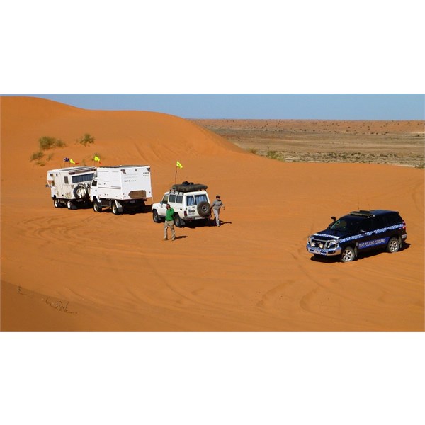
Desert 2018
Submitted: Monday, May 14, 2018 at 09:58
ThreadID:
136703
Views:
3422
Replies:
4
FollowUps:
3
This Thread has been Archived
Julie S2
Has anyone done the simpson this year yet? we are off in June and July for another trip across. Doing some gorges and hopefully doing the Sandy Blight
Junction. Have to organise permits yet. Any road news or things we need to be aware of this year? Done it heaps of times, but every year its a bit different.
TIA
Reply By: Member - Warrie (NSW) - Monday, May 14, 2018 at 18:34
Monday, May 14, 2018 at 18:34
You might need to check the
water levels at the Eyre
Creek crossing on the QAA and the
Warburton crossing on the
Rig Road. Check the
Lake Eyre yacht Club site.There was a pulse of flow in April but it may be all gone by July....W
AnswerID:
618899
Follow Up By: Bob Y. - Qld - Monday, May 14, 2018 at 18:52
Monday, May 14, 2018 at 18:52
Eyre Ck flow was/is mediocre, referred to officially as Minor. Flow down the
Warburton was originally a Major flood in the Diamantina, but 7 years without a flow, and the hungry soils of Goyder’s
Lagoon, will reduce the flow to some degree.
I’m hoping the
Warburton is open by early August, for a
Rig Road trip, without a double run on QAA. Will check how it’s going when I pass the crossing on 29th May, and post here...........if I remember!
I wouldn’t worry about the rest of the tracks, just drive to conditions, and accept that French Line will be rough as guts.
Bob
FollowupID:
891015
Follow Up By: Member - Stephen L (Clare SA) - Monday, May 14, 2018 at 19:08
Monday, May 14, 2018 at 19:08
Hi Bob
Not sure if you get the Westprint Friday Five, but the latest bulletin from National Parks have said the
Warburton Crossing in now closed due to flooding.
Cheers
Stephen
FollowupID:
891016
Follow Up By: Bob Y. - Qld - Monday, May 14, 2018 at 19:59
Monday, May 14, 2018 at 19:59
Thanks Stephen. Don’t get that one but been following the
water elsewhere so knew it was closed.
I just want to see the crossing in flood, and how high it is at the moment.
Bob
FollowupID:
891021
Reply By: Member - Warrie (NSW) - Friday, May 18, 2018 at 18:24
Reply By: Peter_n_Margaret - Friday, May 18, 2018 at 21:14
Friday, May 18, 2018 at 21:14
We left Dalhousie on 4-5-18 and arrived Big Red 12-5-18.
Travelled via French, Colson, WAA, Knolls, French, QAA.
No
water issues anywhere - all dry.....
It was a bit harder than last year I reckon, with some sand blows on dune tops left over from some easterly winds. Big Red was relatively easy from both sides. Anyone can drive up...... :)

Big Red 12-5-18
Cheers,
Peter
OKA196 motorhome
AnswerID:
618998
Reply By: Member - mark D18 - Saturday, May 19, 2018 at 14:52
Saturday, May 19, 2018 at 14:52
Julie .
Just finished our Crossing today via the Rig rd WAA line and Coulsens track .
This was my 4th crossing and I would next time give the WAA and Coulsens a miss and just do the French line , much better trip .
Would have been a better trip if the knuckleheads in the 7 Porsche Cayans heading east were not digging up the track unnecessarily .
Was not a difficult crossing this time .
Cheeers
AnswerID:
619007