Hi all.
We’ve just returned to
Perth winter after a short three weeker to the north; which included the Balgo to
Kiwirrkurra track.
As this is a remote area option which isn’t traveled too much, other than by community members, I thought I’d pass on some notes.
Diesel at Balgo is now 24/7 via a credit card set-up. Very efficient. Just remember (because it wasn’t on the pumps) that diesel is pump #1. Was $2.34/L and, at
Kiwirrkurra (normal long lunch till 1400 hours) it was $2.40 (or something close. (not bad at all, these prices, given the remoteness). The Balgo store is amazing and open 7 days. The K store is also
well provisioned and
well worth supporting.
For any of youse who might think of doing this trip. Don’t miss the
lookout over ‘Balgo Pound’ immediately south of the Balgo watertank via a very short off-leg. Simply amazing. There are also fantastic
views 10 or so kays further south.
Lake MacKay is expansive and you get great
views, plus a Desert Oak grove. Scenically, that’s about it. The rest of the track is easy dunes and the usual spinifex scrublands.
The total distance is close to 500 kays and includes a huge ‘loop’ to the east to
Lake MacKay shores. See image.
The first 100 kays south of Balgo is easy via a graded track kept open by a an exploration mob basing itself at
Yagga Yagga.
The last 100 kays to
Kiwirrkurra is even zippier via a very recently graded ‘road’ courtesy of another exploration outfit.
The middle 300 kays is slow and scratchy in
places, but is very easy to follow, and is kept open by community travel between B and K. (we met one such vehicle just north of
the Lake).
There is good easily gettable
water in the ground level
tank at Bibbard. (you could feed the resident ‘fairly’ friendly
dingo some spare provisions).
The only difficulty in the entire length of the track was a small
gully crossing some (I think) 15 or so kays south of Bibbard. The line that was being taken was with the
wheels high up on the steep wall of the gully on one side with the other side
wheels on the flat. We didn’t like it much and opted to create a new line but it was extremely tight. To be honest, it still leaves me feeling a bit ill as to what might have happened if it got pear shaped.
Anyway, it worked for us and here we are…
Cheers.
JB.
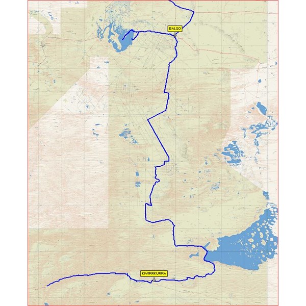
Balgo to Kiwirrkurra Plotfile Immage