Tuesday, Mar 12, 2019 at 19:19
G'day Robert
Not too sure if anything I say about the region or even Rudall River N/P will be valid as far as information goes, projected as far forward as June, as much can change in three months.
But as it has been aptly stated in a previous reply the track system inside the boundaries of the
park are rough, very corrugated, sandy, rocky and deeply eroded in many
places, especially
the Desert Queen Baths track.
I came in from
Newman ~
my home town, the
Jigalong road was being touched up by a grader, on the Ethel
Creek station proper, not sure if the grader will work it's way to the
Jigalong boundary though.
The Balfour Downs portion of the track was quite washed out in
places and all
water courses that cut the Balfour track were vehicle wheel track width only, so there are deep erosion channels either side of the wheel width on the track.
The
Talawana track right through to the Kintyre/Telfer access track was surprisingly good, and by good I mean 'bloody nice to drive' though sandy in the western end of the sand ridge country, the
Talawana track is clay topped.
The South Bore/Pump
water point is just a 'place' as the pump has been vandalized, so there is no way of bringing
water to the surface.
The north bore/pump produced plenty of
water, the first six or eight pumps gave plenty of foul smelling
water and a few frogs, there after it just plain stank, but it's
water!
The track right through to the north bore/
hand pump ~ or the Telfer end entry is very rough, sandy, rocky and quite wet in
places, the Rudall River watercourse is very loose but navigable in low range, the entire length of this track North to South is unmaintained and deeply corrugated.
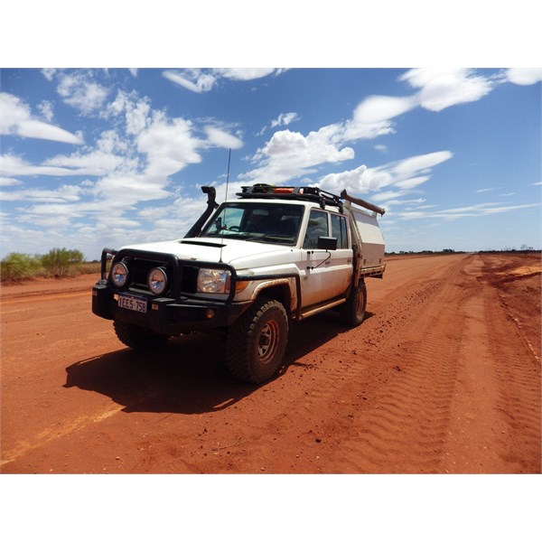
I spent three days ~ two nights out there exactly one month ago, solo vehicle, two occupants, no major issues apart from a couple of staked tyres,and a few loose driving lights/etc.
Average day time temperature 45 degree C. nights got down to a chilly 33 degrees C ~ massive thunder storms but we had no rainfall at all, the Talawana was wet in patches but more so once we were west of the upper reaches of the
Oakover River catchment.
Apart from that it's absolutely magnificent.
Safe travels : Joe Fury
Ethel Creek/Jigalong access road 13/2/2019
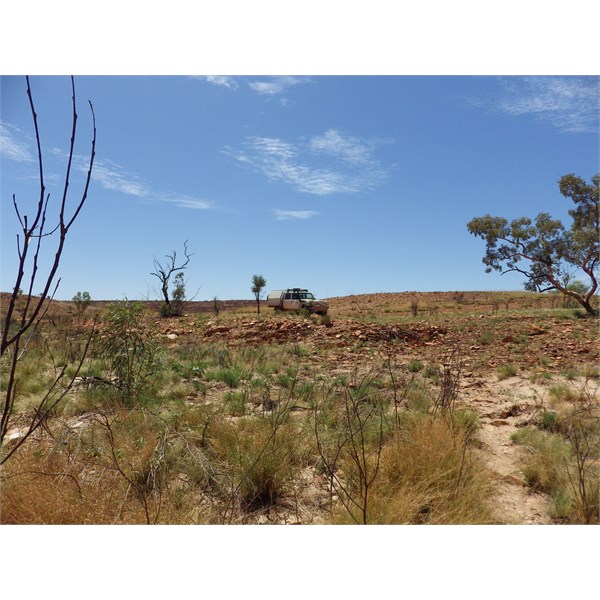
Throssell Range 14/2/2019
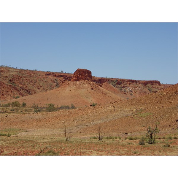
Darlsons Pinnacle 14/2/2019
AnswerID:
624384
Follow Up By: Mick O - Wednesday, Mar 13, 2019 at 06:30
Wednesday, Mar 13, 2019 at 06:30
Nice photo of
Darlsen Pinnacle Joe. Glad you made it in there. Cheers. Mick.
FollowupID:
897863
Follow Up By: Joe Fury - Wednesday, Mar 13, 2019 at 16:04
Wednesday, Mar 13, 2019 at 16:04
G'day Mick
Firstly, thank you for your input and information in all respects to what Hugh and I had planned and attempted. I won't say any more as it is not my story to tell.
Sadly for Hugh incorrect dosage of Thyroid medication was the undoing, the good thing is that his negative symptoms came to head before he crossed the
Telfer road.
My apology for miss spelling
Darlsen Pinnacle, it's quite an amazing feature that at a guess not too many 'outsiders' would have seen personally. I did remark to Hugh at the time as to how utterly insignificant we were at the time.
No doubt Hugh will keep you in
the loop in all respect to what his next step will be with this 'adventure'
Again ~ thank you for everything.
Safe travels : Joe F
FollowupID:
897882
Follow Up By: Mick O - Sunday, Mar 17, 2019 at 20:49
Sunday, Mar 17, 2019 at 20:49
Mate if anyone can get this done, it will be Hugh and with you to back him up on the ground, even more so.
It's amazing but unforgiving country as 'Outback Al' and I found out 10 years ago now. Near did for me in a day and yet to be attempting what Hugh plans to do......
well I think you and I are of a similar mind there (Crazy bastard lol). He's certainly done the research and hard yards in preparation though.
I'll be watching from afar and celebrating when he pops out on the other side.
Thanks to you as
well mate. He couldn't get it done without you.
Cheers
Mick
FollowupID:
897962
Follow Up By: Member - Robert S21 - Friday, Mar 22, 2019 at 21:43
Friday, Mar 22, 2019 at 21:43
Thank you Joe Fury for your information. It was good to get your perspective.
Robert.
FollowupID:
898081
Follow Up By: Austag - Sunday, Mar 31, 2019 at 12:16
Sunday, Mar 31, 2019 at 12:16
Hello Joe, did you climb and explore the
pinnacle? Don't suppose you found our "visitors jar" and added to it?
FollowupID:
898208
Follow Up By: Joe Fury - Sunday, Mar 31, 2019 at 17:47
Sunday, Mar 31, 2019 at 17:47
G'day Austag
It's a negative on your questions ~ our visit to the area was primarily to fulfill a request of a fellow 'adventurer' and to check and see first hand,
water availability and easiest passage though the Throssell Range at a given point.
Sounds a little contrite, but we tried to minimize everything as much as possible in respect of being in the region, though we did seek and gain permission from the traditional land owners through their representatives,
well before venturing into this part of the western desert region.
Safe travels : Joe Fury
FollowupID:
898213