Morgan to Danggali...Which Way ?
Submitted: Tuesday, Jul 02, 2019 at 22:52
ThreadID:
138640
Views:
5627
Replies:
2
FollowUps:
5
This Thread has been Archived
dean ( SA )
Years ago I came home from Canopus to
Morgan but didn't take note of the road names, just followed the signs but I think it was along option 1.
Google maps show two ways.
1.
Morgan-
Morgan Vale rd-Danggali Rd-Canopus 180km
2.
Morgan-Canopus Track-Canopus 130km.
I don't remember seeing any other way out than going the longer way, or back the way we came through
Renmark.
My question is, can you go along Canopus track or is it a closed track that google maps thinks is a through road.
Reply By: wooly0005 - Tuesday, Jul 02, 2019 at 23:38
Tuesday, Jul 02, 2019 at 23:38
From
Morgan take the main road to
Renmark and about 5kms out of
Morgan there is a dirt road on the left called Bungunnia Road. Take that road past a couple of stations all the way to
Morgan Vale.
Somewhere along the way it changes name to The
Morgan Mail Road.
After
Morgan Vale it goes along to Canopus and
Hypurna.
I think Canopus track is on a station.
AnswerID:
626492
Follow Up By: dean ( SA ) - Wednesday, Jul 03, 2019 at 08:09
Wednesday, Jul 03, 2019 at 08:09
I reckon that's the way we came back,
well signposted. That would make sense that Canopus track goes through a station, couldn't see any signs etc when out there.
FollowupID:
900317
Reply By: Member - Stephen L (Clare SA) - Wednesday, Jul 03, 2019 at 09:56
Wednesday, Jul 03, 2019 at 09:56
Hi Dean
Yes it would have been option No 1 and it would have brought you out north of Canopus an this location.
Cheers
Stephen
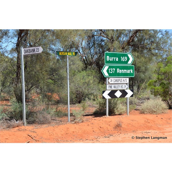
This is where you would have come out
AnswerID:
626499
Follow Up By: Allan B (Sunshine Coast) - Wednesday, Jul 03, 2019 at 10:47
Wednesday, Jul 03, 2019 at 10:47
.
You astonish me Stephen.
Name some vague out-of-the-way place and within minutes you can pull up a photo of it.
FollowupID:
900323
Follow Up By: dean ( SA ) - Wednesday, Jul 03, 2019 at 11:57
Wednesday, Jul 03, 2019 at 11:57
Looking back through my photos I found the same one so that confirms that.
What do you know about this Canopus track that pops up on Google maps.
Or, is it just another situation where maps will highlight a private/gated track etc
FollowupID:
900324
Follow Up By: Member - Stephen L (Clare SA) - Wednesday, Jul 03, 2019 at 13:07
Wednesday, Jul 03, 2019 at 13:07
Hi Allan
If did not do it, someone else might have, so I did not want to get left at the starting blocks.......lol
Hi Dean
To be honest I do not use Google Maps, only my Topo Maps on OziExplorer.
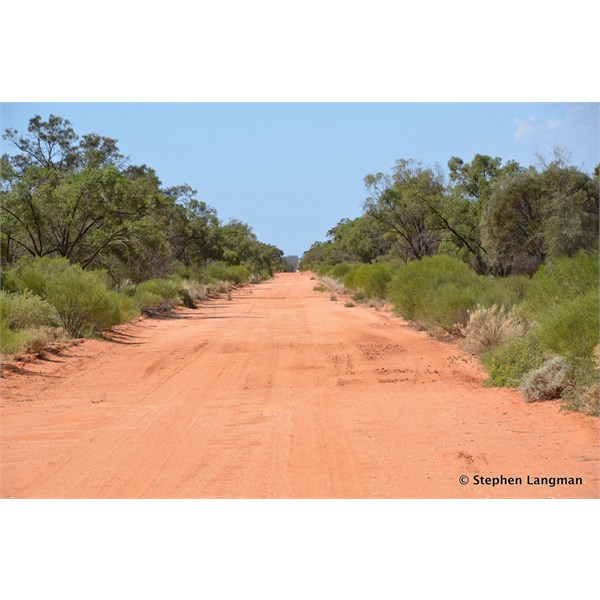
As you know, there are a network of roads in that area are all very
well defined station roads and are open to everyone to travel, and as such are public gazetted roads.
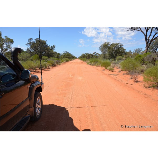
The Road that were enquiring about is the official
Morgan Mail Road and a good road to drive.
If you wanted to experience more great roads, you could head even further north, and then take in some more great scenery back to
Burra.
As with that station country out East of
Burra, it is ever change from bluebush too mallee.
Cheers
Stephen
You will not know what the conditions are like next out east of Burra
You will not know what the conditions are like next out east of Burra

You can do a big loop, and head for either Burra or Yunta
FollowupID:
900328
Follow Up By: dean ( SA ) - Wednesday, Jul 03, 2019 at 15:37
Wednesday, Jul 03, 2019 at 15:37
All good, yes North of
Burra has some great tracks and scenery as
well.
We'll be on bikes this time so are looking for shorter
routes when possible.
FollowupID:
900334