Walkers Crossing track vs Cordillo Downs road
Submitted: Thursday, Mar 04, 2021 at 16:40
ThreadID:
141193
Views:
11329
Replies:
11
FollowUps:
4
This Thread has been Archived
Member - Wildmax
Hi all
We're urrently planning this year's travel, which includes the Big Red Bash on the way north. We'll be taking the Frome Downs Road from
Yunta to join the
Strzelecki Track at Mt Hopless and then on to Moomba/
Innamincka.
Two options from there to
Birdsville - either via the
Walkers Crossing Track, or the
Cordillo Downs road.
I acknowledge the obvious cautionary point .....
Walkers Crossing in particular is subject to adverse weather conditions, especially any rain. This is for travel in late June, so obviously pre-trip weather checks are imperative.
But I have also read the
Walkers Crossing track is horrendously difficult to navigate because of the proliferation of private oil field tracks which criss-cross the area. Any comments on degree of difficulty re navigation and terrain would be appreciated.
Thanks
PS: We're experienced and
well-equipped outback travellers....Hilux plus AOR Eclipse (latter about 2.4t).
| Wildmax
2018 Hilux and Black Wolf 210 tent - for the outback tracks less travelled
Formerly an AOR Eclipse and a TVanMember
My Profile Send Message |
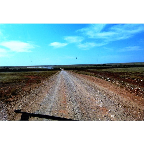
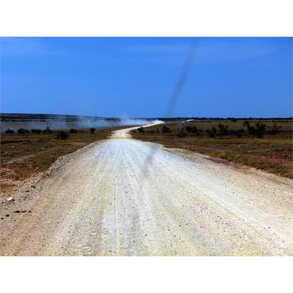
Reply By: Peter_n_Margaret - Thursday, Mar 04, 2021 at 17:52
Thursday, Mar 04, 2021 at 17:52
I would not consider the
Walkers Crossing Track to be difficult to navigate at all. Just stay alert and keep an eye on a decent map.
It is a "road", not a "track".
It is likely to have some significant corrugations in areas.
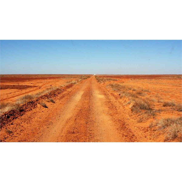
First pic is the northern end, near the
Birdsville Track.
From 2018.
Walkers Crossing Track 2018
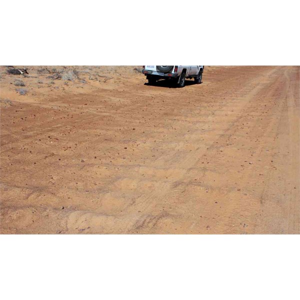
Walkers Crossing Track 2018
Walkers Crossing Track 2018
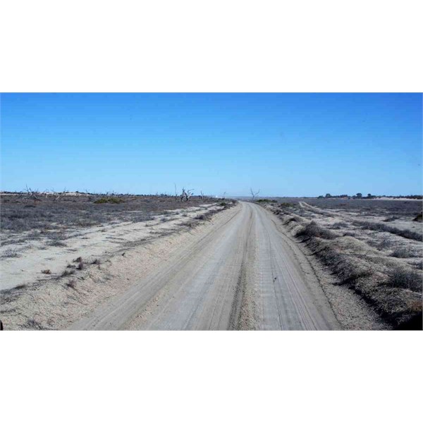
Walkers Crossing Track 2018
Walkers Crossing Track 2018
Cheers,
Peter
OKA196 motorhome
AnswerID:
635380
Reply By: Member - Warrie (NSW) - Thursday, Mar 04, 2021 at 18:06
Thursday, Mar 04, 2021 at 18:06
Most if not all junctions in 2015 had signposts pointing out
no entry to the wells. Quite a pity if you'd like a stickybeak. Pete's pix cover the track conditions nicely and you can go into
Places and check out more. Not enough
water down the Cooper year to date, so unless a big fall occurs in April, the crossing which is bridged anyway will be open. You can even drive down the
creek bed a bit. LOL One can be lured into a false sense of security on the sandy flat sections and so build up speed and then encounter a washout which does the
suspension no good at all.
AnswerID:
635381
Reply By: Peter_n_Margaret - Thursday, Mar 04, 2021 at 18:52
Thursday, Mar 04, 2021 at 18:52
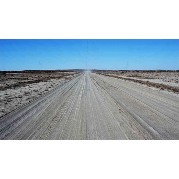
The
Cordillo Downs road can be a bit notorious with stones. We typically prefer to go via
Betoota, besides the pub is open again. :)
These pics are on the Planet Arrabury Road south of the Hadden Corner turn off in 2012. It is generally better than the
Cordillo Downs Road.
Planet Arrabury Road
Planet Arrabury Road
Cheers,
Peter
OKA196 motorhome
AnswerID:
635383
Follow Up By: Member - McLaren3030 - Saturday, Mar 06, 2021 at 08:48
Saturday, Mar 06, 2021 at 08:48
I would also suggest Planet Arabary as an alternative, you could also visit Haddons Corner as
well.
Macca.
FollowupID:
912990
Follow Up By: Member - Wildmax - Saturday, Mar 06, 2021 at 10:16
Saturday, Mar 06, 2021 at 10:16
Thanks Peter and Macca. I agree that's a good option, but we've already been that way and camped out at Haddon's Corner, so was looking at Walkers or Cordillo as alternatives this time.
Cheers
| Wildmax
2018 Hilux and Black Wolf 210 tent - for the outback tracks less travelled
Formerly an AOR Eclipse and a TVanMember
My Profile Send Message |
FollowupID:
912997
Reply By: Member - Cuppa - Thursday, Mar 04, 2021 at 18:52
Thursday, Mar 04, 2021 at 18:52
Walkers Crossing. We found having a GPS off road navigator reassuring, but would have found our way without it. It's a good & enjoyable drive when dry.
AnswerID:
635384
Reply By: My Aussie Travel Guide - Thursday, Mar 04, 2021 at 22:00
Thursday, Mar 04, 2021 at 22:00
We did the
Walkers Crossing track last year and enjoyed the drive. A couple of sections we found not so easy to navigate. Having map software helped. Some tracks had no public entry signs whereas others didn’t. So we took a wrong turn here and there, but soon picked these boo boos up on our map. If you take a wrong turn, it’s easy enough to turn around. Road conditions in all directions were highway style. So no dramas. Terrain for the entire track was good. Enjoy!
AnswerID:
635387
Reply By: Member - Boobook - Thursday, Mar 04, 2021 at 22:17
Thursday, Mar 04, 2021 at 22:17
Like a few have said, the
Walkers Crossing can get a little confusing with all the roads crisscrossing. But it's not too bad.
The EO track is accurate and you can download it for reassurance.
Also PM or email me if you are planning to go to Coongie lakes then to
Birdsville.
AnswerID:
635388
Reply By: Member - Cuppa - Thursday, Mar 04, 2021 at 22:24
Thursday, Mar 04, 2021 at 22:24
http://cuppa500.com/Blog/2017/09/26/birdsville-to-tibooburra/
AnswerID:
635389
Follow Up By: Member - Wildmax - Thursday, Mar 04, 2021 at 23:05
Thursday, Mar 04, 2021 at 23:05
Thanks Cuppa, your blog is a really interesting read - in the folder to help with our trip planning :-)
| Wildmax
2018 Hilux and Black Wolf 210 tent - for the outback tracks less travelled
Formerly an AOR Eclipse and a TVanMember
My Profile Send Message |
FollowupID:
912971
Reply By: AlbyNSW - Friday, Mar 05, 2021 at 07:20
Friday, Mar 05, 2021 at 07:20
The first time I did
Walkers Crossing I started out with my very own self guided
mine tour before finding the right way through lol but I wouldn’t let that put you off
Both
routes are excellent and would recommend doing them both at some point so you won’t be missing out with either option
AnswerID:
635391
Reply By: rumpig - Sunday, Mar 07, 2021 at 08:34
Sunday, Mar 07, 2021 at 08:34
Have done both
Walkers Crossing and
Cordillo Downs, scenery wise I preferred the
Walkers Crossing route. We had no real issue finding our way along it, I did nearly miss one turn though as I drove past a tiny street
sign indicating we should turn there, caught sight of it at last second as I went past it, so had to spin back around to make that turn and go the right way.
AnswerID:
635442
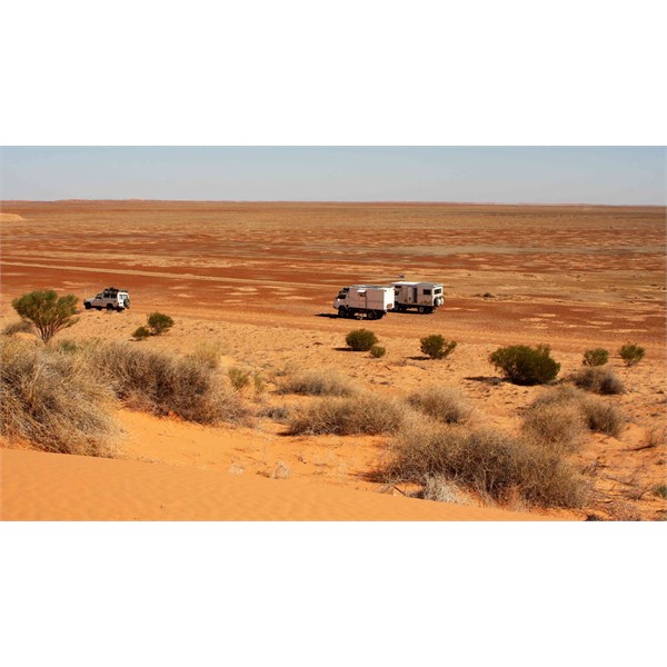
Reply By: David I1 - Tuesday, Mar 09, 2021 at 21:43
Tuesday, Mar 09, 2021 at 21:43
I did
Walkers Crossing in 2019 doing the following Burke and Wills. Some parts are quite rocky. Had a group with road vans travelling at some speed pass me. When we arrived at
Birdsville, all were under their vans fixing broken bits and pieces. Some people never learn that road vans should stay on bitumen roads, not dirt roads and tracks.
AnswerID:
635501
Follow Up By: Member - Wildmax - Tuesday, Mar 09, 2021 at 22:31
Tuesday, Mar 09, 2021 at 22:31
Very true !!!
| Wildmax
2018 Hilux and Black Wolf 210 tent - for the outback tracks less travelled
Formerly an AOR Eclipse and a TVanMember
My Profile Send Message |
FollowupID:
913071
Reply By: Frank P (NSW) - Wednesday, Mar 10, 2021 at 12:42
Wednesday, Mar 10, 2021 at 12:42
In 2018 I took my then 13yo city-bred grandson on an outback and desert tour, just him and me in swags, to give him a taste of life outside the big smoke and to show hime why we travel the way we do. We took the
Walkers Crossing Track
Innamincka to
Birdsville to access the Simpson.
Navigation was easy as I recall - the route is clearly shown on
EOTopo. In some
places the track was in a sunken trench, maybe nearly a metre deep and only 1 vehicle wide, so dealing with on-coming traffic could have been an issue, especially if towing (we weren't). Not that there's much traffic there. It was pretty rough towards the
Birdsville end, but otherwise an easy, scenic drive.
AnswerID:
635511