Moorowing Rock north of Bullabulling
Submitted: Sunday, Mar 14, 2021 at 13:11
ThreadID:
141245
Views:
7439
Replies:
2
FollowUps:
3
This Thread has been Archived
equinox
Howdy there,
Anyone been to Moorowing Rock?
Looking at the sat images there does not appear to be anything there at the location on the map.
What about Caenyie Rock? This I think is the actual Moorowing Rock as I think the real Caenyie Rock is roughly 10kms north west of the Moorowing Rock on the map.
Anyone know anything? Just trying to put the jigsaw together.
Cheers
Alan
Reply By: Phil B (WA) - Tuesday, Mar 16, 2021 at 06:10
Tuesday, Mar 16, 2021 at 06:10
Hi Alan,
I had to dig deep to find anything on these
two rocks.
This is what I found about Caenyie/Caenylie/Caenye Rock
Aboriginal name recorded by F.M. Roe, second in charge of C.C. Hunt's exploring party, on 3rd October 1866 it was incorrectly positioned on early maps. As a result Reserve 8479, when gazetted on 2nd January 1903 (page 4) was incorrectly stated to be at Caenyie Rock -"said rock being situated about 12
miles north-westward of Bulla Bulling".
Since there is no rock in that position, post-1968 maps applied both name and reserve to
the rock nearest there; one at co-ords 369.3 170.4 yds. Roe's diary and bearings, consulted during research in 1985, proved conclusively that Caenylie Rock was actually situated some 21km northwards. Consequently, positional amendment for Caenye Rock was approved on 15th February 1985.
Charles C Hunt
In his journal Hunt shows Mulyering for Mt Burges. Maybe Moorowing Rock is a corruption of the name. Moorowing Rock is to the west of Mt Burges and to the north of Caenyie.
The attached map shows both rocks.
The red lines are the main trunk lines of the Kurrawang Woodline rail
routes. The Moorowing Rock area looks as though it was a good cutting area given the rail lines there.
Note that Caenyie has two polluted wells.
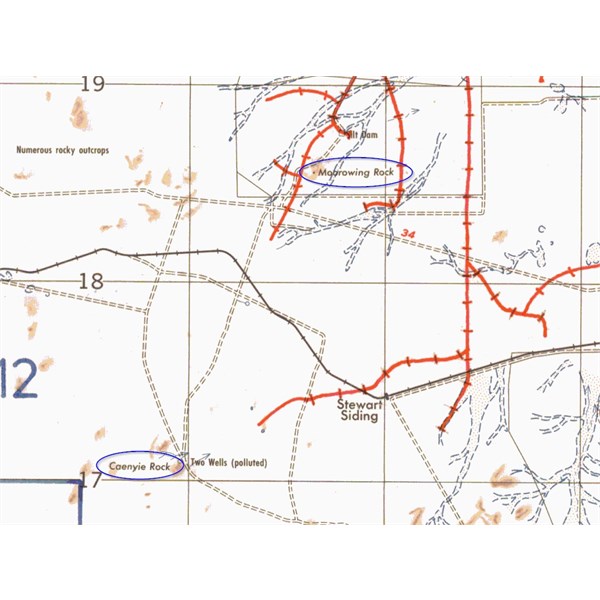
Caenyie_and_Moorowing_Rocks
AnswerID:
635603
Follow Up By: Dusta - Tuesday, Mar 16, 2021 at 12:27
Tuesday, Mar 16, 2021 at 12:27
nice work phil. i was lost trying to find those
two rocks
FollowupID:
913207
Follow Up By: equinox - Tuesday, Mar 16, 2021 at 20:05
Tuesday, Mar 16, 2021 at 20:05
Thanks Phil,
Looking at the sat image of the southern Caenyie you can make out what looks like two decent sized gnammas on the north eastern edge - I wonder if these are the
two wells that are mentioned?
If the northern Caenyie is the real Caenyie then what was the other Caenyie is a pretty big rock so close to
Coolgardie to be unnamed. I was thinking this may be Moorowing as it is in the area and the sat image of where Morrowing Rock is does not match what other outcrops are the area look like; so may be a bum steer - I have found an old map that puts it in the general area.
I thought more people would have been in the vicinity to be honest - I may visit on the weekend but as always I have too few days and too many outcrops.
Cheers
Alan
FollowupID:
913225
Follow Up By: Phil B (WA) - Wednesday, Mar 17, 2021 at 09:34
Wednesday, Mar 17, 2021 at 09:34
A pleasure Alan,
You said 'I was thinking this may be Moorowing as it is in the area' - yep good thinking.
By the way, there is no mention of Moorowing R in Geonoma the govt database.
Below is an extract CC Hunt explorations in WA 1864 to 1866 composite map (sorry best image I have). it shows Burges and Caenyie but no Moorowing or an unnamed rock.
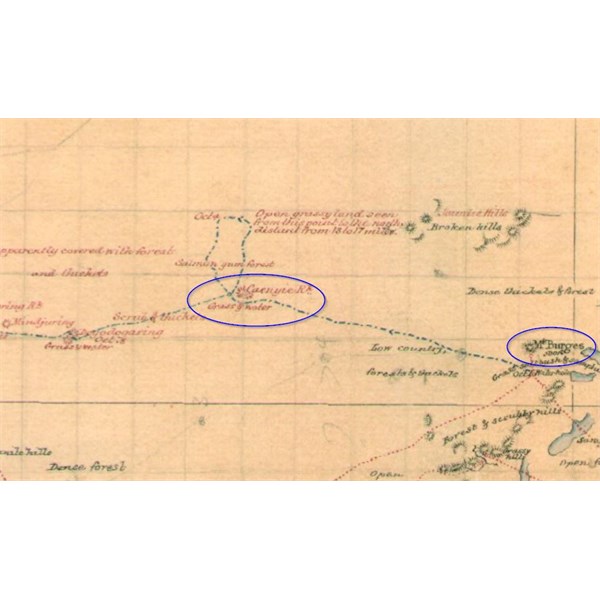
CC Hunt explorations in WA 1864 to 1866 composite
Happy hunting PB
FollowupID:
913247
Reply By: equinox - Saturday, Apr 17, 2021 at 13:13
Saturday, Apr 17, 2021 at 13:13
Here are my findings:
An extract from an old map
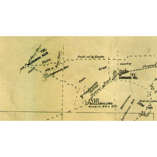
Old Map
Waypoints on modern map:

New map
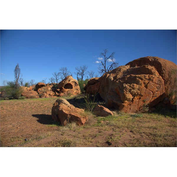
Position of conglomerate blow on old map:
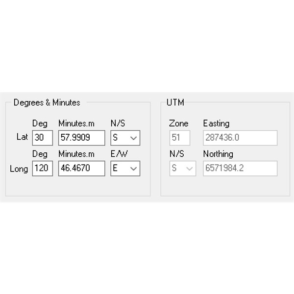
coords of blow
to the north west of Bullabulling is not Caenyie. It is Morrowing.
I drove from Bullabulling to
the rock and there was a conglomerate blow right where the old map said it was.
Here is a picture of it:
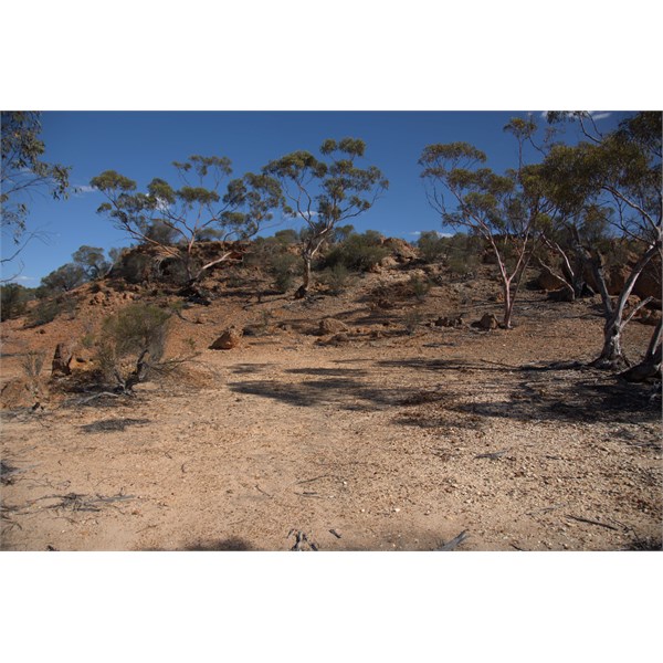
Conglomerate Blow
Morrowing Rock is very pristine and does not have many modern human visitors judging from the amount of visible tracks and damage etc...
Here is a picture of some of it:
Part of Morrowing Rock
I found some inscriptions.
B Dimer (had date but could not read)
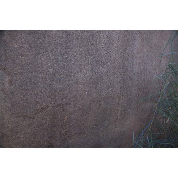
Dimer
3 female names:
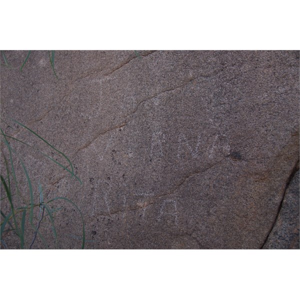
names
Some horseshoes I brought together:
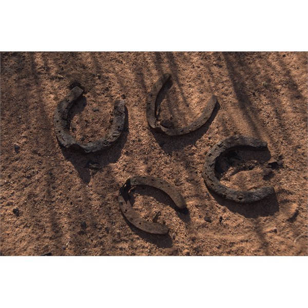
Horse shoes
Not related but good view of Mt Burges from the west:
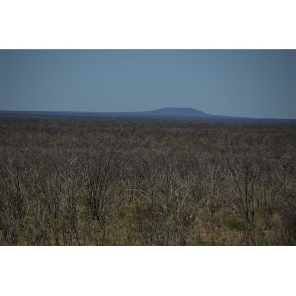
Mt Burges from west
Cheers
Alan
AnswerID:
636037