Hi Folks,
Planning to drive the
Hay River Track, north to south, in winter of 2024. The ExploreOz app has helped tremendously. For anybody who has done it, I'm trying to gauge the pace at which you would realistically be driving the track (assuming normal conditions)? I've set aside 4 days (3 nights) averaging 30km/h.
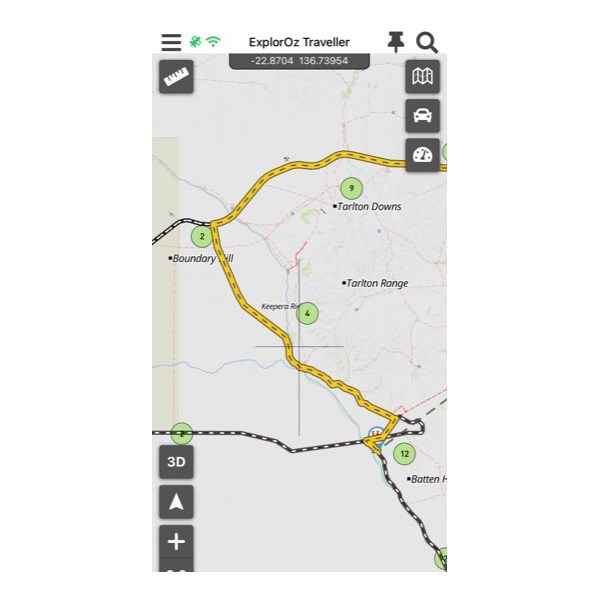
Also, does anybody know if you can drive the road in the photo below, connecting the Plenty H'way and
Batton Hill camp? It's about 4km west of
Arthur River campsites. HEMA says it's a private road but ExploreOz suggests it. I can't find a name for the road so assume it is a private road. I'd ideally like to drive it as I'll be coming from
Boulia.
Hay River