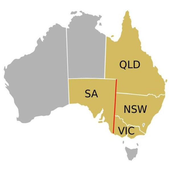
The border between the Australian states of South Australia and Victoria was established in 1836 by imperial letters patent "as the 141st degree meridian of longitude east of Greenwich". Due to human error by numerous
explorers and surveyors, it took more than 75 years and a protracted legal dispute before the precise placement of the border was settled, resulting in the forfeiture of more than 500 square
miles of territory from South Australia to Victoria. In 1914, after a successful appeal to the
United Kingdom's Judicial Committee of the Privy Council, a sum of £215,000 was awarded to the state of South Australia and the legal dispute was ended.
Following the establishment of the colony of South Australia in 1835, the region between the coast and the
Murray River was rapidly being settled by squatters selecting large runs for sheep grazing. With no clear border legal oversight was impossible. An accurate border needed to be defined. The earliest relevant reference to the eastern
boundary of South Australia is contained in a despatch dated 30 September 1844 from Governor
Grey of that Colony to Lord
Stanley.
The Governor reminded the Secretary of State that it would be extremely difficult to determine with accuracy a number of points upon the earth's surface through which the 141st degree of East longitude passes, and pointed out that in addition to difficulty there would be attendant expense both in ascertainment and maintenance.
141st meridian east

Captain Charles J. Tyers
In 1839 Charles Tyers was transferred from the Royal Navy to the Colonial Service and instructed by Sir George Gipps,
the Governor of New South Wales, to ascertain the precise longitude at the mouth of the
Glenelg River so that a distance to the 141st meridian (the eastern border of South Australia) could be measured.
Several months later Tyers completed a survey from
Melbourne to the
Glenelg River and on an expanse of
sandy beach he formed a broad arrow with
limestone rocks. This became known as Tyers' Mark and was used to determine the starting point for the border survey. Due to primarily inadequate equipment this was later determined to be 2
miles and 4 chains in error.
For several years following Tyers' survey no action was taken to extend his work but by 1845 the need to have the
boundary line defined on the ground had become urgent, particularly to the east of
Mount Gambier. South Australian pastoralists had worked their way east from the coast and there were disputes when they met pastoralists from the Wimmera country pushing their way westwards with flocks of sheep.
There was uncertainty as to which Government should grant pastoral licenses to the squatters and which had legal control. In November 1846 the Colonial Secretary's Office directed surveyor Henry Wade to proceed from
Sydney to the disputed territory to define a "
Boundary for Police Purposes".
By March 1847 Wade had got his party of seven and equipment at the mouth of the
Glenelg River. He was joined by assistant surveyor Edward White who had been appointed by the South Australian government to act as an observer on its behalf.
After much deprivation and hardship due to drought and reluctance by his men to continue with poor work conditions, Wade was still 155
miles from the
Murray River after nine months of swamp,
sand dunes and broken equipment. The expedition collapsed at the 36th parallel of latitude. On 16 December 1847 the South Australian Government published a proclamation that the "line as marked on the ground" by Wade should be "deemed and construed" to be the eastern
boundary of South Australia. In March, 1849 New South Wales issued a proclamation in similar terms. Wade later died in 1854.
As the survey was only partially completed the two colonies were in agreement that surveyor White should complete Wade's line to the
Murray River as soon as possible. This was doubly urgent as the state of Victoria was to be proclaimed within twelve months further complicating legal and later political matters.

Henry Wade, in Brisbane, early 1850s
In August 1849 the extension from Wade's line was begun. White and his party of five were similarly troubled by the severe nature of the
Big Desert mallee country: where there was little
water in 1847 there was none two years later. Within two weeks mutinous men had deserted him and two of his three horses collapsed from being without
water for four days. White led the other until it also lay down, he himself was also on the verge of collapse but he managed to bleed the horse and drink half a pint of the blood. Lost, he did not know how far from the
Murray River he was but he managed to stagger on for about two
miles to find himself on the riverbank at the border of three states and the survey completed. After drinking and resting he retreated back to the dead horses and collecting his saddle and bridle he returned to the river, managed to cross it and borrow a horse at Chowilla sheep station. He rode 180
miles to
Adelaide and filed a report on the survey. White died three years later.
Doubts as to the accuracy of the Wade-White line grew with the availability of better astronomical equipment and the advent of the telegraph. As a result of appointments of Government Astronomers in
Sydney and
Melbourne there were far more precise values for the longitudes of these
places and hence the 141st longitude of the legal border.
By agreement an expedition left
Adelaide in April 1868 for Chowilla near the
Murray River and the border. It was led by George Smalley, N.S.W. Government Astronomer and Charles Todd South Australian Superindentent of Telegraphs. The purpose was to make transit observations of eleven stars whilst similar observations were made in
Melbourne and
Sydney. Whilst Tyers had used a small three inch theodolite this expedition had a 45-inch telescope, the largest available portable device in Australia at the time.
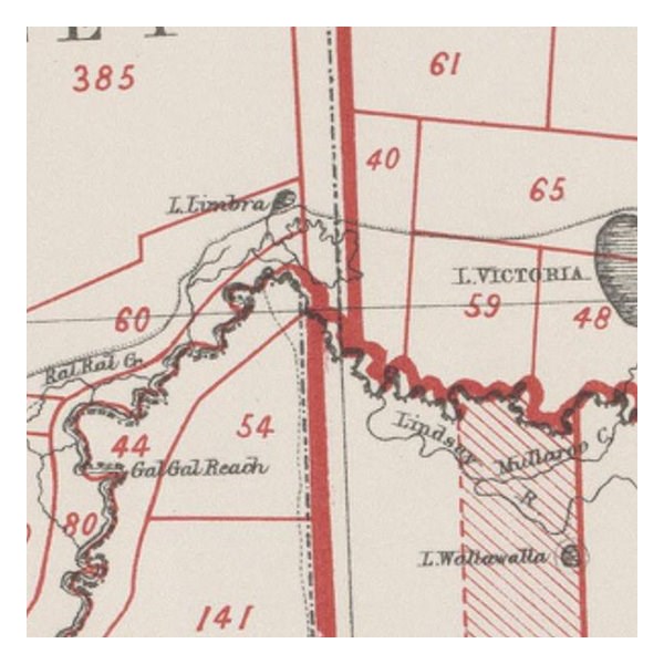
As a result of their observations Smalley and Todd declared the new 141st meridian. This led to the discovery that the proclaimed border on the ground was at least two
miles and 19 chains to the west of the more accurate measurement of the 141st meridian. The "Disputed Territory" as it was termed between the surveyed border and the actual 141st meridian contained over 500 square
miles of land. By 1849, 47% of it had already been sold freehold or leased out by the Victorian Government. If the more accurate border were adopted, Victoria would not have owned the land to be able to sell or lease it. This was the beginning of the battle of the Disputed Territory, a bone of contention which was to last for more than forty years.
1883 map showing Victoria's western border is further to the west than that of NSW
The South Australian Government did not let the matter rest. In 1874 it suggested the value of the land was about £800,000. Between 1883 and 1893 South Australia sent more than 70 letters or telegrams to
Melbourne seeking Victorian relinquishment or financial redress. There were many futile conferences. The nearest to an agreement between the two states was in 1908. Then it was decided, subject to ratification by parliament, that £215,000 should be regarded as compensation to South Australia. Parliament did not ratify the proposal, nor did anything come of the 1909 South Australian premier's plan to send surveyors to subdivide some of the land on the east of White's marked border, the last "legally proclaimed" border.
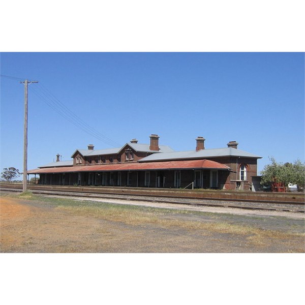
Serviceton railway station in the formerly-disputed territory
South Australia finally abandoned all hope of settlement, due to Victoria's intransigence, and in 1911 it appealed to the High Court only to have the appeal dismissed. In 1914, it resorted to an appeal to the Privy Council which unanimously ruled in favour of Victoria. When the railway line was built from
Melbourne to
Adelaide, a station was built in the disputed territory and paid for equally by both governments to provide a place for the exchange of locomotives and crews. While this station is no longer used, the building remains in the tiny town of
Serviceton.
.