Have you ever been frustrated trying to get somewhere for years and then finally made it, and I don't mean with your girlfriend.
Well Madigan line Camp 20 has been unfinished business for us but no longer.
Its been under
water for years but now lies
well exposed - although the evidence could be subject of a "Sunday Mystery Photo" competition!
A bit over 2 years ago we had a real chance to do it at the end of a full
Madigan line crossing trip.
We had just passed
camp 19 of 25 camps after 6 days of slogging across the North Simpson and were approaching the easier camps that are mostly Adria Downs station tracks.
Camp 20 should have been the start of the home run but in seeking permission to cross we (and no-one it seems) was aware that the entire eastern Simpson was basically cut in half by the flooded Eyre
creek and surrounding areas.
We fought hard to aquire
Camp 20 but in the end the swamps were to much.
In what became a controversial drive (post 88482) we along with
Howard (ACT) then took a gamble by heading south and driving out the entire western side swamp, waterway by waterway until we got to an Eyre
creek crossing.
From there it was an easy run to Madigan
camp 25 (
Birdsville hotel) but we had bypassed the in-between camps and over a couple of drinks vowed to go back one day.
Its now late 2013 and we had just completed an exploration run to the Simpson Geo-Centre (post 103723) to prove the viability of this as a Simpson side trip.
This trip had gone so
well we were 3 or 4 days ahead of schedule and decided to drop into
Birdsville to replenish supplies and head back out again with
camp 20 the target.
Despite talking to station owners we still were not clear on whether it was accessible.
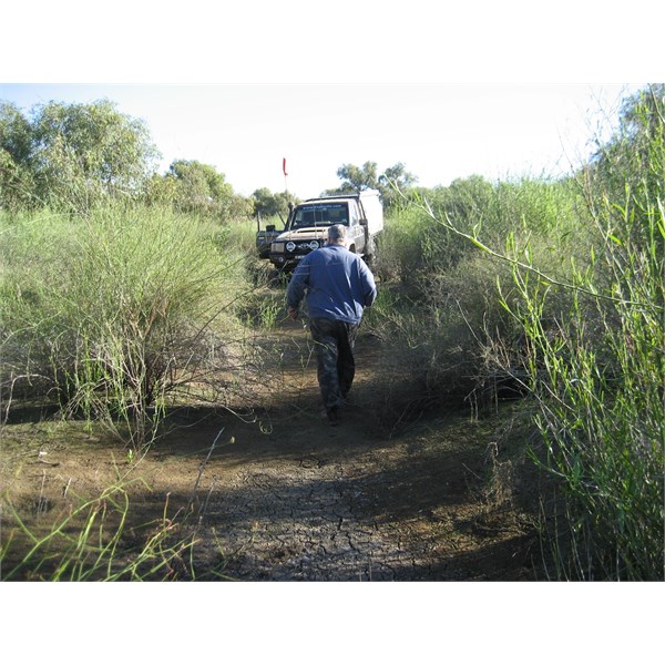
Things are a lot drier now but there is still quite a swamp just east of Big Red.
Compared to the Moguls of the Geo-Centre drive the station tracks were like velvet and we soon had passed the sad
ruins of the old
homestead near
camp 21 and were approaching
camp 20's GPS location - it should have been easy but as we weaved in and out of scrub visibility was short and we came out on a small dune only 200 m from the GPS point, but sure enough, as we crested the dune a beautiful
lagoon appeared like magic in front of us.
Now I was sure I had plotted the point correctly, but that does not mean there is a confirmation marker at the point, so we pushed on looking for a way across.
We followed
Howard across he top end of
the lagoon where it was bone dry and began working our way south , and after a while we found what appeared to by a stake in the ground half hidden by a tree and dead animal bones , it was
camp 20.
Its hard to recognize, but the photo shows the now corroded marker and finally we achieved our objective.
Corroded
Camp 20 marker
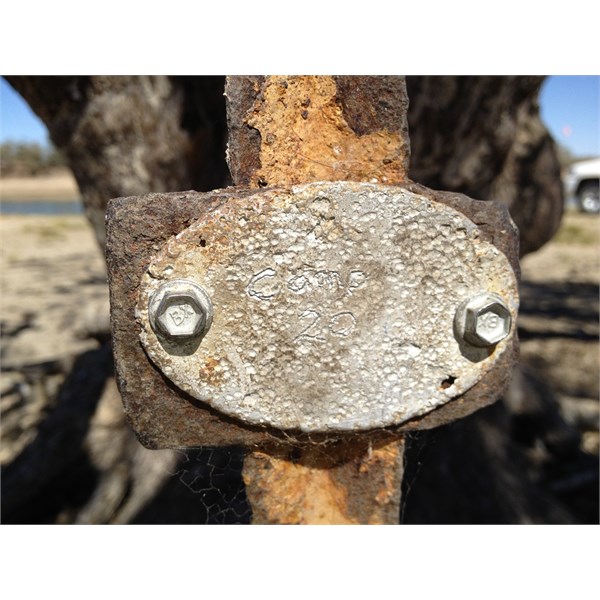
Corroded Marker at Madigan Camp 20
Post hidden under tree opposite
water hole
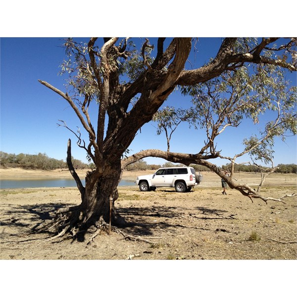
Marker Post Under tree behind Waterhole
The countryside now 2013.
The Vegetation now 2013
Near same spot in 2011.
The Vegetation near same place but 2011