Tweed Heads is a town located on the Tweed River in north-eastern New South Wales, Australia, in Tweed Shire.
Tweed Heads is located next to the border with Queensland, adjacent to the "Twin Town" of Coolangatta, a suburb of the
Gold Coast. It is often referred to as a town where you can change time zones – even celebrate New Year twice within an hour – simply by crossing the street, due to its close proximity to the Queensland border, and the fact that New South Wales observes daylight saving whereas Queensland does not.
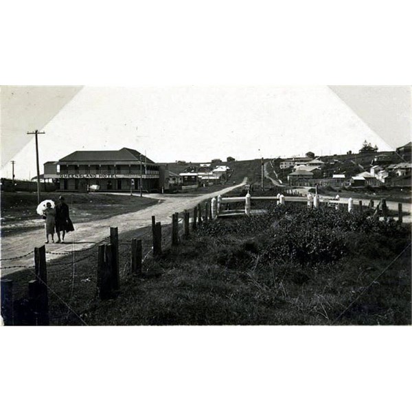
border between the two states of Queensland and New South Wales
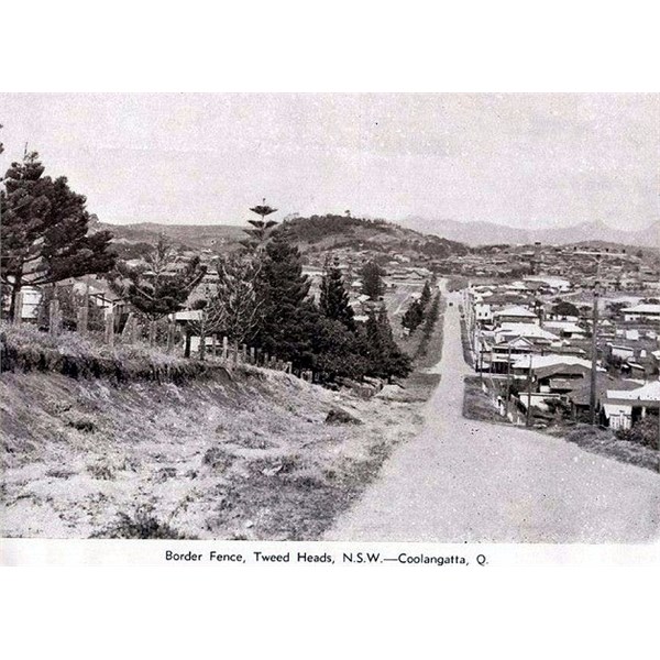
border between the two states of Queensland and New South Wales - 1952
In 1823 John Oxley was the first European to see the Tweed Valley where upon exploring 7
miles upstream of the Tweed River he entered into his journal:
"A deep rich valley clothed with magnificent trees, the beautiful uniformity of which was only interrupted by the turns and windings of the river, which here and there appeared like small lakes. The background was Mt. Warning. The view is beautiful beyond description. The scenery here exceeded anything I have previously seen in Australia."
The area was settled by timber-getters around 1844. The first school opened in 1871, and by the 1890’s the river port of Tumbulgum was the centre of
population. After the timber had been cleared, farmers moved in and bananas, cane and dairy farming became prominent as
well as a fishing industry. The focus moved to Murwillumbah when the first Local Government municipality was declared in 1902. The Tweed Shire, which amalgamated the Municipality of Murwillumbah and Shire of Tweed, was declared in 1947.
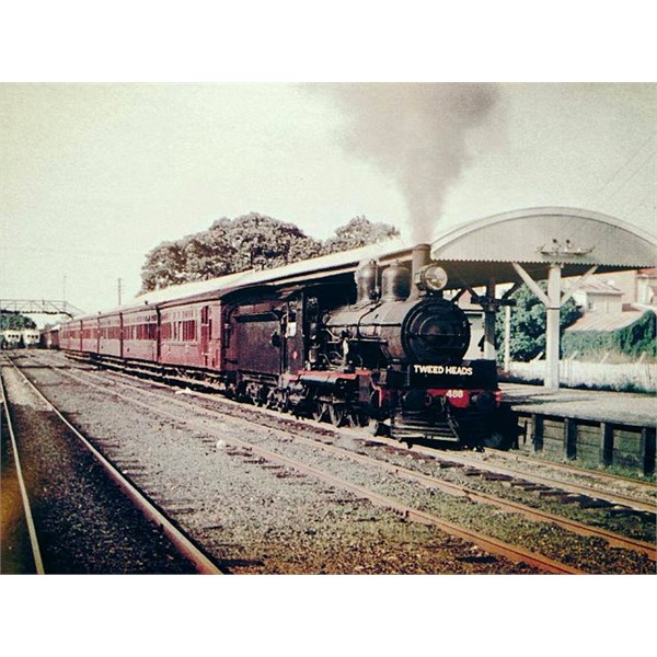
PB15 488 at Southport station with a Tweed Heads service.
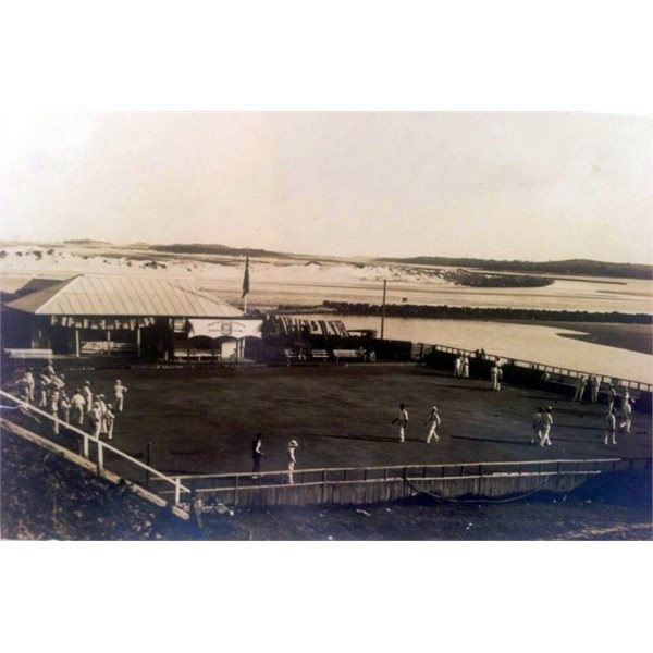
The Tweed Heads Bowls Club was founded in 1921
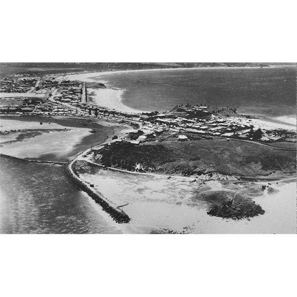
Aerial view of Tweed Heads, 1950
was once connected to the Queensland Railways system, with the South Coast line providing a direct connection to
Brisbane. The railway opened in 1903 and closed in 1961. The site of the station has been converted to parklands and commercial development. The
Tweed Heads Bowls Club was founded in 1921. The club started life on the banks of the Tweed River directly under
Point Danger in a modest clubhouse. Then in 1975 a new clubhouse was built on Greenbank Island not far from the original site.
A number of
well-known sporting teams represent the local area. One of them is the
well known NRL club named the
Gold Coast Titans and the Queensland Cup team
Tweed Heads Seagulls
Tweed Heads has two Australian rules football team's Tweed Coast Football Club and Coolangatta
Tweed Heads Australian Football Club with the Tweed
United as the Soccer Club plus Coolangatta-Tweed Barbarians Rugby Union Club,
Tweed Heads Bowls Club,
Tweed Heads Rowing Club, Tweed Valley Sailing Club and
Tweed Heads & Coolangatta Surf Life Saving Club.
Tweed Shire covers 1303 square kilometres and adjoins the NSW shires of Byron, Lismore and Kyogle, with the NSW/Queensland border to its north where it divides the twin towns of
Tweed Heads and Coolangatta. With 37 kms of natural coastline, wetlands and estuarine forests, lush pastoral and farm land, the entire basin of the Tweed River, and mountainous regions containing three world-
heritage listed national parks, Tweed boasts a unique and diverse environment. Centrepiece of the Shire is
Mount Warning, ( I have climbed it twice) where the sun first hits the Australian continent , it was Lieutenant James
Cook named
Mount Warning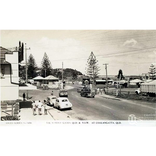
Border gate at Coolangatta
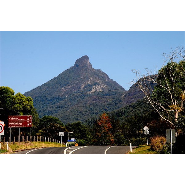
Mount Warning
Prior to
European settlement, the area was blanketed in sub-tropical forest and was home to the Nganduwal/Minjungbal people. Many of the Shire’s towns and villages derive their names from the language of the local Aboriginal people.
.