HN7 Am I dumb or have I been conned?

Submitted: Saturday, Jul 12, 2014 at 14:24
ThreadID: 108708 Views:42160 Replies:14 FollowUps:15
This Thread has been Archived
I've had my new HN7 for a few days now and as far as I can see I've bought a very expensive copy of an Hema atlas and Camps 7
I have no need for the street navigation as there are no streets around here.
Bluetooth I already have
A reversing camera is already fitted
And the rest of the stuff is pretty superfluous.
If I wanted to navigate from say, Goulburn to Captain Billy’s Landing, is it possible on the HN7?
To make matters worse I read the manual and was aghast to see there are 44 pages devoted to street navigation and only 16 to 4WD Navigation.
The Hema website has a voice on the advertising You Tube and only “dings” on the instructional videos
Am I dumb or have I been conned?
Back Expand Un-Read 2 Moderator

Reply By: HKB Electronics - Saturday, Jul 12, 2014 at 14:35

Saturday, Jul 12, 2014 at 14:35
I'm not familiar with the Hema product but if it is simialr to OZI explorer it is not
a street by street software, ie it does not give voice instructions like turn right at
x street etc, and you can't put in a destination address for example, it is just a moving map.

Someone more familiar with the software will no doubt provide more info.

The street navigation if good one will have a lot of country tracks etc though may no have some very minor ones in remote locations, they usually have enough though to get people into trouble thinking they are roads but then turn into goat tracks:)

Leigh

Lifetime Member
My Profile  Send Message

AnswerID: 535956

Reply By: Chris_K - Saturday, Jul 12, 2014 at 16:06

Saturday, Jul 12, 2014 at 16:06
Hi Trevor

The Hema Navigator is pretty "average" when it comes to street navigation. Mine tells me to turn into streets, where the is a "no left turn" for example. The 4WD part is pretty good though - it's pre-loaded with some pretty detailed maps - but in your example above - it won't tell you directions from Goulburn to Captain Billys Landing. It will (should) give you pretty accurate directions from where ever you are to another street (in the street navigation bit) in say Cooktown. But from there - you'll need to use the 4WD Hema Maps part for the rest of the journey.

I'd suggest that most people wouldn't buy one for their street navigation attributes!

Chris
AnswerID: 535959

Follow Up By: AlanTH - Saturday, Jul 12, 2014 at 17:11

Saturday, Jul 12, 2014 at 17:11
I'll second that, if you want a street navigator look elsewhere as our Hn5i or whatever it is sent us round and round and round the block several times in Streaky Bay looking for the caravan park. So I followed street signs instead.
In Albany it nearly sent us up a close which would have made it fun turning the van around.
Mostly I se the Topo maps as have found even the off road stuff is not that good.....tracks which have been in existence for years missing etc.
Not worth the 7 hundred our daughter spent on it quite frankly.
And with a booklet of 81 pages it isn't exactly user friendly.
AlanH.
0
FollowupID: 819955

Reply By: pop2jocem - Saturday, Jul 12, 2014 at 17:22

Saturday, Jul 12, 2014 at 17:22
Gee Trev, I wish I knew you were in the market for a HN7. You could have saved yourself a few bucks and still achieved the same degree of disappointment. You could have bought mine at a good discount.
If it makes you feel any better either you and I had our hopes too high or we have both been conned.

(:=((

Cheers
Pop
AnswerID: 535965

Reply By: Gone Bush (WA) - Saturday, Jul 12, 2014 at 17:39

Saturday, Jul 12, 2014 at 17:39
I don't think either of you, Trevor and Pop, were conned.

Maybe you didn't look into the product enough to see if it delivered what you expected before you bought.

I have the HN6 and use mostly the Oziexplorer part. It does exactly as expected before I bought it. The IGO street nav software is OK, not as good as Garmin, imo, but still OK. I use that when I want to find Camps 7 POIs.

It's all as advertised.

I'm glad I ain't too scared to be lazy
- Augustus McCrae (Lonesome Dove)

Lifetime Member
My Profile  My Blog  Send Message

AnswerID: 535966

Follow Up By: Grumblebum and the Dragon - Monday, Jul 14, 2014 at 09:29

Monday, Jul 14, 2014 at 09:29
Ditto.

John
0
FollowupID: 820099

Reply By: Sand Man (SA) - Saturday, Jul 12, 2014 at 17:53

Saturday, Jul 12, 2014 at 17:53
Hi Trevor,

No you're not dumb and you haven't been conned.

Perhaps the one thing you should consider is "why did I buy it"
If it was for the offroad tracking capability and the moving map display of where you are at any given time (OziExplorer) then rest assured in the fact that you have one of the best offroad moving map displays around, with the ability to place waypoints along your route, as you go.

I owned the original HN5 and I did a fairly comprehensive review of the product.
The street guidance application was very ordinary and I never used it.
I have more recently upgraded to the HN6 and this has a better street navigation application in iGo, but apart from testing it out, I still don't use it.
I bought both of the Hema products for the ability to run OziExplorer as I travel this great land of ours and absolutely love it for that purpose.
With the range of digital maps available, you can run say a Hema map display on Ozi and have the same printed map if you or your "navigator" need to refer to a hard copy map. Also, as David improves the EOTopo product (I have a copy of that as well) you will have another digital map to use. At the moment the EOTopo maps do not contain distance references and that is a big downside to me at present. As David further develops EOTopo we will end up with a product that will replace the NATMAP one I have been largely using for several years.
The range of Hema maps that come with the HN7 are more than adequate to give an accurate display of the region you are travelling through and you can call up a more detailed regional maps , such as the Kimberley region I have recently traversed.

When I need a street navigation app, I use a separate device (TomTom) because you cannot run two apps at the same time on the HN7 and I would interrupt the tracking capabilities of Ozi, if I shut it down to run something else.

You need to be aware that the HN7 and OziExplorer do not provide voice guided navigation ability. You would need to run iGo (Street Navigation) app to do that and I am not sure how good iGo is for the more remote areas of our country.

I discovered on our recent trip to the Kimberley, that even my trusty TomTom did not recognise some of the destinations (place Names) along the Gibb River Road and yet my mate's Garmin did. When it comes time to upgrade the TomTom, I will take a closer look at the Garmin product before making a decision, which to buy for "street navigation" capabilities, especially for remote areas.
It is handy to know what the distance is and how long it will take to get from point A to point B. I managed to overcome TomTom's deficiency in recognising some locations by obtaining the co-ordinates from OziExplorer (the night before) then entering them into TomTom as a destination and then it provided me the detail I desired. TomTom falls down by not having a comprehensive Place name database of the more remote locations, for instance Drysdale River, or Middle Lagoon. Garmin had no problem with these.

All in all, in 4WD mode, the HN7 will give you a great moving map display of exactly where you are in the vast area of our Country and the ability to record your track for future reference and also any waypoints (points of interest) you wish to mark along that track.

In Street Navigation mode, it should provide a reasonable voice guided function as you travel in the more built-up areas and major towns.

It will not provide a trip planning function as does TomTom, or Garmin, etc.


Bill


I'm diagonally parked in a parallel Universe!

Member
My Profile  My Blog  My Position  Send Message

AnswerID: 535969

Follow Up By: pop2jocem - Saturday, Jul 12, 2014 at 20:38

Saturday, Jul 12, 2014 at 20:38
Bill,
I understand my "navigator" and myself may need to persevere a bit longer and hopefully become a little more conversant with it's "characteristics"
We also travelled the GRR a couple of months ago and that proposed trip was one of the reasons we bought the unit because we thought it would give us a reasonable intro to it's use and operation. I am glad we also took along a $10 paper map and didn't rely on this instrument giving us simple info such as a distance to our next entered waypoint if that's the correct term. It constantly came up with varying numbers which were obviously very wrong.
No I didn't expect it to talk to us as we went.
You start off tell us what a great bit of kit it is and then list multiple problems with using it.

Cheers
Pop
0
FollowupID: 819981

Follow Up By: Member - Trevor - Saturday, Jul 12, 2014 at 21:04

Saturday, Jul 12, 2014 at 21:04
I'm not at all interested in the street navigation. So we can forget that.
At the risk of being flogged I have found the EOTopo maps to be much better than the Hema. I particularly like the inclusion of State Forests as these are usually pretty good camping spots. Although on page 113 of the manual it does show Daisy Hill State Forest.
Not being in the 4WD at this hour on a Saturday night I am wondering how to get the EOTopo maps on the screen of the HN7? I'm under the impression they are an overlay?
0
FollowupID: 819985

Follow Up By: Sand Man (SA) - Saturday, Jul 12, 2014 at 22:22

Saturday, Jul 12, 2014 at 22:22
Pop,

I don't believed I stated any "problems" with the Hema.
The inability to run multiple applications is not a fault of the Hema.
No navigation device has this capability at present.
My old Dell PDA could run both OziExplorer and CoPilot 6 concurrently and hot key (swap) between them. This was achieved by a program called GPSGate.

I do not wish to interrupt OziExplorer as I travel and therefore do not close it down to run another application. My Choice and therefore I run a separate street navigation device which is also handy for much of Australia, to give me distance and ETA details.
Bill


I'm diagonally parked in a parallel Universe!

Member
My Profile  My Blog  My Position  Send Message

0
FollowupID: 819994

Follow Up By: Member - Scott M (NSW) - Sunday, Jul 13, 2014 at 00:41

Sunday, Jul 13, 2014 at 00:41
"Not being in the 4WD at this hour on a Saturday night I am wondering how to get the EOTopo maps on the screen of the HN7? I'm under the impression they are an overlay?"

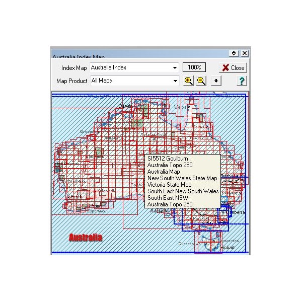
Trevor - if you look at the map raster set that comes with the HN6 & HN7, they also supply the 250K topo maps for all of Australia.

You just need to zoom in or out to the required level of detail.

As for the street / city maps, I find Tom Tom personally still one of the best. The iGo I don't think much of, however I didn't buy it for the street maps.


0
FollowupID: 820004

Follow Up By: Member - Trevor - Sunday, Jul 13, 2014 at 09:02

Sunday, Jul 13, 2014 at 09:02
Hi Scott,
I think the dumb part is winning
I'm in my study using the wonderful Windows 8.1 so that gives you an idea of how crazy I am. I have downloaded the Hema maps to the screen.
I'm using EOTopo and have managed to save one map
2014 Trip to the Cape
I have tried to put in some waypoints but can't get them to save on the map.
Any clues?
Cheers, Trev
0
FollowupID: 820011

Follow Up By: Member - Stephen L (Clare SA) - Sunday, Jul 13, 2014 at 09:44

Sunday, Jul 13, 2014 at 09:44
Hi Trev

Please read my reply to your post. Waypoints are NEVER EVER saved to any map file, but as an actual waypoint file. Using Windows 8 in Ozi mode is no different than any other Windows operating system.

No I do not have Windows 8, but helped set Ozi onto a brand new, out of the box Windows 8.1 Ultrabook computer for an EO Member that broke his computer hours into his 4 month trip only last week.

I can now tell everyone that Windows 8 is very fussy on what type of GPS receiver you are using, and will not work with older type receivers.


Cheers


Stephen
Smile like a Crocodile

Lifetime Member
My Profile  My Blog  My Position  Send Message

0
FollowupID: 820015

Reply By: Member - Megan and Kevin D (AC - Saturday, Jul 12, 2014 at 18:02

Saturday, Jul 12, 2014 at 18:02
Hi Trevor
I have an earlier version: Hema Navigator. If you are using OziExplorer and the associated maps (1:250,000 or Hema Maps), the Hema doesn't give you voice instructions about how to get somewhere but what it does do, and what has proven invaluable to us, is show you where you are exactly.

We have had a couple of experiences where we were faced with a number of wheels tracks and had no real idea which track was the track marked on the map. Once you start to head down one, you can pretty quickly see if you are on the track marked on the map. If you're not, you turn back and try again. It's worked every time for us. Two occasions are memorable - in Nuytsland Nature Reserve and in the Gammon Ranges.

It is also quite easy (once you decide to learn how!) to plot your route ahead of time and then follow the plot marks (waypoints) on the screen. A voice can tell you how far to the next mark. That also is useful although sometimes I add too many and the voice can drive us mad - but it is easy enough to delete them.

I found the Hema Navigator so useful that I bought the app for my iPad and that too works like a charm. It costs a bit but that is balanced by the fact that it doesn't require internet access - it works anywhere (so long as the iPad battery is charged). If something goes seriously wrong with the iPad, I have the Hema Navigator and a pile of Hema (and other) paper maps.

I hope you come to enjoy it, although if you were expecting voice instructions while using the Hema maps, for example, I can understand your disappointment.

Megan
AnswerID: 535970

Reply By: The Bantam - Saturday, Jul 12, 2014 at 18:09

Saturday, Jul 12, 2014 at 18:09
Perhaps you are expecting the wrong things.

The typical street navigation devices are strange in the world of electronic navigation in that they will navigate for you.

Most GPS uints other than street navigators will not nevigate for you or tell you where you should go.

They will provide you very accurate information on where you are now.....the direction and speed at which you are traveling at a given time..and if they are mapping GPS units they will show you a map.

But you are responsible for knowing where you are going, the actual navigation and the choices.
That is the way it has to be, because once you get away from well defined and reulated streets you need your wits about you and your eyes well and truly open.

cheers
AnswerID: 535971

Reply By: Swaggee - Sunday, Jul 13, 2014 at 07:16

Sunday, Jul 13, 2014 at 07:16
Hi Trevor

Your not the first and you will not be the last to complain about the unit, for the price you paid you could of bought a Samsung Galaxy Tab2,3g that will do everthing and more.. Run Ozi Explore, Memory Maps with Victopo and Sygic for AUS and NZ (these are added costs but you'd still be around the same $$$) or just use Google maps which is great ...
Plus it has around a 10inch beautiful screen etc.. Pay movies and music etc

I bought a Magellan XL years ago, cost 1200 bucks, the GPS would go offline under tree canopy etc, the city software was pathetic at best, the Topo was great but was always song guessing where I was and sometimes getting lost, with this one is nearly had a year is spot on everytime using Rooftops in The High Country is brilliant although now I can get around without mapping etc.. so I know how it feels to get something your not happy with...

Anyway Goodluck...
AnswerID: 535989

Follow Up By: katepaul - Sunday, Jul 13, 2014 at 22:30

Sunday, Jul 13, 2014 at 22:30
Hi What Samsung do you need 16-32- 64 gb to run all those maps you mention
Thanks kate
0
FollowupID: 820078

Follow Up By: Swaggee - Monday, Jul 14, 2014 at 06:29

Monday, Jul 14, 2014 at 06:29
Hi Kate

Mine is 32 gig but they take an external SD card too, I tested mine over the weekend as I've only had a 32gig card in it, I replaced it for a 64 gig and it worked fine, so plenty of room for movies, music photos, etc etc..
Plus I bought an Office program and I keep all the Pdf files for my Vehicle manual, Coleman North star light manual with parts breakdown etc, so it had meany extra features, I wouldn't be without the 3g feature either but you can buy wifi and hotspot to your mobile, wifi are about $240 maybe cheaper...

Mines the Samsung Galaxy Tab2,3g, GT-5100.

Here's a pic using Ozi Explorer with my customised screen...

0
FollowupID: 820089

Follow Up By: get outmore - Wednesday, Jul 16, 2014 at 00:31

Wednesday, Jul 16, 2014 at 00:31
Yes samsungs are not a crapple.
just put a 64gig sd card.
As for hema navigators.
There less than $100 of equipment.
There just a $50-70$ navigator you can get from ebay with ozi cd and 2sets of maps.
I got mine off ebay fully set up for about $100.
Even the sunshades sell for $30 with the hema name ($5 off ebay no hema name)
0
FollowupID: 820172

Reply By: TrickyD(SA) - Sunday, Jul 13, 2014 at 08:34

Sunday, Jul 13, 2014 at 08:34
I have the Hema 6 and I am more than pleased with it. After all it is just a "moving map" That is all I need when travelling outback WA. I also use a MIO on the wife's side of the car that has been loaded with off road maps and a trick to make it work the same way as the Hema. More than pleased with it although the costs are out there. I was a passenger for the Big Red Bash so I had a play with it while going along and found lots of things on it that I did not know existed. such as Hat trouser and "bra" conversion. Must remember that next time I am in buying pants. Overall it does what I want it to do and most of the maps pick up those little side tracks that I need for camping .
AnswerID: 535995

Reply By: Gronk - Sunday, Jul 13, 2014 at 10:42

Sunday, Jul 13, 2014 at 10:42
I see the Hema ( and probably a lot of others too ) only go as far as 250K maps ?

What device ( or maps ) have 25K ones ??

When navigating thru nat parks and forests, the 250K maps are too big and don't show a lot of small tracks ( and contours )
AnswerID: 536005

Follow Up By: Member - Trevor - Sunday, Jul 13, 2014 at 10:46

Sunday, Jul 13, 2014 at 10:46
Hi Gronk
My EOTopo has contours which is one of the reasons I like it
It also appears to be accutrate
Cheers, Trev
0
FollowupID: 820024

Follow Up By: The Explorer - Wednesday, Jul 16, 2014 at 08:56

Wednesday, Jul 16, 2014 at 08:56
Hi

Hema navigators come supplied with a variety of maps (i.e Hema's Great Desert Tracks etc etc but also including 250K topo). If you want other maps at different scales for various areas (eg EOTopo 200 or various 100K, 50K, 25K maps for select areas) you have to scan/calibrate your own or purchase and load them yourself (see exploroz shop -digital maps - for examples). Make sure the maps you buy will suit your requirements before purchase.

For Australia there are no complete (i.e. all of Australia) paper or raster maps at 100, 50 or 25K scale...just certain areas.

Cheers
Greg
I sent one final shout after him to stick to the track, to which he replied “All right,” That was the last ever seen of Gibson - E Giles 23 April 1874

Lifetime Member
My Profile  My Blog  Send Message
Moderator

0
FollowupID: 820180

Reply By: Member - Scott M (NSW) - Sunday, Jul 13, 2014 at 17:09

Sunday, Jul 13, 2014 at 17:09
PLenty of small tracks & contours on this one....

AnswerID: 536015

Reply By: John Paine - Sunday, Jul 13, 2014 at 21:34

Sunday, Jul 13, 2014 at 21:34
I use iPad mini with Hema
Great for the outback, didn't get lost in the back tracks near innamincka.
Use all the other apps & internet in towns
AnswerID: 536029

Reply By: Michaeljp - Monday, Jul 14, 2014 at 14:54

Monday, Jul 14, 2014 at 14:54
I also bought the HN7 just for the moving maps and im happy with it so far. I also have an ipad air with hema and mud maps but its to big to mount in the Patrol. The HN7 is smaller and doesnt take up much window space in the lower right of the windscreen/dash area. But i cannot work out how to get into the Ozi part of it when im in the 4WD section. The instruction booklet is all but useless.
AnswerID: 536049

Follow Up By: Member - Trevor - Monday, Jul 14, 2014 at 16:39

Monday, Jul 14, 2014 at 16:39
Hi Michaeljp - This is a bit of a turn around for me. But here is how is how I get into the EOTopo
Remember I'm working on my computer screen
Top left hand
Open FILE
then
LOAD FROM FILE
then
OPEN RECENT MAPS
There are a whole stack of maps listed including the one I have saved.
Hope this helps
Cheers, Trev
0
FollowupID: 820112

Reply By: Nick n Sue - Sunday, Jul 20, 2014 at 14:45

Sunday, Jul 20, 2014 at 14:45
Hi Guys
new to all this however got sick of my Garmin for outback trips so bit the bullet and bought a HN7. All $700 worth.
Drove from Perth to Alice. about 200k out of Warburton passing no turnoff on the Great Northern it repeatedly asked me to perform a u turn in varying kms. The unit then turned itself off repeatedly and could not find a location when it did run.
I rang Hema when I arrived in the NT and was told that it was a power issue and that I should go out and buy myself a new charger!! The guy on the phone from the help desk was obstructive and of no use whatsoever.
I have since fully charged the machine again (did it when I first opened the box as per instructions)and it wont even turn on.
I will keep you posted with Hemas response.
AnswerID: 536329

Follow Up By: Member - Trevor - Sunday, Jul 20, 2014 at 19:00

Sunday, Jul 20, 2014 at 19:00
Hi Nick n Sue
Mine also went into melt down as I tried to save too much information on the SD Mini Card.
I sent it back to Hema and they have been fantastic I think it was Greg I spoke to then Dan who told me I had tried to save a big map which had clogged up the works.
Adele from ExplorOz has been brilliant in trying and promising to help me.
I expect to have the unit back tomorrow
Cheers, Trev
0
FollowupID: 820420

Sponsored Links