GPS loadable maps
Submitted: Tuesday, Nov 08, 2016 at 23:04
ThreadID:
133738
Views:
5196
Replies:
4
FollowUps:
4
This Thread has been Archived
dermie66
Hi All
I'm just learning to use a GPS and looking to buy a Garmin GPSmap 64s handheld. Searching the
forum it isn't clear to me the best way to go with loadable background maps (not sure if I even want them yet).
For bushwalking how helpful is the TOPO? (I've been learning with an old Garmin 72 and did OK without background data, but the LCD display has now died)
For those of us with eyes that aren't what they used to be, how readable are the colorful displays in different lights?
Should I pay upfront for TOPO on an SD card?
Is there any difference purchasing and loading later?
There seems to be some support for the free Shonky maps, what are the pros and cons?
What alternatives do those with experience suggest?
Thanks in advance
Dermie
Reply By: Tony G15 - Wednesday, Nov 09, 2016 at 09:39
Wednesday, Nov 09, 2016 at 09:39
OZTOPO on SD card is very good. Have used it on a couple of GPS units. Good detail with contour lines.
AnswerID:
605775
Reply By: maurice b - Wednesday, Nov 09, 2016 at 12:09
Wednesday, Nov 09, 2016 at 12:09
Buy the GARMIN TOPO MAPS AUSTRALIA & NEW ZEALAND V5 on ebay and give them a try. They will work on Nuvi's including the Garmin 64 and other models .It is also routable but don't trust it in remoter area's . I personal don't like shonky map . You can create your own maps using OSM and they a very detailed. Join the Garmin 62/64 Yahoo group lots of info .However you would have a lot more selection of maps using ios and Android apps including Oziexplorer a lot easier for vehicle touring
AnswerID:
605777
Reply By: Member - Trouper (NSW) - Wednesday, Nov 09, 2016 at 12:21
Wednesday, Nov 09, 2016 at 12:21
Unlike Maurice b I have been using Shonky Maps for about 8 years and I'm quite used to them. They reduce the contour lines down to 50 metres as apposed to the normal 10 metres but I don't find it an issue particularly in hilly terrain.
They are FREE and it would do you no harm to try them out. An alternative to Garmin TOPO is the compatible GPSOZ Topo maps which I believe are better with more detail, however I have not used them personally. Get onto the GPSOZ website you can download a sample. Then ask Garmin if they'll do the same,(I bet not)
AnswerID:
605778
Follow Up By: Member - Trouper (NSW) - Wednesday, Nov 09, 2016 at 12:33
Wednesday, Nov 09, 2016 at 12:33
I forgot to ask, are you using the 64 for vehicle navigating or walking. If for vehicle get the Nuvi 2797. 7inch screen lots of info and costs about $280 but you do need to add the topo maps
FollowupID:
875530
Follow Up By: DesF - Wednesday, Nov 09, 2016 at 19:46
Wednesday, Nov 09, 2016 at 19:46
I have both Oztopo V8 and Garmin TOPO, plus Shonky Maps, they ( TOPO's) are both good but you can do
routes on the tracks ( Dotted lines ) on the Oztopo V8, but not on the Garmin TOPO. Other wise they are all good gear ,
Cheers Des.
FollowupID:
875541
Follow Up By: maurice b - Wednesday, Nov 09, 2016 at 20:52
Wednesday, Nov 09, 2016 at 20:52
I would love to try out Oztopo but its a lot of money if I don't like it . I usually create .gpx files of
routes on Ozi pc and transfer them to the Garmin Nuvi via usb connection .Problem is the gpx file can't contain many points otherwise it won't be read (unlike the Zumo 62/64 ect so have to make a series of small files. For trackless desert nav and in 4x4 mode its a fantastic device for plotting a go to as crow flys by just touching the main nav screen then touching where you want to go by scroling to a point then go to.Of course i use it in conjunction with Ozi Android that I preload it with
routes on pc or create points enroute .In June this year I used my Nuvi as a test with OSM free maps preload at home with the
Madigan Line waypoints and a route of complete track and the nuvi actually guided me to
Birdsville from Mt Dare .(not recommended for learners) The OSM map also contains Steve L 2006 Trackless Geo's route line crossing same as on the NT
EoTopo sheet. 'Hope your getting royalties Steve'
FollowupID:
875542
Reply By: maurice b - Thursday, Nov 10, 2016 at 18:42
Thursday, Nov 10, 2016 at 18:42
For those interested in alternative free maps for the Garmin look at the Open Street Maps online.They are free and legal .I have included some screen shots however i have added the contours from another program to overlay the screen and can be switched on or off. If you decide to purchase a Garmin Nuvi be sure it has the create a route function and be able to turn tracking on or off as the cheaper ones lack these features."Trouper" are you able to screen shot similar areas of your Oztopo maps to compare
http://www.osmaustralia.org/garmin.php 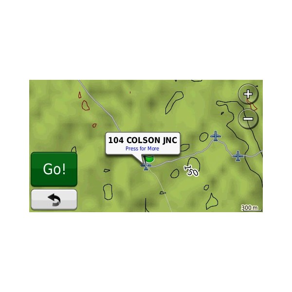
Colson jnc to Geo baseA
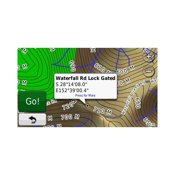
Mt Barney qld area
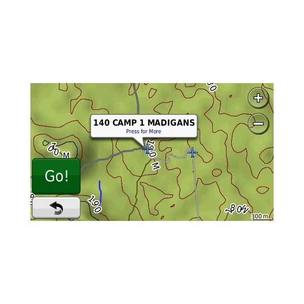
Madigan camp 1 Area
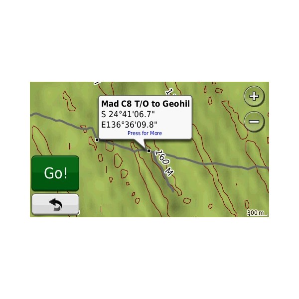
Madigan camp 8 / Geosurveys Hill turnoff
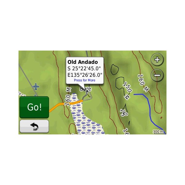
Old Andado
.
AnswerID:
605814
Follow Up By: dermie66 - Thursday, Nov 10, 2016 at 21:53
Thursday, Nov 10, 2016 at 21:53
Thanks to everyone for their input. I'll have a look at the other options raised before deciding.
I'm only considering the GPS for bushwalking at this stage, not as a dash mounted unit for vehicle navigation.
cheers
FollowupID:
875588