Bush Fire Warning near Dargo in Vic High Country
Submitted: Monday, Mar 13, 2017 at 17:50
ThreadID:
134457
Views:
4718
Replies:
3
FollowUps:
2
This Thread has been Archived
Member - Allan L2
There are currently two bushfires burning in the
Dargo area. The largest approximately 20 Km NW of
Dargo & is approximately 435Ha in size.
Billy Goat Bluff track is closed. The fire is travelling in a NW direction & is not under control.
The second fire is approximately 10 Km NW of Castleburn, 85ha & is also not under control at this stage.
Reply By: Member - sparra - Monday, Mar 13, 2017 at 18:33
Monday, Mar 13, 2017 at 18:33
Was up at Angusvale yesterday and there was a fair bit of smoke around once the wind changed to the northwest in the arvo.
AnswerID:
609363
Reply By: Old 55 - Tuesday, Mar 14, 2017 at 11:58
Tuesday, Mar 14, 2017 at 11:58
We were on
Billy Goat Bluff track on Sunday afternoon when the fire came up the top near
the Pinnacles catching about 25 vehicles by surprise. There was a mass exodus down
the Pinnacles road onto Moroka road to get out of the fires way. It came up over the ridges from nothing to a roaring wall of flame in about 30 minutes.
Shows how easy it is to get trapped especially when you only have one direction to go.
AnswerID:
609378
Follow Up By: Member - Allan L2 - Thursday, Mar 16, 2017 at 06:50
Thursday, Mar 16, 2017 at 06:50
Great to hear that you all got out of the area safely. It is always a concern of
mine when exploring one way / dead end tracks. I think of the possibility of a very large tree falling & try too keep out in some weather conditions back as you are aware things can change very quickly the high country.
This case demonstrates why we should all carry a PLB / EPIRB / Etc should things have got worse & blocked escape.
FollowupID:
879303
Reply By: Sigmund - Friday, Mar 17, 2017 at 19:52
Friday, Mar 17, 2017 at 19:52
This is the Crooked R fire today from Blue Rag.
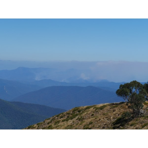
Crooked R fire
AnswerID:
609465
Follow Up By: andrew t - Saturday, Mar 18, 2017 at 16:22
Saturday, Mar 18, 2017 at 16:22
there is a map available on the delwip website showing the road closures for both the crocked river fire and the
dargo fire, and remember fire travels very fast uphills, best to keep out of the areas and let the fire crews do what they can, rather that tying up resources and possibly lives trying to keep sightseers safe when they should not be in the area anyway
FollowupID:
879352