AN Unsuccessful E/W Simpson crossing via Geocentre and
Geosurveys Hill.
Les PK
Ranger his mate Dennis and i left
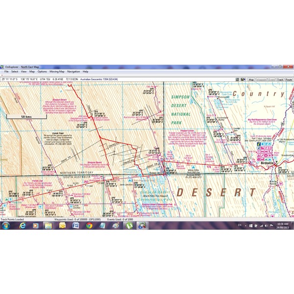
Birdsville the first week in May 2015, a 105 series cruiser a BT50 and a new HiLux to tackle a trackless East West crossing of the Simpson via Geocentre ,
Geosurveys Hill,then to take a straight westly line to the Colson Track, Maccs reserve, on to Mt Dare. I had 270 litres of diesel in my 1hdft 105 and the other 4 cylinders had 220liters. We left the French Line about 30 kms west of Poeppels and headed north up via Mirranponda lakes with the intention of following the old shot lines marked on the Hema and government Maps. This track, Mirranponda to Mt Dare is actually marked on the
Eotopo and OSM Maps it's the Tracklog image of Exploroz member Steve Langman from 2006. This track is non existent and as the shot lines were graded in the 1960s were only noticeable is some sections which were overgrown and washed out. It was quiet hard going mainly in 2nd low making our way over what you would call virgin ground, very hard on the
suspension and crossing the soft dunes.We struggled on some dunes and one had to be snatched over many times.
We camped just north of Thomas
well on the second night then passed the open cut pit,
the grove of Gidgee then we cut across to the main N/S
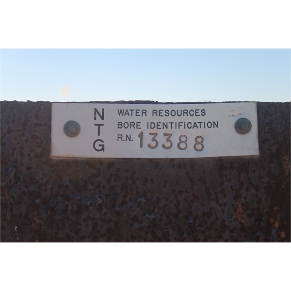
Shotline that runs up from Erabana
well on the French line and made it to the Geocentre for the 3rd nights
camp that afternoon. The run up this line was quiet easy as it's a recognised route except for the last half a dozen dunes where you exit to head west to the Geocentre. The next day we continued north up a dune corridor and came across a
plaque planted there by Willem Kempen, his mate and wife Jude in the late 1980s .After travelling aprox 70km north from the Geocentre we turned west on a direct bearing to
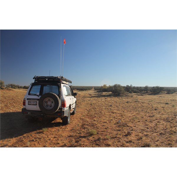
Geosurveys Hill.The dunes were now a lot higher and each vehicle had to make there own route across the dunes as once the ground was broken it was to hard for the following vehicles to cross on the same path.We made it aprox 6km east of
Geosurveys Hill. We
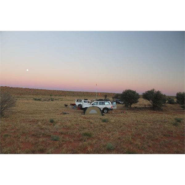
camp on top of a dune due to the nature of the terrain.
After filling the long range tanks in the 4 cylinders that night and saw the needle positions on the gauges we realised that we used a lot more fuel than we expected. That was twice the amount you would use on a French Line crossing, so to play it save as we knew that the dunes would be harder and higher the further west we travelled. We come to a decision to play it save to return to the French line directLy down the dune corridors. We arrived at the French line on the 6th day not far from Erabena
Junction after
camping the 5th night aprox 30km north of it.
No Mechanical problems to any vehicles. I was the only one lucky not to get any stakes. The other 2 had 2 stakes each. From memory the 2 X 4 cylinders arrived at Mt Dare with there fuel lights on. I still had under half of my 180liter rear
tank about 60L. As none of us filled our tanks completely at Mt Dare i am unable to give accurate fuel consumptions but the 6 and 4 cylinders weren't to much in difference. We did estimate that we could have used over 30L/100ks in sections .
Navigation. Les and i both used Nuvi Garmin with Topo v4 in 4x4 mode and a custom map from OSM overlay that had Steve L track. I used Ozi, Les, MapOut and Hema 4wd on ipad.
Communication. I had a
HF radio with phone connection via the HFradio Club and an Isatphone ,Les had a Iridium phone.
WATER We had 60 to 80 in each vehicle. Fuel. 4 cy had 220l / 6cy 270l
TEMP. As it was early in the season, the lowest overnight temp was about 3 to 4 deg however reached 30 deg during the day,quiet hot having lunch with no shade.
In June 2017 Les, Bob Y ,Trev and myself completed the western section from Mt Dare to the French Line via Geosurveys Base A ,
Geosurveys Hill, Northern Fuel dump and the Geocentre to
Birdsville.
The route
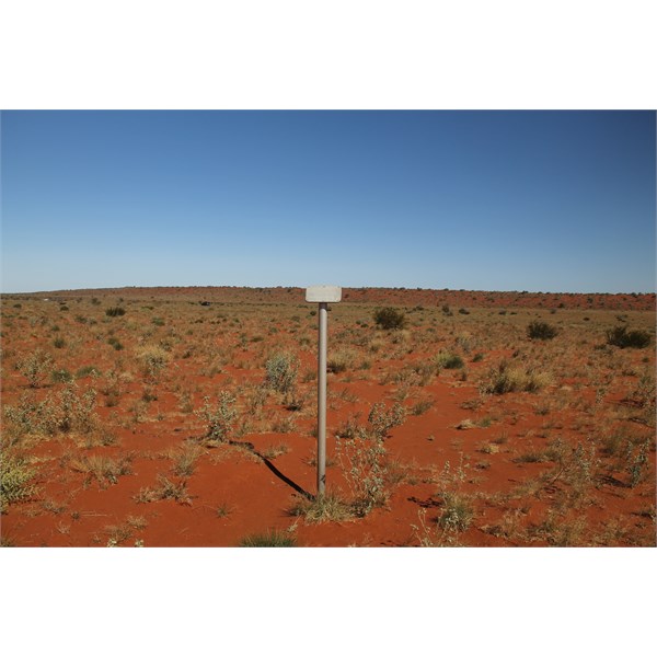
Marker
North of Mirranponga
Following a shot line
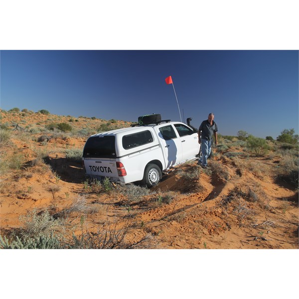
Soft dunes
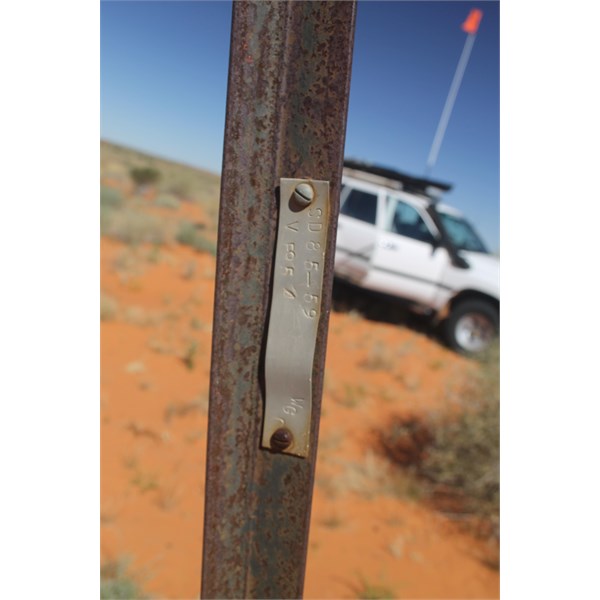
Star Droppers found on some shot lines
North of the Geocentre
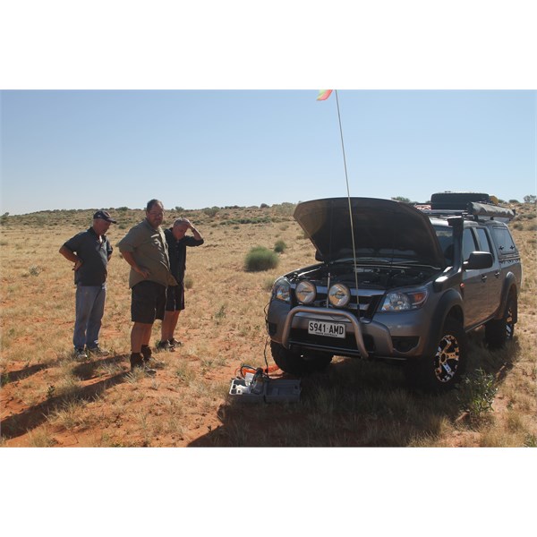
Tyre Repair
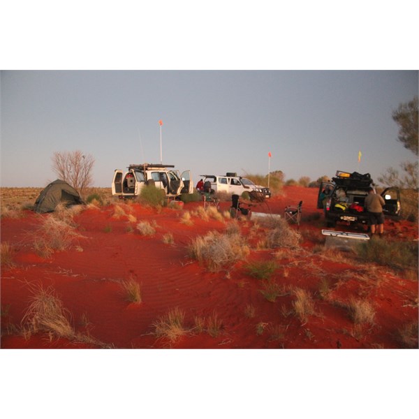
No flat area's to camp
Willem Kempens plaque planted in the late 1980's
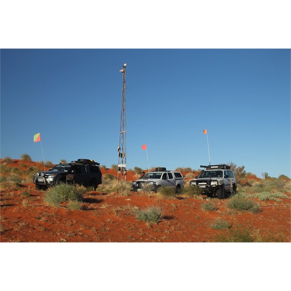
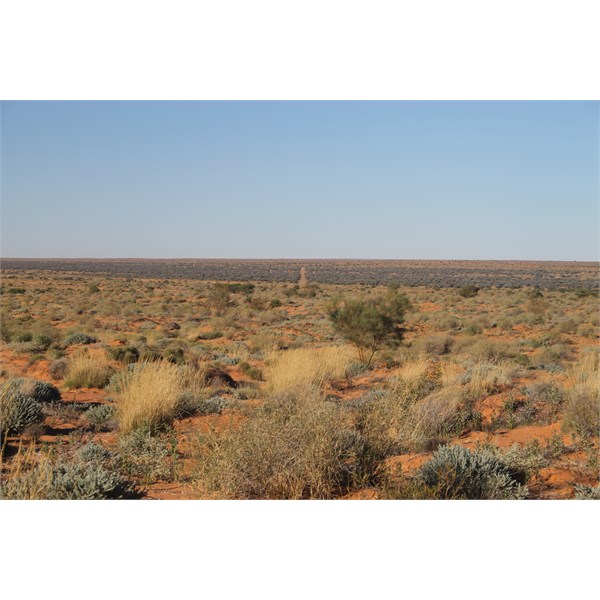
Tower at the Simpson Geographical centre
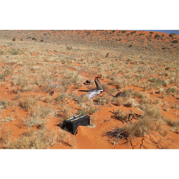
Old vehicle parts on the main N to S shot line