Haig to Cocklebiddy
Submitted: Thursday, Sep 02, 2021 at 21:50
ThreadID:
142504
Views:
8760
Replies:
4
FollowUps:
9
This Thread has been Archived
Member - Wildmax
Hi, in the past few weeks has anyone done the track from
Haig on the transline down to Cocklebiddy?
Will be going that way towards the end of the Sept, and
Haig down seems a much better option than backtracking from
Rawlinna to Balladonia.
Thanks for any feedback.
| Wildmax
2018 Hilux and Black Wolf 210 tent - for the outback tracks less travelled
Formerly an AOR Eclipse and a TVanMember
My Profile Send Message |
Reply By: Gramps - Thursday, Sep 02, 2021 at 23:02
Thursday, Sep 02, 2021 at 23:02
Are you sure you don't mean
Rawlinna to Cocklebiddy ? Did that in April.
Regards
AnswerID:
637767
Follow Up By: Member - Wildmax - Friday, Sep 03, 2021 at 18:04
Friday, Sep 03, 2021 at 18:04
Thanks Gramps. Yes, I did mean
Haig, because I plan to continue along the transline to there before heading south.
Looked like it might be a bit better track than the one down from
Rawlinna, but intetested to hear how you found that that one in April.
Cheers
| Wildmax
2018 Hilux and Black Wolf 210 tent - for the outback tracks less travelled
Formerly an AOR Eclipse and a TVanMember
My Profile Send Message |
FollowupID:
915894
Follow Up By: Bob Y. - Qld - Saturday, Sep 04, 2021 at 08:58
Saturday, Sep 04, 2021 at 08:58
Wildmax,
I just checked Hema’s GDT SW map & they have a note on the map recommending your proposed route, through
Haig. Reason being the station tracks through
Rawlinna Station, north of “Arubiddy”, may cause some confusion, or words to that effect.
A group of us travelled north from Cocklebiddy, in June ‘18, to
Rawlinna. Was slow going north of “Arubiddy” because of the frequency of protruding
limestone in the wheel tracks & plenty of gates.
Whole lot of nothin, Cocklebiddy-Rawlinna Track WA.
Bob
FollowupID:
915898
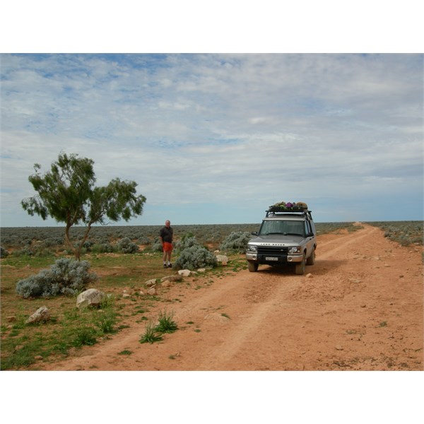
Follow Up By: Stephen L (Clare) SA - Saturday, Sep 04, 2021 at 14:25
Saturday, Sep 04, 2021 at 14:25
Yes it is a slow drive Bob, but we found it interesting.
Just keep the speed down and keep an eye on the track for the
Limestone outcrops.
Not sure why Hema Maps would say that, as when we did it there were a number of signs on the gates to let you know you were on the right track.
Yes there are other side tracks going off, but like any bush track, keep to the
well used track.
Unless the signs have been removed, you would have to be blind to get lost.
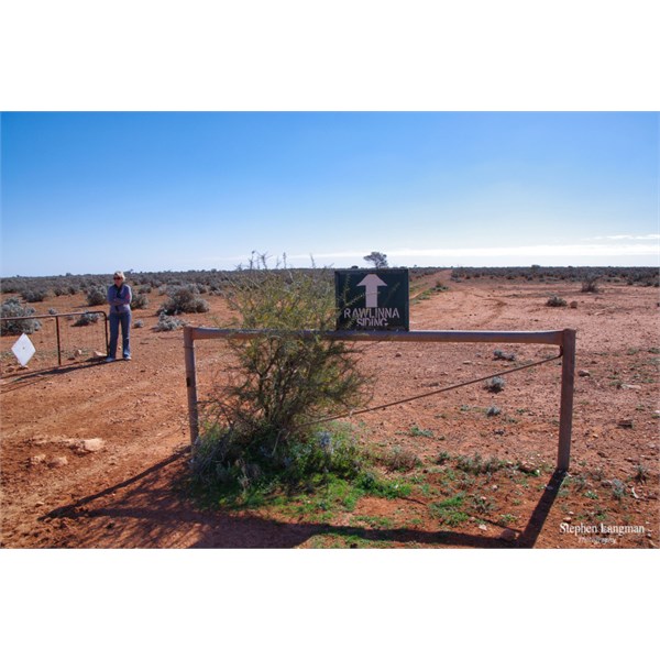
with signs like this, you must be blind to get lost
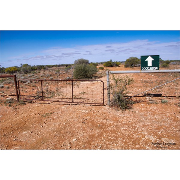
with signs like this, you must be blind to get lost
FollowupID:
915900
Follow Up By: Gramps - Saturday, Sep 04, 2021 at 22:13
Saturday, Sep 04, 2021 at 22:13
Wildmax,
I travelled North from Cocklebiddy through Arubiddy Station then to
Rawlinna. Track to the transline was much as Bob Y and Stephen L have described. Pretty slow going with lots of
limestone outcrops and "boulders" along
vermin proof fence. Once I got to transline it was smooth as to
Rawlinna. Did'nt see either of the signs Stephen has in his photos although there was one for
Rawlinna at a
fork in the track to Arubiddy
homestead.
Unfortunately I was travelling without a '
gate opener' so that got a tad tiresome.
Regards
FollowupID:
915901
Follow Up By: Bob Y. - Qld - Sunday, Sep 05, 2021 at 08:51
Sunday, Sep 05, 2021 at 08:51
A screen shot of Hema GDT SW map:

Cocklebiddy to Rawlinna WA
Bob
FollowupID:
915904
Follow Up By: Gramps - Sunday, Sep 05, 2021 at 09:13
Sunday, Sep 05, 2021 at 09:13
Bob Y,
I see you went through the
gate for
Rawlinna Station. I chickened out and went along the fence to the transline.
Screenshot of Westprint "Australia's Outback Tracks"
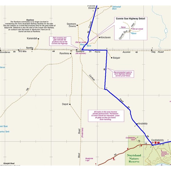
Westprint "Australia's Outback Tracks"
FollowupID:
915905
Reply By: Member - Wildmax - Sunday, Sep 05, 2021 at 10:55
Sunday, Sep 05, 2021 at 10:55
Thanks everyone for taking the trouble to provide some feedback on this query. Much appreciated.
| Wildmax
2018 Hilux and Black Wolf 210 tent - for the outback tracks less travelled
Formerly an AOR Eclipse and a TVanMember
My Profile Send Message |
AnswerID:
637799
Reply By: Member - Echucan Bob - Wednesday, Sep 08, 2021 at 22:15
Wednesday, Sep 08, 2021 at 22:15
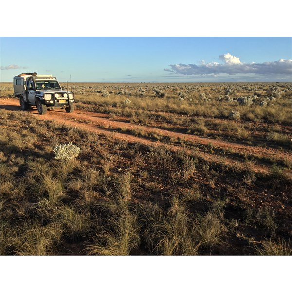
The Cocklebiddy to
Rawlinna Rd doesn’t offer a lot of shade.
Cbdy to Rwlna Rd
AnswerID:
637853
Follow Up By: Member - McLaren3030 - Thursday, Sep 09, 2021 at 09:01
Thursday, Sep 09, 2021 at 09:01
That is why the area is called The
Nullarbor Plain. :-)
Macca.
FollowupID:
915986
Reply By: Member - Wildmax - Thursday, Oct 07, 2021 at 22:02
Thursday, Oct 07, 2021 at 22:02
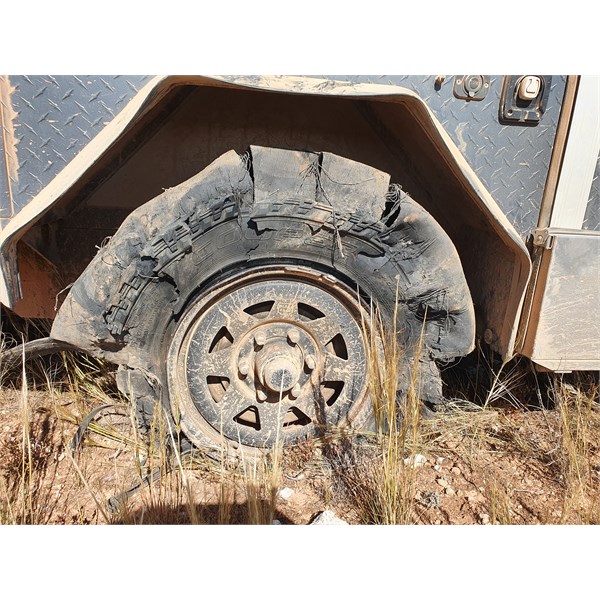
Sad end for a Cooper ST Maxx
Just answered my own question, for anyone interested.
The trans line from Kalgoorie to
Haig is in good condition, and a pretty easy run with the usual caveats about driving to the conditions. Interesting sights along the way, and good opportunities to
camp - we chose Zanthus and
Haig, but you are spoiled for choice and there is plenty of rail traffic to keep you interested.
The drop down from
Haig to the Eyre Highway near Cocklebiddy is another story - quite a challenge for vehicle and driver (not to mention my passenger, who also had to open and close innumerable gates!!)
It is basically rock all the way, and if you want to avoid damage most of the time is spent checking wheel placement rather than admiring the (extremely flat) view.
It took us six hours to cover just under 120 km, and when we aired up back on the highway I was congratulating myself on getting through unscathed. Then, another 20 km on the bitumen and one of the camper tyres gave me a stern message.
| Wildmax
2018 Hilux and Black Wolf 210 tent - for the outback tracks less travelled
Formerly an AOR Eclipse and a TVanMember
My Profile Send Message |
AnswerID:
638236
Follow Up By: Gramps - Thursday, Oct 07, 2021 at 22:15
Thursday, Oct 07, 2021 at 22:15
Wildmax,
Hahaha sounds like everyone had a great time.
Regards
FollowupID:
916581
Follow Up By: Member - David M (SA) - Thursday, Oct 07, 2021 at 22:20
Thursday, Oct 07, 2021 at 22:20
Going to need a couple of plugs for that one Wildmax.
Dave.
FollowupID:
916582