Sandover Road info
Submitted: Wednesday, Nov 07, 2012 at 21:36
ThreadID:
98904
Views:
4250
Replies:
3
FollowUps:
1
This Thread has been Archived
Greg & Dianne
Hello all, we are thinking of travelling to
Alice Springs next year via the Sandover. Can anyone give us some info on
camping spots along it, also the conditions although that will probably change. Also what would the track be like up into
Davenport Range National
park from the Sandover. We have travelled the Plenty and thought this would be a different track to take. Would appreciate all comments and suggests please. Thanks to all and safe travels. Grg & Dianne
Reply By: Bob Y. - Qld - Wednesday, Nov 07, 2012 at 23:29
Wednesday, Nov 07, 2012 at 23:29
G & D,
We went across the Sandover on way home last August, after crossing the Plenty, on way to
yulara, to see our daughter. We had to go to
Camooweal, for Drovers' festival, so it was a good run.
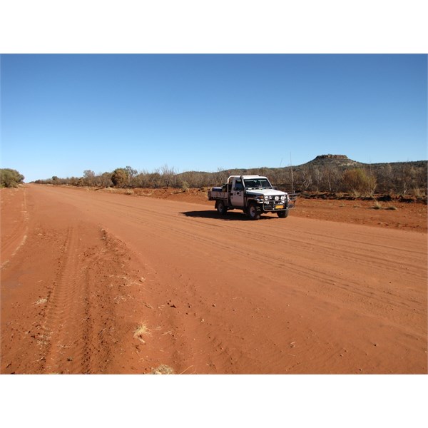
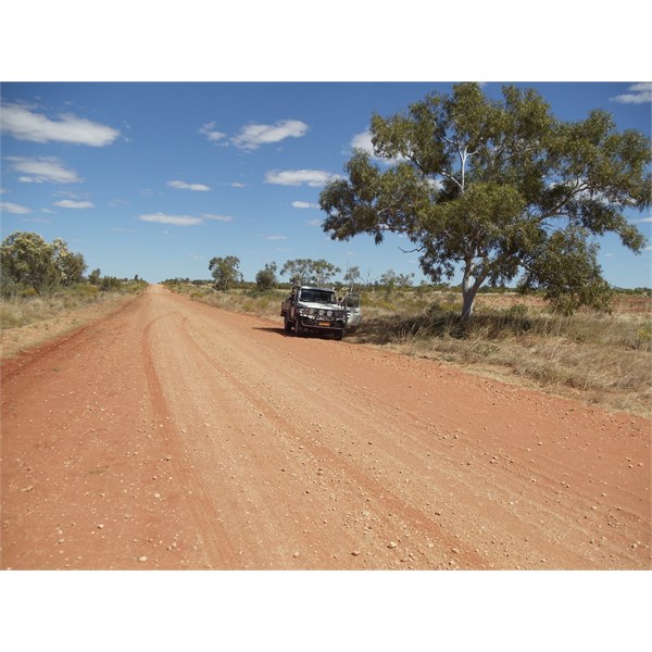
It's much sandier than the Plenty, and the surface was also in better condition then. Except between Arlparra Community & the store. About 3 - 5 kms of the "best" corro's I've ever seen. Then there's about 20 kms of bitumen, before reverting back to normal.
Once you get past some of these communities, the road loses it's broad status and ends up being a little better than 2 wheel tracks. But still good surface. We enjoyed the drive, and there was also some flowering trees, and different vegetation to what we are used to.
Camping spots seem a bit scarce, and we spent the night at the end of a spoon drain, where the grader had cleared a spot. Did mark a place where we had dinner, at an
old quarry, which would make a
good camp, even for a number of vehicles. Will dig up the co-ordinates tomorrow and post them here. Lot of areas on the western end were burnt out, so while clear, definitely not a clean
camp.
Kunoth Knob, on Sandover Highway NT.
Overall, a good drive, and so different to the Plenty.
Bob.
AnswerID:
498107
Follow Up By: Bob Y. - Qld - Thursday, Nov 08, 2012 at 12:04
Thursday, Nov 08, 2012 at 12:04
G & D,
The dinner/night
campsite is marked on Hema maps on my HN5i, but the co-ordinates are:
21 46'21.8" S 136 15' 26.2" E.
Dinner Camp @ Gravel Pit - Sandover Highway
This was our
campsite, on western end of the highway. Just off the road, but almost invisible to any passing traffic.
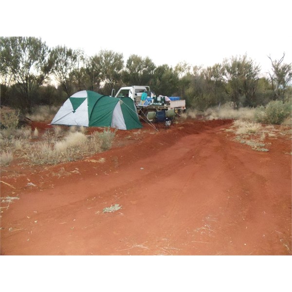
Campsite, between road & fence - Sandover Highway NT
There are a few other gravel pits, that would be suitable for a
camp, and some of the phone repeater towers often have a clear area around the site, that might be suitable for a night.
Hope you enjoy it next year,
Bob.
FollowupID:
774096
Reply By: ExplorOz - David & Michelle - Friday, Nov 09, 2012 at 12:32
Friday, Nov 09, 2012 at 12:32
Hi Greg & Dianne, you might find some other useful information in the
Blogs - I've just run a quick check and seen 9 matching results (by blog title) containing the word "Sandover".
Whilst we've also driven the Sandover, it was over 12 years ago. We were very conscious of needing to find a
camp well off the road due to the presence of "local" traffic at night without lights! As others have said, it is vastly different country to the Plenty but a really great shortcut/alternative route and worth taking. I have heard that Utopia is the site for some pretty unusual activities during certain times of year so I think that was in the back of our minds too. We felt a little unsettled and didn't spend time poking around exploring so can't offer any special insights unfortunately. Hope you enjoy it!
Michelle
AnswerID:
498194
Reply By: Greg & Dianne - Tuesday, Nov 13, 2012 at 21:49
Tuesday, Nov 13, 2012 at 21:49
Thanks folks.
AnswerID:
498453