Sunday, Dec 23, 2012 at 13:35
Hi Allan
I can only comment on the original HN5 v the new HN6
There are a few differences between the two, some good, some OK.
Firstly the screen size does make the biggest difference and if you are looking at buying one, pay the extra and go for the 6" screen and you will not regret the purchase.
My original HN5
Screen size 5", still good.
Maps very good, complete with the original Natmap 250K of Australia, but broken up into zones due to the full version being over 8gb in size. I tried to add the one complete Natmap to the Maps folder, but being over 8gb, the unit would not read the maps.
Still very user friends and a very reliable unit for me, that I still keep for the 'just in case' situation. The biggest downside was in my opinion the Route 66, which Hema did see the light in the end and gave it the big flick.
My new HN6
The bigger screen size is great and it did take a little getting use to the new layout.
The first biggest thing that I personally do not like is that Hema have gone away from the Natmap 1:250 Map zoned areas and instead have made their own. Hema claim that is has the same detail, but I personally do not agree and have loaded the old Natmap's series of zoned maps into the new HN6 and use them instead. They now use iGo for street navigation which is fare better that the old Route 66.
I have found a few sections when for some reason, sections of road are complexly missing on their 1:250, but are in full on the Natmap series.
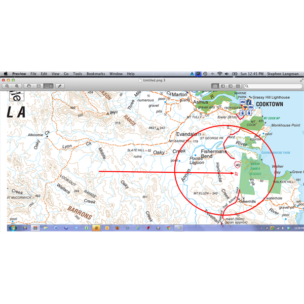
Hema's own 1:250k map - missing section of road south of Cooktown
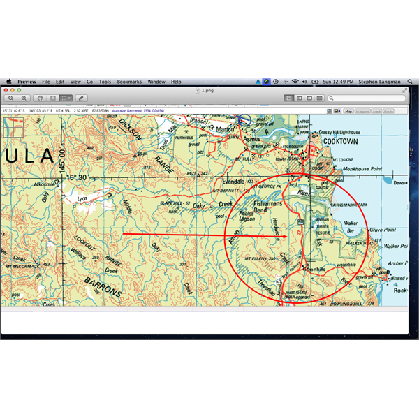
Natmap series 1:250k map, more detail and not missing section of road
The new HN6 now has the ability to load saved tracks and waypoints easier compared to the old HN5, a new feature that I really like. The old way you would have to open folders, add waypoints or track and then they would be able to be used when required. The new way is just like using OziExplorer, send selected tracks and waypoints on the map direct to your HN6 and it is that easy.
Either way they are great units and are perfect for where I use
mine, out in the bush.
Have a Great Christmas.
Cheers
Stephen
AnswerID:
500934