Road from Prairie Downs (WA)
Submitted: Thursday, Jan 24, 2013 at 21:16
ThreadID:
100169
Views:
3948
Replies:
3
FollowUps:
2
This Thread has been Archived
Member - Denis B (WA)
My Hema maps show a track heading north from Prairie Downs
homestead (SW of
Newman) up into the Opthalmia Range towards
Giles Point. From there it appears that one can keep heading north to the Gt Northern Hwy, or turn east onto a track/road that runs directly into
Newman.
Anybody out there who has travelled these tracks or knows anything about their condition? I'm planning on towing a Pioneer off-road camper.
Any input greatly appreciated.
Reply By: equinox - Thursday, Jan 24, 2013 at 21:34
Thursday, Jan 24, 2013 at 21:34
Hi Denis,
Did that one in 2009.
I wrote a brief write up in
forum thread 67463:
HERE
It may be a bit harder to get through on the western track with all the mining activity these days. Member Joe F may have updated info.
Cheers
Alan
AnswerID:
503308
Follow Up By: Member - Duncan W (WA) - Friday, Jan 25, 2013 at 10:52
Friday, Jan 25, 2013 at 10:52
It's a very good track from memory. But on the track that cuts across from a bit west of Mt Giles had
termite mounds very close to the edge of the track and some in th enormal wheel tracks so if using that track be carefull. Some nice scenery through there as
well.
FollowupID:
779981
Reply By: Member - Joe F (WA) - Friday, Jan 25, 2013 at 13:07
Friday, Jan 25, 2013 at 13:07
G'day Denis
The road/track system through Prairie Downs and onto and through Turee
Creek Station is generally a very good road ~ it is maintained by the station owners, so in essence a private road so I would suggest you contact the stations prior to your travel date.
The road/track has several major
creek crossings and most of the time these crossings are dry, but the region you are wanting to travel through is the upper catchment of the
Fortescue River, flooding of the area is common.
Several mining ventures are also plundering the region, so there may be issues with these operations, the main one being Rio Tinto and their "Mini Giles" lease, the road from
Giles Point to the Great Northern Highway, is
mine use only ~ no public access!
Today 25/1/2013 ~ it's raining and it had rained quite heavily throughout the night.
21 mil in the gauge, but thats my
unofficial back yard weather station.
Prairie Downs ~ 08 9175 7016
Turee
Creek station ~ 08 9175 7015
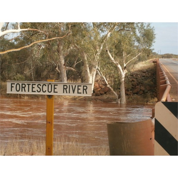
Fortescue River.
Safe travels :
AnswerID:
503357
Reply By: Member - Denis B (WA) - Friday, Jan 25, 2013 at 16:29
Friday, Jan 25, 2013 at 16:29
Thanks for your input guys.
I'm not planning to travel until the second half of April so hopefully the rain won't be an issue then...but it seems as if the mining companies might scuttle my plans!
I can understand why they don't want anybody close to an actual mining operation, but it seems a shame to shut us out of interesting country where they are simply running around exploring!!
Thanks again
AnswerID:
503379
Follow Up By: Member - Joe F (WA) - Saturday, Jan 26, 2013 at 12:30
Saturday, Jan 26, 2013 at 12:30
G'day Denis.
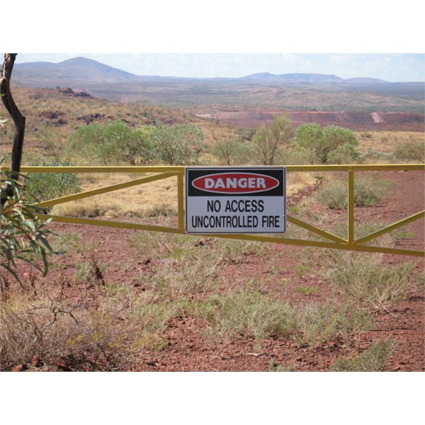
The mining industry can and does do some very strange things, sadly its all backed by the government and the general public is none the wiser.
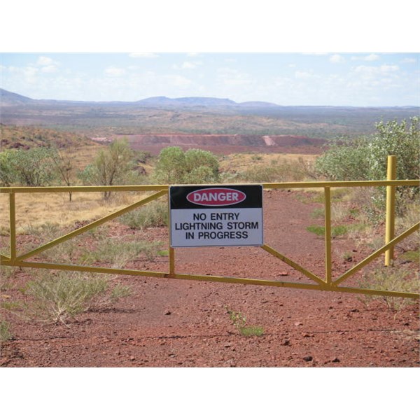
Mine sign
Mine sign
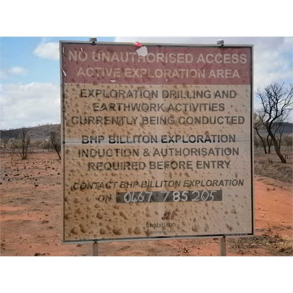
Their lease their sign
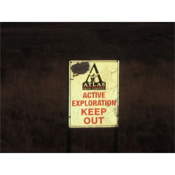
An Atlas effort
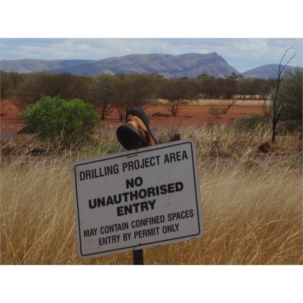
Giles Point.
Safe travels :
FollowupID:
780081