Plumridge Lakes
Submitted: Saturday, Feb 08, 2014 at 17:00
ThreadID:
106141
Views:
3472
Replies:
2
FollowUps:
2
This Thread has been Archived
Old Bushie
Gday
I am planning a trip from Kalgoorlie to
Plumridge Lakes then east to the Connie Sue around
Easter. It appears there is several ways to get there and I'm seeking suggestions on whether it's better to go via the south end of Lake Minigiwal or on the Nippon HW to Officer Basin then north to Snake Corner or along the PNC Baseline Rd then north on the Cable Haul Rd.
The most recent threads I could find were from 2011 where there was mention of a fair bit of mining activity.
Has anyone been out there in the last 6 to 12 months that could provide info on track access and conditions.
Thanks in advance.
Reply By: equinox - Sunday, Feb 09, 2014 at 03:32
Sunday, Feb 09, 2014 at 03:32
Hi Bushie,
It's been almost 2 years since I've been out that way, so I'm not within your 6 to 12 months time frame however no one else has answered your post so here's my info.
I went from Pinjin to Connie Sue Highway via PNC Baseline, Cable Haul Road and
Rason Lake Road.
No problems were faced the entire time, easy tracks etc....
There is a "new" mining track that starts just south of Pinjin and heads north east. It is a
well made and graded mining track. This continues past
the junction of the PNC Baseline Road. At
the junction though I turned right along the PNC Baseline Road. There is a
sign at this
junction that said, "
No Entry Construction Site". I ignored this
sign and went down the PNC Baseline Road to the south east (Pretty easy to put a
sign up, not so easy to back up the information with relevant legislation etc...).
At
the junction near Officer Basin you have the choice of visiting
Queen Victoria Spring to the south (which I did). Continue on though. After here it is a bit tricky as there are at least two tracks that lead to nowhere and you may have to back track to stay on the main route. (use my plotfile, I have edited out the side tracks).
Continue on to the Cable Haul Road and head north to the next
major junction - Here you have the option of exploring the lakes.
From there head east along the
Rason Lake Road until the Connie Sue.
Cheers
Alan
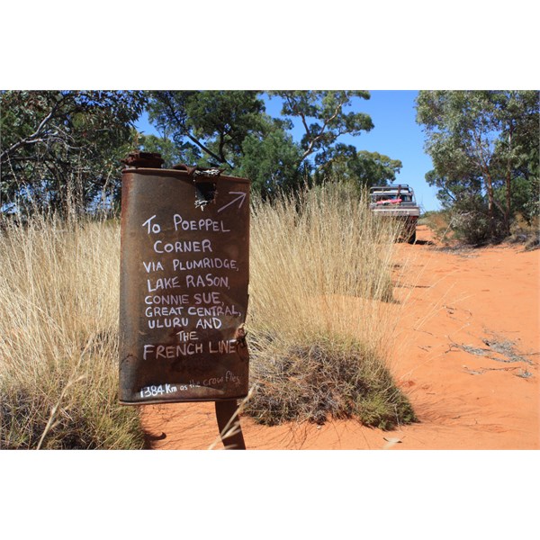
Sign on Road
AnswerID:
526016
Follow Up By: Old Bushie - Tuesday, Feb 11, 2014 at 01:04
Tuesday, Feb 11, 2014 at 01:04
Gday Alan
Many thanks for your very informative reply. That is the info I was seeking. Beaut to also peruse your
blogs after receiving your reply, it looks like we have a lot in common. Will look out for you around the tracks.
Regards
FollowupID:
808348
Reply By: get outmore - Tuesday, Feb 11, 2014 at 09:57
Tuesday, Feb 11, 2014 at 09:57
I went NE of Kal via pinjin and lake minigwal.. but that was a few years ago now
I think exploration for Tropicana was just starting then
AnswerID:
526179
Follow Up By: Member - Paul B (WA) - Wednesday, Feb 12, 2014 at 00:49
Wednesday, Feb 12, 2014 at 00:49
I did the track north from
Mulga Rockhole (35 or 40 km east of Pinjin
homestead) to Lake Minigwal about 7 or 8 years ago and it was very overgrown, hard to follow and slow going in the main. I reckon we were the first vehicle in years especially on the northern end. I took that track because it looked the shorter more direct route big what it turned out was the other had been upgraded for the Tropicana gold project and what took us 2 days via Lake Minigwal would have taken about 3 hours on the Tropicana Road.
I shared my OziExplorer track on exploroz.com for your reference.
Enjoy the trip.
FollowupID:
808446