Saturday, May 14, 2016 at 15:45
Hi Les
The correct location should be at
MacCabe Corner, and the one down from the Old Customs House.
Because the original survey was to say...." totally ballsed up ", that is why Charles Todd was employed by the South Australian Government to correct the border survey north of the Murray.
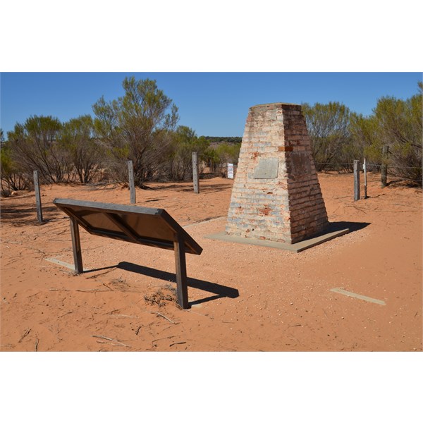
A temporary observatory was set up near the
Todd Obelisk , and with astronomical observations and accurate time signals over a nearby telegraph line between
Adelaide and
Sydney, he was able to accurately the correct position of the 141st Meridian of Longitude, to proclaim the correct position for the State Border.
Todd met with the NSW Government Astronomer, George Smalley and both men accepted the determination, and the now
Todd Obelisk was built to mark the correct location. Even with todays modern surveying equipment, Todd"s position is accurate to 100 metres, compared to the stuff up by the Victorian Surveyor that are 3.2 kilometres out.
The rest is all history, so from where I see it,
MacCabe Corner should be the true Tri State
border marker, and not the marked one for Victoria at the
Border Cliffs.
Cheers
Stephen

The Todd Obelisk marks the correct position of the 141st Meridian of Longitude.
The Todd Obelisk marks the correct position of the 141st Meridian of Longitude.
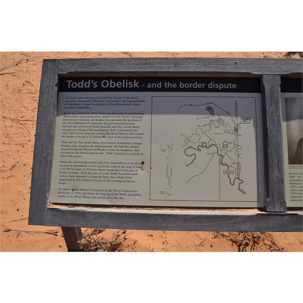
The full story of the saga is told at Todd's Obelisk
FollowupID:
869364