Sunday, Jan 28, 2018 at 10:56
Hi Maurice
I was not asking Les to tell me where the claypans were, just asking for a copy of his track file, as I am entered to see the way he travelled.
As for some total idiots trying to drive up the face of
Geosurveys Hill, all I can say is I hope that put a hole in their sump....bloody idiots and we all wonder why these special areas get closed to to everyone.
I like dozens of fellow viewers here on EO love to explore, inspect and respect special
places of Aboriginal importance. Yes I love to photograph these very special
places, but will never post the location so as to keep them safe.
Below are some of the
places where we have visited and some of those very special Aboriginal
places that only a hand full of people ever get to witness.....
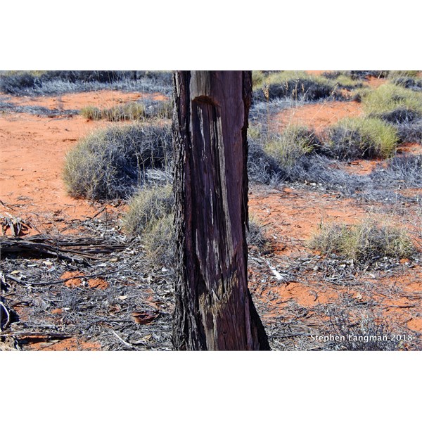
Woomera Tree
The above tree is where an Aboriginal, using a stone axe cut this
Woomera from a Black Oak in the
Great Victoria Desert.
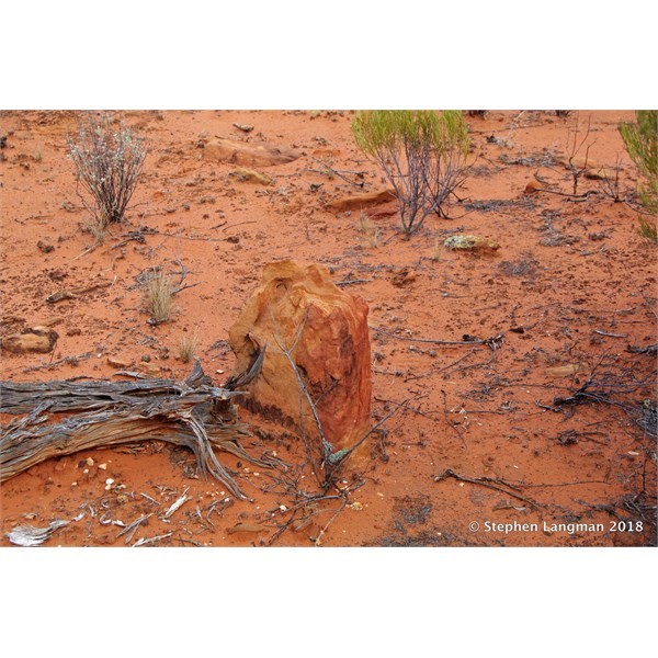
Aboriginal Direction Marker Stone
Just like we use road signs today when travelling, Aboriginal used these large flat stones around the size of a laptop point in the direction of travel to be taken to reach a special ceremonial site. This stone is in the
Great Victoria Desert and we followed a number of them to reach a special site.
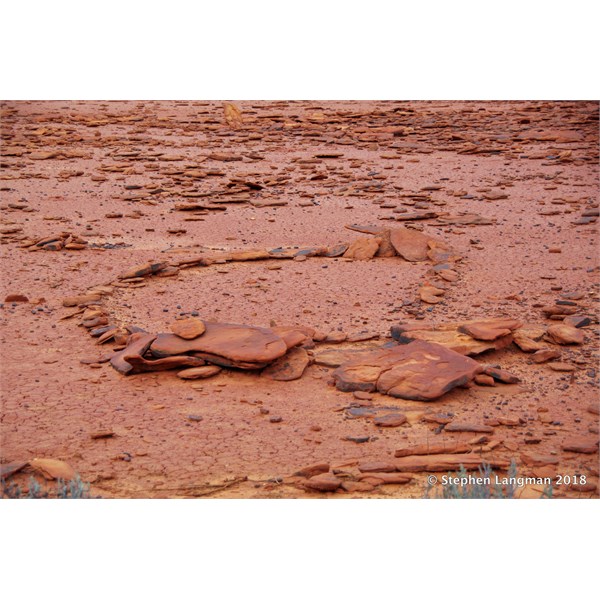
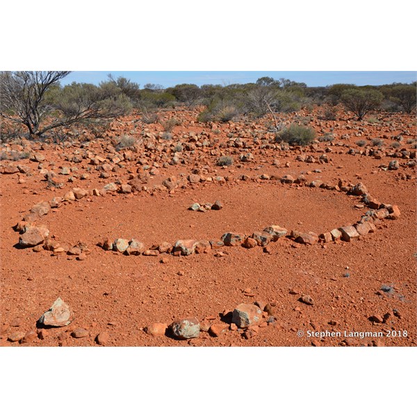
Claypan where the special ceremonial site was located.
Claypan where the special ceremonial site was located.
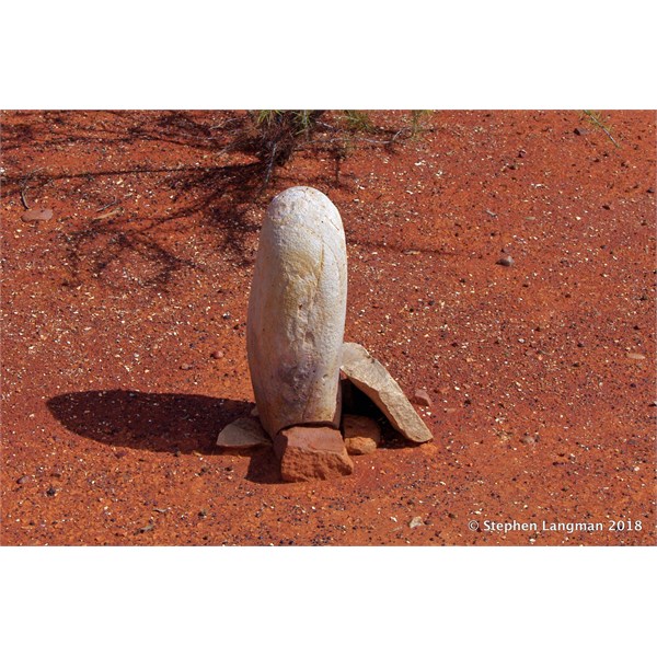
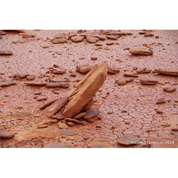
Some sort of ceremonial marker
The above Stone is some form of special ceremonial Aboriginal Marker is is located in the
Coober Pedy Area
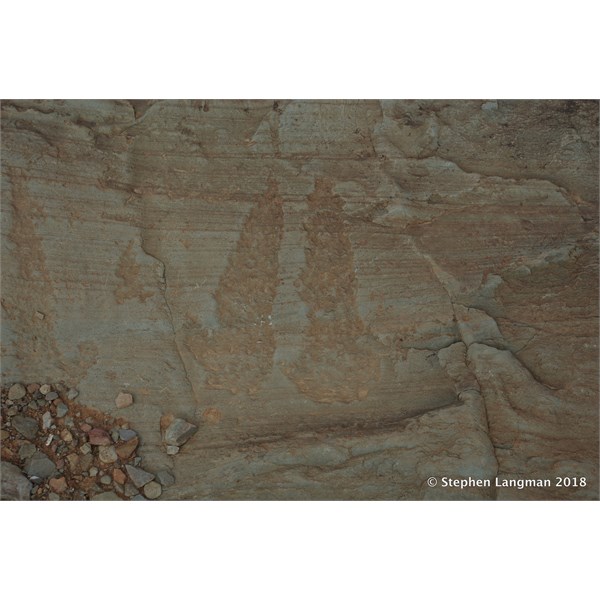
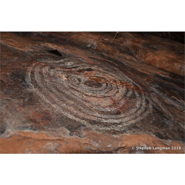
Aboriginal petroglyphs - Mid North of South Australia
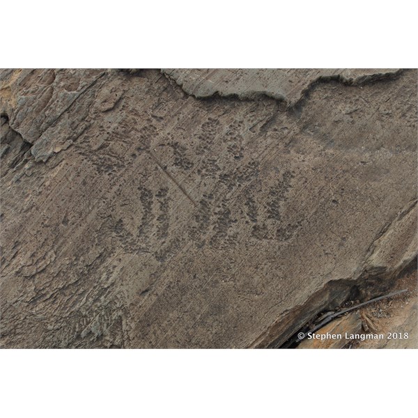
Aboriginal petroglyphs - Mid North of South Australia
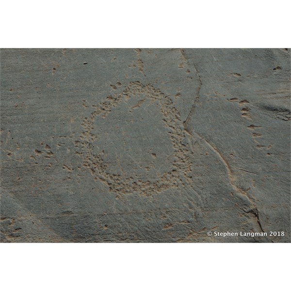
Aboriginal petroglyphs - Mid North of South Australia
It is no secret that I live in
Clare, in the Mid North of South Australia and the above Aboriginal petroglyphs are on private property just over an hour away from where I live.
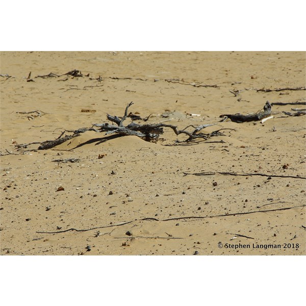
Aboriginal Grave not exposed yet
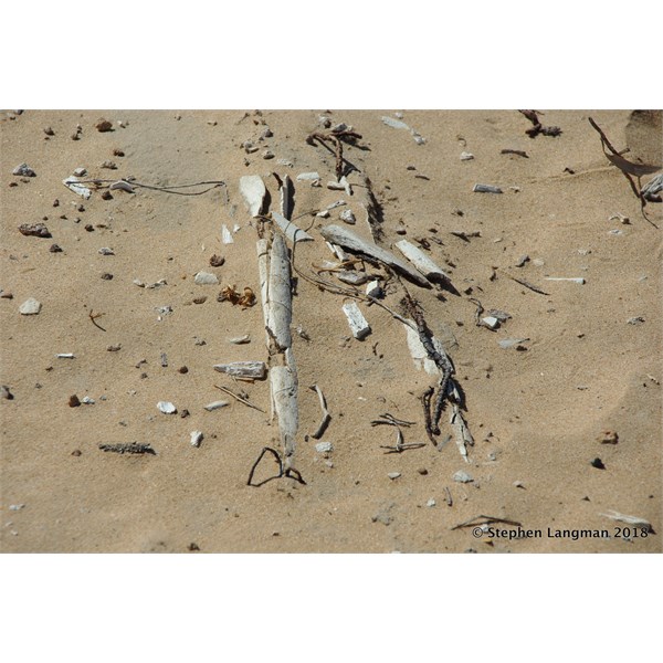
Exposed Aboriginal Grave
Exposed Aboriginal Grave
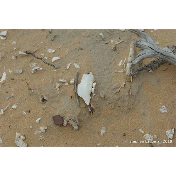
Exposed Aboriginal Grave
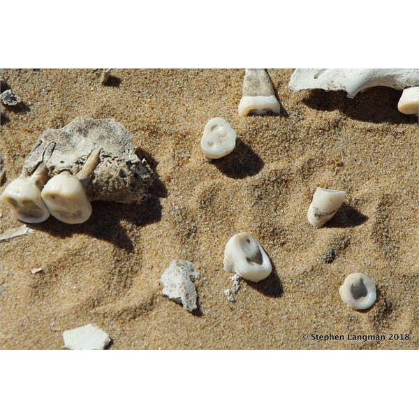
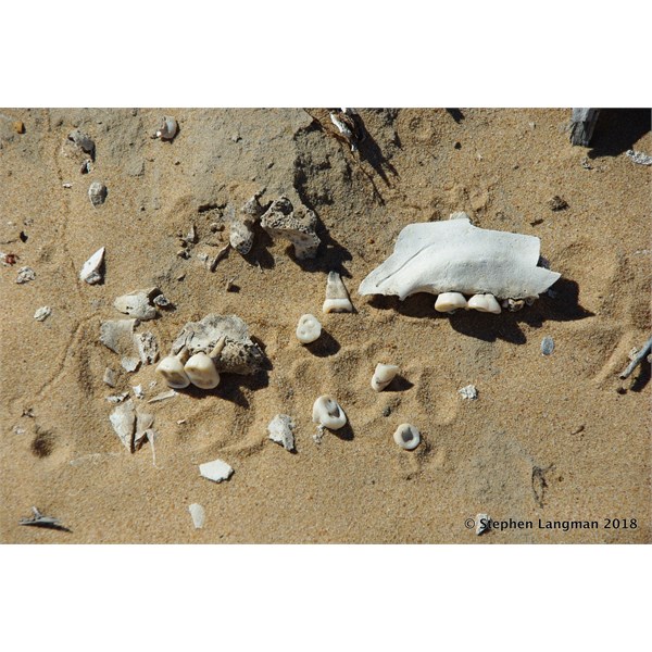
Remains of Aboriginal Skull - note how easy it is to identify from the teeth that have been worn flat from eating cooked food with sand
The above images are from the Riverland in South Australia near
Renmark. There were 4 intact
graves and at least 8
graves that had been exposed by wind and time. I contact the
Berri Branch of the National Parks with 4 emails and 2 phones calls reporting the location. National Parks could not give a stuff about this site and never had the decency to return my emails or phone calls.
On the other hand, when I contacted the Aboriginal section of the Museum in
Adelaide, I was put through immediately to the lady in charge and she wanted to know as much as possible about the site. Over one more phone call and two emails, she was thrilled about this site, as she was telling me that any more than 3
graves in any one location was classed as a site of signifiant value and needs recording.
All I can say about National Parks...
well it is not worth repeating and will never waste my time with them again.
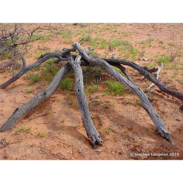
Simpson Desert- remains of Aboriginal wirily
Simpson Desert- remains of Aboriginal wirily - note the grinding stone by the side
The
Simpson desert still holds lots of
places to show that it was a place where the local people called home, and lived out there in harmony with nature for thousands of years.
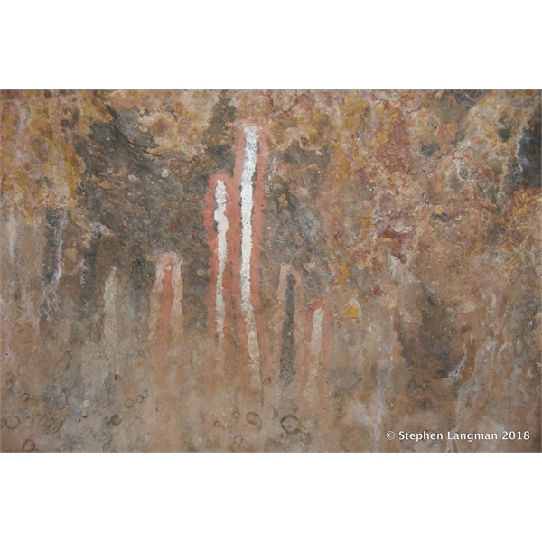
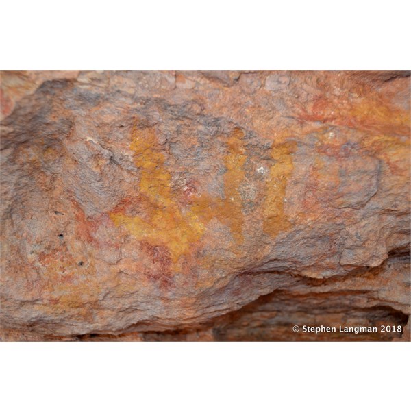
Cave art site in the Great Victoria Desert
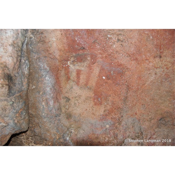
Cave art site in the Great Victoria Desert
Cave art site in the Great Victoria Desert
Cave art site in the Great Victoria Desert
The above 2 sites are located in the
Great Victoria Desert near the
Great Central Road. We were the first ever private group to view this location, the first person was the person that located them and the second group was from the Museum in
Perth.
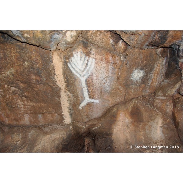
Ceremonial site Great Victoria Desert
There must still be hundreds of such sites all over Australia, just as they were made by the local Aboriginal people for special ceremonies and still have not been located by white people.
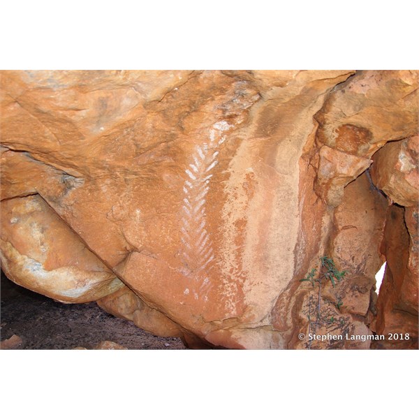
Aboriginal cave art site
More Aboriginal art from another remote
cave site in the
Great Victoria Desert.
Rock Art near Kingoonya
This special rock art site is found in the
Kingoonya area of South Australia and is on a private station and the owners will only allow people to view the site that they can trust.
I can go on and on Maurice, but as you can see, you will not be able to locate these sites on the internet as they are not published, but can only view the images and trust that I am giving your the correct details.
The reason why I and other very few privileged people get to view these very special
places is for one reason only - Trust.
Cheers
Stephen
FollowupID:
887787