Sunday, Feb 04, 2018 at 17:11
Hi Allan
It sounds like things have not changed a lot from when the track was first opened up.
I would love to find out what has happened out that way in regards to Native Title claims and how much more land they have acquired out that way. I have made a couple of phone calls to station people out that way and if what they are telling me is correct, some one or groups has been making mega dollars at their expense, but can not say much more until I speak with another station manager tonight.
I did read your post and it was interesting reading. Like you, we were told that we would have Batton
Hill to ourselves (my group of 7 vehicles that is) having booked our trip months in advance, as
well as keeping in regular contact before the trip.
When we arrived, there were 5 other vehicles there which meant showers and
toilets were at a premium and everyone was camped quite close together.
In the photo of Roz doing the hand washing, is that an additional sink and is the original one still there?
When we were there, Lindsay kept the place immaculate and ever morning while we were still sleeping in our swags, he would get the fire going, put the large kettle on the fire and was the most perfect
camp host.
Yes I did receive you great email, but I have been on and off the internet since Friday, when
Clare was under siege for nearly 2 days with a massive bush fire. There were 7 fixed wing fire bombers as
well as 3 helicopters. It was like being in a war zone with the aircraft flying around all the time.
Full praise goes to our very dedicated volunteer CFS people that saved countless homes and farm equipment and stopped the fire from jumping one gully. If they did not stop it there, they say dozens of houses inside the actual
Clare township could have been destroyed, and where we live, was right in the fire path.
Cheers and keep safe.
Stephen
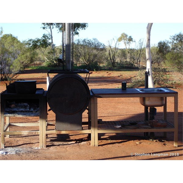
The original cooker and wash up area at Batton Hill
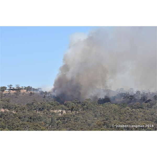
They thought this place was going to be destroyed, by the fire bombers save it
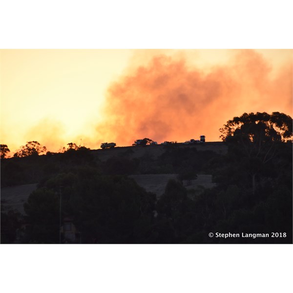
At dusk, the top of that hill was covered in CFS trucks to halt the advancing fire.
FollowupID:
888134