Wentworth to Renmark
Submitted: Tuesday, Jul 07, 2020 at 06:16
ThreadID:
140219
Views:
12902
Replies:
4
FollowUps:
9
This Thread has been Archived
Rosemary Michael M
Want to travel to
Adelaide but need to cross border in nsw Nsw when they lift the restrictions. What is the road from
Wentworth to
Renmark like, will I need a map, travelling in a land cruiser. Is there likely to be
water to cross?
Reply By: MUZBRY- Life member(Vic) - Tuesday, Jul 07, 2020 at 06:34
Tuesday, Jul 07, 2020 at 06:34
Gday
Last time i was there the road was like a freeway , with signs , a very
well used road
AnswerID:
632411
Follow Up By: old mate - Tuesday, Jul 07, 2020 at 13:12
Tuesday, Jul 07, 2020 at 13:12
How long ago was that? I am in the same boat need to get a vehicle I have bought in NSW to return to SA. Its a motorcycle (road bike). I know some of the road is bitumen and the road is dirt. Also waiting for the borders to open. I could take it slow on this road or the long way via
Broken Hill.
Thanks.
FollowupID:
909096
Follow Up By: Peter_n_Margaret - Tuesday, Jul 07, 2020 at 15:14
Tuesday, Jul 07, 2020 at 15:14
Without crossing the border into Victoria (which is what the question was about) you must stay on the northern side of the river.
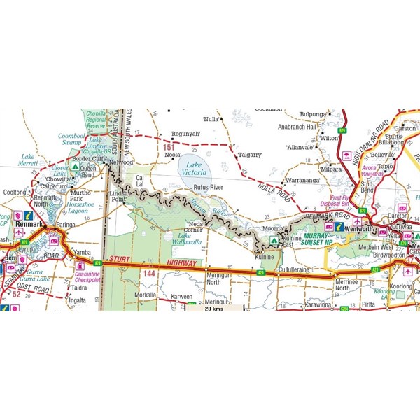
It is 151km from
Wentworth (in NSW) to
Renmark (in SA) by the shortest route. The first 25km is bitumen and the last 13km is bitumen.
The remaining 113km is gravel.
Cheers,
Peter
OKA196 motorhome
FollowupID:
909100
Follow Up By: Rosemary Michael M - Tuesday, Jul 07, 2020 at 16:54
Tuesday, Jul 07, 2020 at 16:54
So from
Wentworth am I taking the
Renmark road and turning left when it gets to Nulla Road and going north of
Lake Victoria, past Rufus River
Park until it comes onto
Wentworth road to
Renmark. Is it about 3 hours?
Many thanks
FollowupID:
909103
Follow Up By: Peter_n_Margaret - Tuesday, Jul 07, 2020 at 18:13
Tuesday, Jul 07, 2020 at 18:13
Turning right onto Nulla Road (not left) will be the quickest route.
Left via Rufus River will have more scenic options and is a bit more complicated.
Wentworth to Renmark
Cheers,
Peter
FollowupID:
909105
Follow Up By: MUZBRY- Life member(Vic) - Wednesday, Jul 08, 2020 at 08:19
Wednesday, Jul 08, 2020 at 08:19
Gday
I think i may have misread the question sorry about that
FollowupID:
909109
Follow Up By: Bricky - Sunday, Jul 19, 2020 at 06:44
Sunday, Jul 19, 2020 at 06:44
Just saw this post so don't know if you have left yet.
We went through on the day you posted. No problems at all, few corrugations but nothing serious. Stayed south of
lake Victoria.
Cheers
FollowupID:
909373
Reply By: Member - Stephen L (Clare SA) - Tuesday, Jul 07, 2020 at 07:31
Tuesday, Jul 07, 2020 at 07:31
The road will be a typical mix of country dirt roads from corrugations, sandy sections and good sections.
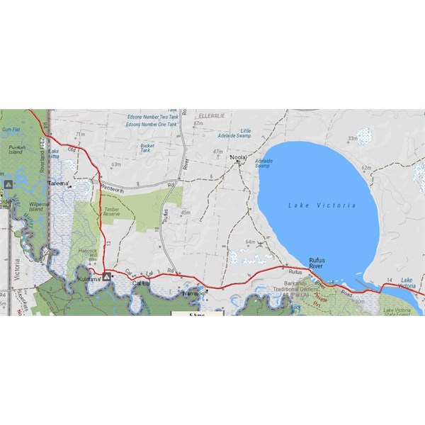
It not signposted, but you have 2 options. The one that we prefer is the lower road that will take you through Ruffus River and the bottom of
Lake Victoria. Nice little
lookout and display there, while the Main Road skirts the top section of
Lake Victoria.
Then when you cross into South Australia, a great detour down to the
Todd Obelisk and Scab Inspectors Hut .
AnswerID:
632412
Follow Up By: Nomadic Navara - Tuesday, Jul 07, 2020 at 15:32
Tuesday, Jul 07, 2020 at 15:32
Rufus River Road - -
The Main Road.
Play around with the maps to see more detail along the
routes. Click on the blue "DETAILS" link to get the driving instructions.
FollowupID:
909102
Reply By: Peter_n_Margaret - Tuesday, Jul 07, 2020 at 09:42
Tuesday, Jul 07, 2020 at 09:42
October 2019.
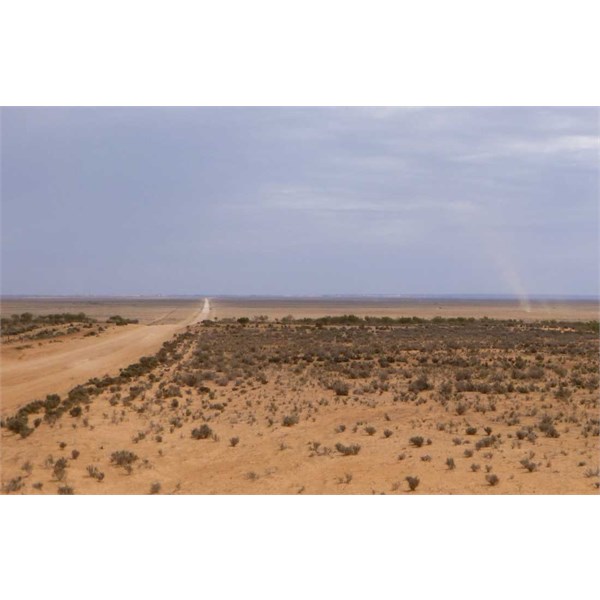
West of Wentworth October 2019
EDIT.... I think this is the east end of the road that goes south of
Lake Victoria
Cheers,
Peter
OKA196 motorhome
AnswerID:
632414
Follow Up By: Peter_n_Margaret - Tuesday, Jul 07, 2020 at 10:02
Tuesday, Jul 07, 2020 at 10:02
Getting to Wompinni Station
Wompinni Station (at the most western end of the GPS track, on the river) is being developed for tourist visits.
Not sure if they are open now or not. A wonderful bit of diverse country right on the river.
Call them on 0422138074.
You will need a decent map...... :)
Cheers,
Peter
OKA196 motorhome
FollowupID:
909091
Reply By: Rosemary Michael M - Tuesday, Jul 07, 2020 at 20:06
Tuesday, Jul 07, 2020 at 20:06
Thanks all think I got it. Hope they open the border.
AnswerID:
632422
Follow Up By: Allan B (Sunshine Coast) - Sunday, Jul 19, 2020 at 08:22
Sunday, Jul 19, 2020 at 08:22
.
Rosemary, did you have an association with
Adelaide's Maughan Church?
FollowupID:
909375