Wednesday, Dec 10, 2025 at 10:37
For the benefit of others...
The road in question is the
Voakes Hill Corner to
Cook road.
This is s screen shot of GPS tracks on a HEMA Great Desert Tracks map.
The existence of roads on maps (any maps) in this area is NOT any indication of their availability to be used by the public. It is possible to get permission, on some occasions, to use some of them, on a case-by-case basis.
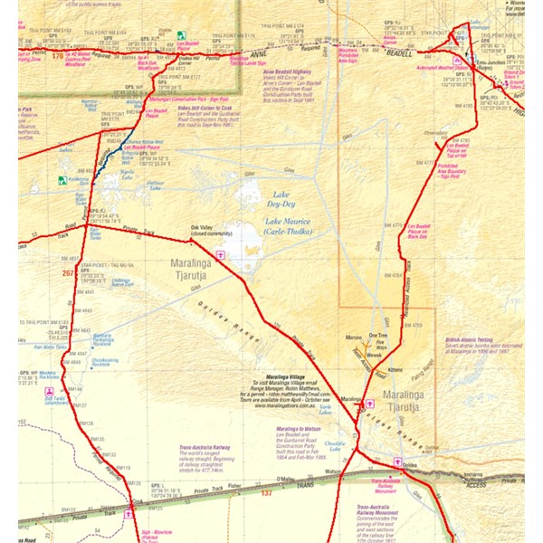
Voakes Hill Corner to Cook road
The section of road with the BLUE GPS track has been permanently closed for over 10 years. Members of the public will NOT get permission to use it. Our group does get permission to use some roads not generally open to the public in this area, from time to time, but we do NOT get permission to use this section. We were there again this year and I have photos of the northern end of the diversion. There is no doubt that the old track is closed and is becoming overgrown.
The EOTopo map of this area is totally misleading.
It does not display roads and tracks that exist accurately or, more importantly, indicate those that might be available for public use, with permission (none are available for public use without permission from
Maralinga Tjarutja Lands).
\
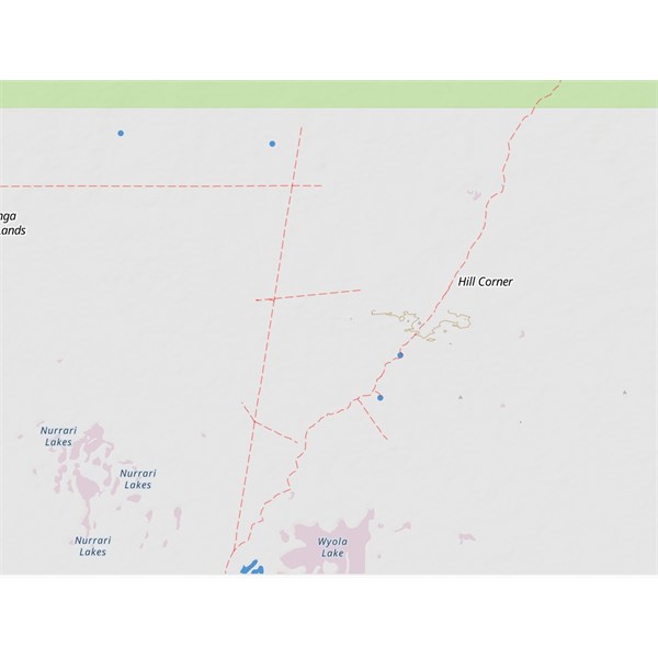
EOTopo version
It should be noted that the whole area north of the rail line and south of the Anne Beadell, between Mamungari CP and
Maralinga, and beyond is full of old shot lines and many significant roads. Many are becoming overgrown and that is being encouraged. Others are available for special use with special permission, on a case-by-case basis.
There are maps that show proper historical detail of the area. This is one that specifically shows the fire history of the area and all the roads, both current and old, plus the shot lines.
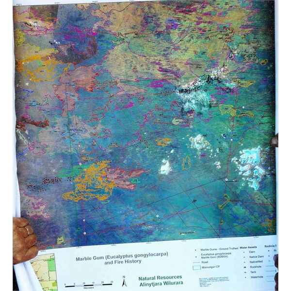
Fire history
For information:
The
Anne Beadell Highway: Several permits are required and they are usually available.
The
Voakes Hill Corner to
Cook Road: Permits are usually available for travelers.
The
Emu Road: Permits for public access are not issued.
The Aboriginal Business Road: I am not aware of permits being issued to the public.
The Lake Dey Dey Road: Usually closed, but I am aware of travelers coming from WA on the Anne Beadell Road getting permits to use this road to attend
Maralinga Tours and to buy fuel at
Oak Valley community on the way through.
I am not aware of any other roads or tracks in the area that are likely to be open for use by general public travelers.
The message is ASK. Things can change from day to day.
Cheers,
Peter
OKA196 motorhome
FollowupID:
930294